The Butlers … Yellowstone and The Tetons …

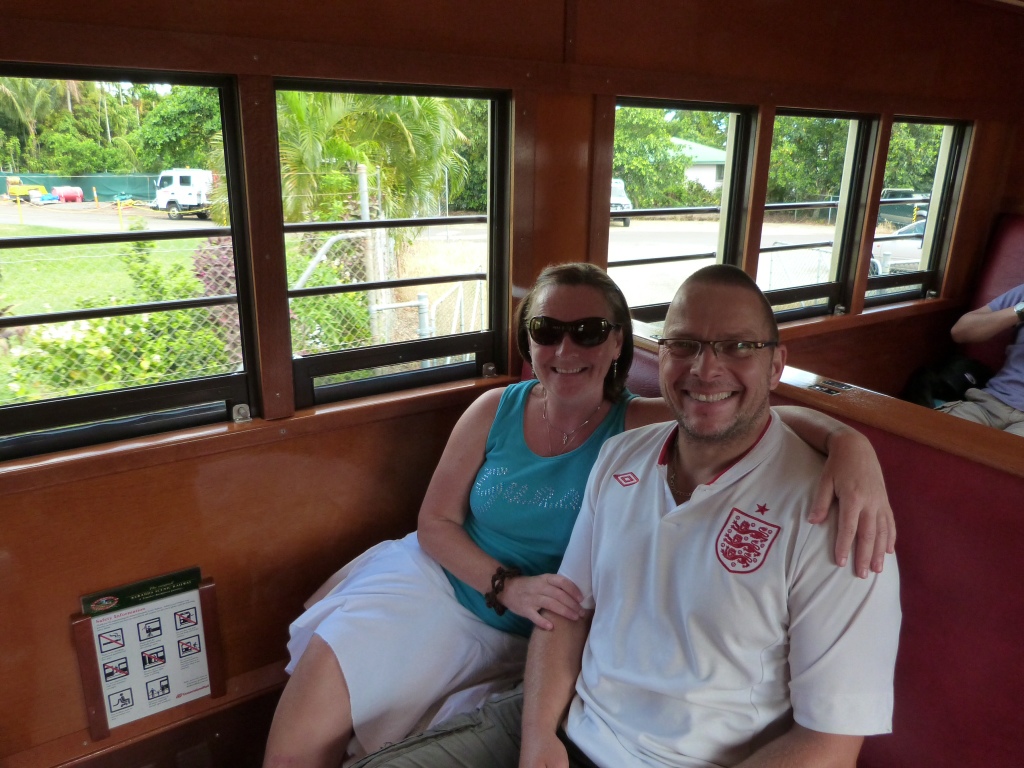
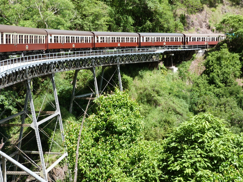
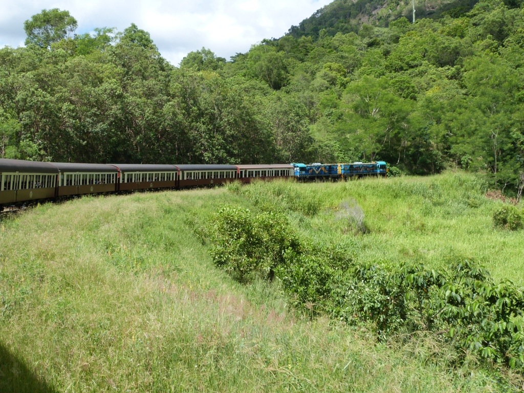
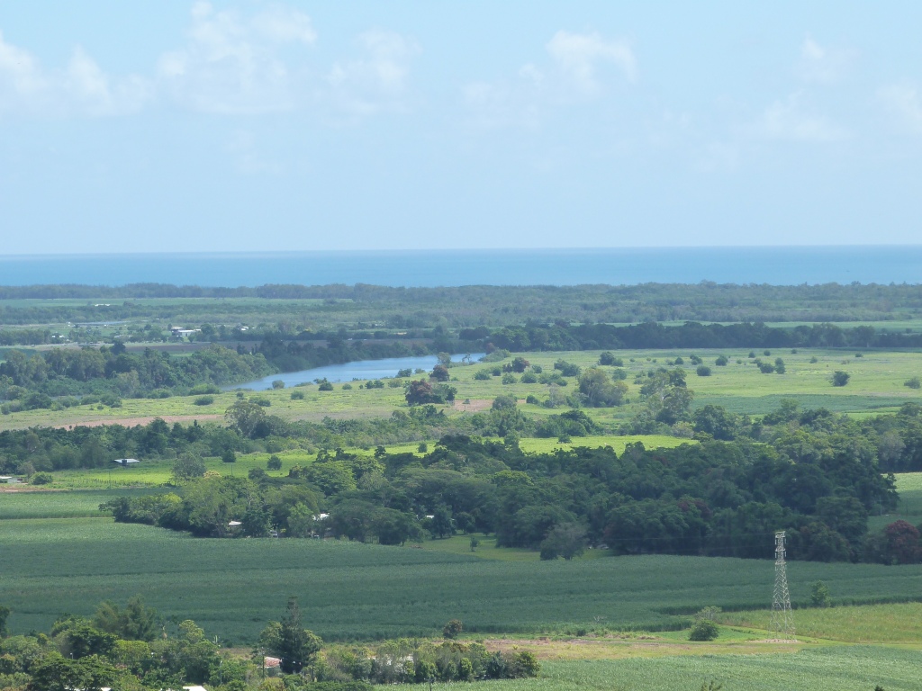
UNDER CONSTRUCTION … PICS TO FOLLOW …

The Butlers … Yellowstone and The Tetons …

Sun, 23rd Jun: Western Big Sky Inn, Deer Lodge, Montana
Three days (at least) on the road are ahead of us to meet up with the Butlers in Victor! We were on the road again after a homemade bagel breakfast in the small kitchenette, we continued east through the state of Washington passing through Moses Lake and Spokane before crossing the border into the state of Idaho. Having previously picked up a subway we stopped for lunch in the town of Coeur D’Alena ……….. Sat in a car park watching the final stages of an Ironman Contest … random eh?

Bellies content we continued east following the Spokane River and had magnificent views of the Couer D’Alena Lake ……… 45mins later at Lookout Pass we were leaving the state of Idaho and were already entering into the upper parts of Montana.

We soon passed through the town of Missoula before looking for a place to stay and came across Deer Lodge the second oldest town in Montana. Having again gone forward one hour to Mountain Time, it was 8pm by the time we found Western Big Sky Inn in the middle of this small town. A very warm and friendly motel, Deer Lodge hotel is located near Rock Creek Lake and the Grant-Kohrs Historic Site – an 1860’s ranch – and within walking distance of Broken Arrow Steakhouse & Casino and other restaurants in town.

Recommended by the proprietors for dinner, we headed to the Broken Arrow. Like most remote places we have visited on this road trip, the Broken Arrow shut at 9pm so it was a quick turnaround after our check in before taking the short walk there. And we were not disappointed 🙂 We enjoy ‘western dining’ surrounded by a large collection of prints depicting ranch life of yesteryear.

Back at the Motel we again watched the TV until the zzzzz’s took hold and fell into a peaceful slumber to rejuvenate the batteries for a day on the road again tomorrow.

Mon, 24th Jun: Pines Guest Haus, Driggs, Idaho
We left Deer Lodge heading south on Highway 90 and it was not long before we were re-acquainted with the gorgeous sight of the Rocky Mountains to the east 🙂 We passed through the town of Butte before continuing south on 287 towards Ennis. This was a simply beautiful drive as we followed the route of the Madison River and the railway all the way to Ennis with the Rocky Mountains on one side and the Madison Range …….. on the other.

At Ennis (Madison County, Montana) we stopped for lunch at ……………. A quaint ‘western’ town with a lot of character and a population of 838.

Refreshed we jumped into the car for the final part of this journey. Continuing south we passed through Beaverhead-Deer Lodge National Forest before skirting past West Yellowstone and Yellowstone National Park where we crossed the border into Idaho again. On Highway 20 we soon passed through Ashton before hitting Highways 32 and 33 for the final push towards Victor. It was on this highway that we had the stunning panorama of the Teton Mountain Range with Grand Teton towering proudly above the rest.

As Bobby was also arriving in Victor today we made the decision to stay overnight in Driggs a mere 5min drive away. A gorgeous location in the Teton Valley with a small population of 1660, nestled at the bottom of The Grand Targhee Ski Resort. The Butlers had taken a 21hr drive to Victor and I for one did not want to impose on their hospitality after such a long time on the road. Hopefully, they would settle into their new rented accommodation overnight and be refreshed for our arrival in the morning 🙂

We check in to Pines Guest Haus – where, as they are fully booked, they offer us Nana’s room in their house! For $40 we were more than pleased and Nancy and John, the proprietors were very kind. The Pines Guest Haus has been in the Nielson family for over 40 years. The atmosphere is that of a small European guesthouse that’s surrounded by an acre of tree-covered lawn. Located on land homesteaded in July 1900 by Leland Monroe Driggs, the Pines Motel was originally a two-story log cabin, built at the turn of the century.

Whilst Nancy prepared the room, Neil and I headed out to a bar, The Royal Wolf …… for some refreshments. We deserved it we reckon after the last three days on the road 🙂 It was a nice friendly bar and we were soon sharing the place with the locals many of whom engaged in conversation with us. There was a good atmosphere and a lot of interest in the game that was on tv – ice hockey; between Boston and Chicago in the latter stages of the Stanley Cup Final.

We walked back to Pines where we checked in and loaded our stuff into our room. I stayed in to ‘wash my hair’ whilst Neil went ‘hunting’ for food! He came back about 9.30pm having revisited the bar and collected our Thai dinner on the way back. It was great and before long we were sleepy so we called it a day excited for tomorrow and the Butlers!

Tue, 25th Jun: Bobby & Anita’s, Big Bear Lane, Teton Valley, Victor, Idaho
We get up late today and head off to O’Rourkes …… for brekkie. It is here we also catch up with the blog of the last few days before hitting the Butler Household … and Victor … Aaaaarrrggghhh!

Victor is the largest city in Teton County and the population was 1,928 at the 2010 census.
At Big Bear Lane there are mountain views in every direction from this adorable home just on the outskirts of downtown Victor. This home, in a three quarter acre lot, has a large loft and windows that capture the incredible views of the surrounding mountains. The large deck at the rear of the property gives views over the ranch to the north and east.

It is an exciting reunion with Bobby and Anita who are eager to hear all about our travels. After a couple of hours relaxing with the family and making ourselves at home, we all head to a friend’s house for tea. Anita’s friend Price, and her family set up home in Victor many years ago. She and her husband Patrick have been building their own home over the last two years and live there with their 4 year old daughter Railen. When we arrive we are greeted by Price, Railen and Dorothy (Patrick’s Mum).

House
Friendly
Hospitality
Tennessee horses

Property high in mountainside … Established

Chat bed

Wed, 26th Jun: Bobby & Anita’s, Big Bear Lane, Teton Valley, Victor, Idaho
Laundry
Bobby cam and Vaughn cafe brekkie work
Anita and kids boots shopping
Neil and I bike ride round Victor … Hit The Station for wifi fix … Kids mum n dad

The Station is a quaint friendly cafe in sleepy Victor … ‘through the simple values of friendliness, honesty, quality and service, they seek to nourish the heart of their beloved community’.

Back at the house we meet up with Bobby and the boys and head off for an afternoon hike. Bobby takes us to the top of the Teton Valley Pass where we could see stunning views of Jackson (Hole) and Wilson and the surrounding mountains. There were numerous trails and we took off on one called The History Trail. Our trail suddenly stopped and interestingly we climbed directly up the steep mountainside to join another one. We were treated to a bit of ‘playtime’ in an area of snow before continuing on the ridge towards the forest. All in all we were out walking for 3hrs before driving the switch back road down into Wilson, Wyoming (another state added to those already visited on this road trip) on the other side of the Teton Valley – the only valley in two states! Here we hung out at The Stagecoach refreshing ourselves. The boys (including Neil) enjoying some tom foolery thinking it was cool to throw hats on the roof lol. A good time was had before Bobby finally called time on the proceedings as he needed to head off to Jackson Airport to pick up his nephews. Joey (18) and Christian (15) are joining the Butlers for the summer and have arrived in time to go to the Rainbow Gathering with them.

Whilst Bobby and the boys head off to the airport, Neil and I drive into Jackson to admire its beauty but also to reward ourselves with views of the Tetons on our drive back to the pass and back via Wilson to Victor. We decided to call into Knotty Pine

The Knotty Pine …. Anita.
Bobby came back with Joey and Christian
Music night
Teton Valley : “best of both states … Idaho and Wyoming”

Thu, 27th Jun: Bobby & Anita’s, Big Bear Lane, Teton Valley, Victor, Idaho
Investigate and explore Yellowstone and Teton National Parks. Book 2 nights accommodation at Lake Lodge, Yellowstone (29th/30th June) and will look at booking 1st July at Teton over the next couple of days.

We sat and made further use of the wifi to look into our plans for the next month or so. We have left the Butlers at the house today whilst they make preparations for their trip tomorrow to Montana for the Rainbow Gathering. They all seem upbeat and keen to start their trip tomorrow. This means that they will have time over the weekend to set up for the beginning of the gathering which officially starts on Monday. So all is good and they are looking forward to it 🙂

We need to make contact with some of the accommodations and bookings we have looked at so we decide to head back to the house to use Bobby’s phone. On our way back we call into Fitzgerald’s Bicycles where Neil asks them to look at the gears on Bobby’s bike. They do so and for no charge!!!! There are so many positives to living in a small community like this 🙂 🙂 🙂 Everybody is so helpful, friendly and hospitable. All being well, the Butlers will be settling into a lovely part of the world.

With the Butlers departure tomorrow, we cycle into Driggs to pick up some credit for Neil’s phone … we will definitely need our own after they have gone. 16 mile round trip on a great cycle path.

Our last afternoon early evening is spent at the first of the summer weekly music festivals in Victor’s small city park 🙂 … Music on Main ………….

Back at house …. Trading / preparing amongst the boys. Gift us some neat crystals (from Arkensaw) … Many treasures …

Shattered we fall into bed by midnight

Fri, 28th Jun: Bobby & Anita’s, Big Bear Lane, Teton Valley, Victor, Idaho
The Butlers departure to Rainbow. A mammoth task was undertaken and they finally got on the road at 1.00pm. It was a fond farewell

Neil and I spent the afternoon relaxing before driving into Driggs for the rodeo

Leaving at 10.00pm we caught the garage before it closed and got ourselves a pizza for supper. Then it was off to bed … Yellowstone National Park tomorrow … Yay, back on the adventure trail 🙂

Sat, 29th Jun: Lake Lodge Pioneer Cabin, Yellowstone National Park (Idaho/Montana/Wyoming)
We have a lazy morning preparing for our trip to Yellowstone. We left Victor heading north and soon picked up Highway 20 towards West Yellowstone. This route gave us stunning views again of the Teton Range in all its glory. We crossed into the state of Wyoming and into West Yellowstone. From here we followed the directions to the park and we were soon showing our Annual Pass at the park entrance. Just before the park entrance we saw our first bit of wildlife … the beautiful Pronghorn ………

The pronghorn (Antilocapra americana) is a species of artiodactyl mammal endemic to interior western and central North America. Though not an antelope, it is often known colloquially in North America as the prong buck, pronghorn antelope, or simply antelope,[3] as it closely resembles the true antelopes of the Old World and fills a similar ecological niche due to convergent evolution.[4] It is the only surviving member of the family Antilocapridae.[5] During the Pleistocene period, 12 antilocaprid species existed in North America.[6] About five existed when humans entered North America[citation needed] and all but A. americana are now extinct.[5]

Pronghorns form mixed-sex herds in the winter. In early spring the herds break up with young males forming bachelor groups, females forming their groups and adult males living a solitary life.[19] There are female bands which share the same summer range and bachelor male bands form between spring and fall. Females form dominance hierarchies with few circular relationships.[20] Dominant females will aggressively displace other females from feeding sites.

Juvenile (“fawn”) in New Mexico.
Adult male pronghorns employ two different mating strategies during the breeding season. A pronghorn male will defend a fixed territory that females may enter or it might defend a harem of females. A pronghorn may change mating strategies depending on environmental or demographic conditions.[19] In areas that have high precipitation, adult male pronghorn tend to be territorial and maintain their territories with scent marking, vocalizing and challenging intruders.[21] In these systems, territorial males have access to better resources than bachelor males.[21] Females also employ different mating strategies. “Sampling” females will visit several males and remain with each for a short time before switching to the next male, at an increasing rate as oestrus approaches. “Inciting” females will behave as samplers until oestrus and then incite conflicts between males. The females watch and then mate with the winners. “Quiet” females will remain with a single male in an isolated area throughout oestrus.[22]
When courting an estrous female, a male pronghorn will approach her while softly vocalizing[19] and waving his head side to side, displaying his cheek patches.[23] A receptive female will remain motionless and sniff his scent gland and then allow the male to mount her.[19] Pronghorns have a gestation period of 235 days, longer than is typical for North American ungulates. They breed in mid-September, and the doe carries her fawn until late May. This is around six weeks longer than the white-tailed deer. Newborn pronghorns weigh 2–4 kg, most commonly 3 kg. In their first 21–26 days, a fawn spends time hiding in vegetation.[21] Fawns interact with their mothers for 20–25 minutes a day and this continues even when the fawn joins a nursery.[21] The females nurse, groom, and lead their young to food and water as well as keep predators away from them.[21] Males are weaned 2–3 weeks earlier than females.[21] Sexual maturity is reached at 15 to 16 months, though males rarely breed until 3 years old. The longevity is typically up to 10 years, rarely 15 years.[7][8][9]

yellowstone
Yellowstone National Park in the northwest United States is home to a large variety of mammals, birds, fish, reptiles and amphibians, many of which migrate within the Greater Yellowstone Ecosystem. These Animals of Yellowstone, especially larger mammals, birds and fish are a major park attraction. Since the creation of the park in 1872, 318 species of birds have been documented within its boundaries. Although Yellowstone is not a birding mecca because of its high altitude and cold winters, it is home to a variety of interesting bird species that attract visitor attention every year. The park has a good resident population of birds and we were lucky enough to see a Bald Eagle, Ospreys, Mountain Bluebirds and Sandhill Cranes. The extensive rivers, lakes and wetlands are summer homes to large numbers of waterfowl, while the forests and meadows host many different species of warblers, sparrows and other passerine birds.

We are handed much literature on the park which explains that Yellowstone National Park inspires awe in travellers from around the world. New Zealand and Iceland are known for geysers, but nowhere are there as many as in Yellowstone. At the heart of Yellowstone’s past, present and future lies volcanism. About 2 million years ago, then 1.3 million years ago, and again 640,000 years ago, huge volcanic eruptions occurred here. The latest spewed out 240 cubic miles of debris. The central part of what is now the park collapsed, forming a 30×45 mile caldera or basin. The magmatic heat powering those eruptions still powers the park’s geysers, hot springs, fumaroles and mudpots. The Grand Canyon of the Yellowstone River gives a deeper view of these forces; its waterfalls highlight the boundaries of lava flows and thermal areas. Rugged mountains flank the park’s volcanic plateau rewarding eye and spirit.

Yellowstone’s wildlife includes bison, elk, grizzly and black bears, wolves, trumpeter swans, and cutthroat trout. vegetation types range from near-desert vegetation at the North Entrance to subalpine meadow and forest on Mt Washburn. Lodgepole Pine covers 60 per cent of the park and makes up 80 per cent of the forested areas.

USA’s very first national park is HUGE! ……………..

Fort Yellowstone – The Army Years 1886-1918:
For the decade after Yellowstone National Park was established in 1872, the park was under serious threat from those who would exploit, rather than protect its resources. Poachers killed animals. Souvenir hunters broke large pieces of the geysers and hot springs. Developers set up camps for tourists near hot springs, along with bath and laundry facilities in the hot springs. In response, Civilian Superintendents were hired to preserve and protect this land. Their experience and intentions varied, and they were all under funded and under staffed. Word got back to Congress that the park was in trouble, but legislators refused to appropriate any funds for the park’s administration in 1886!

Yellowstone National Park turned to the US Army for help. In 1886, men from Company M, First United States Cavalry, Fort Custer, Montana Territory came to Yellowstone under the command of Captain Moses Harris. They began what would be 32 years of military presence in the park.

At first the soldiers lived in temporary framed buildings at Camp Sheridan at the foot of the Mammoth Hot Springs Terraces. After enduring 5 cold, harsh winters, the army realised there was no end in sight to this assignment. Therefore, in 1890 Congress appropriated 50,000 dollars for a permanent post.

The first buildings of Fort Yellowstone, at the far end of the street from today’s Albright Visitor Centre, were finished by late 1891. There were two duplex officers quarters, a guard house, and a headquarters building on the front row, a barracks on the second row, a stables on the third row and two non commissioned officers quarters in the final row. An almost identical set of buildings was finished in 1897 to house a second troop. In 1909, scottish stonemasons and a force of other workers began constructing 7 large sandstone buildings using standard military plans in the colonial revival style. The buildings provide the fort with a distinctive and substantial character. They represent the army’s attempt to live up to a substantial commitment and to provide a model post for visitors. The chapel, built of sandstone, in 1913 was the final building constructed during the army’s tenure. The stone for these buildings was obtained from a quarry between the Gardner River and the Mammoth Campground.

In 1910 at the height of the army’s presence in Yellowstone, there were 324 soldiers here plus some families and numerous civilian employees. These troops staffed Fort Yellowstone and the park’s outposts. From these outposts, the cavalry patrolled the park on skis during the winter, stopping at patrol cabins along the way. These buildings still standing today remind us of the long history of USA’s first National Park and the important role the army played in preserving it for the future.

On entering the park we headed east following the Madison River and at Madison we headed north towards the Norris Geyser Basin. We stopped at Gibbon Falls where Neil took some photos before we proceeded on towards Norris. Just past Beryl’s Spring we came across our first animal jam!!!! We jumped out of the car excitedly crossing the road into the field next to the river where we saw our first Bull Elk … and what a proud example he was! Elk are the most abundant large mammal found in Yellowstone. Yellowstone National Park was established in 1872, when market hunting of all large grazing animals was rampant. Not until after 1886, when the United States Army was called in to protect the park and wildlife slaughter was brought under control, did the large animals increase in number.
More than 30,000 elk from 7-8 different herds summer in Yellowstone and approximately 15,000 to 22,000 winter in the park.
Adult males, or bulls, range upwards of 700 pounds while females, or cows, average 500-525 pounds and they usually live about 15 years in the wild.
Bulls grow antlers annually from the time they are nearly one year old. When mature, a bull’s “rack” may have 6 to 8 points or tines on each side and weigh more than 30lbs.

Having continued on to Norris we stopped and called into the museum and the information station where we had the privilege of seeing the spot of the world’s biggest geyser; the Steamboat. However, this has not erupted since 2005!

From Norris we continued heading east to Canyon Village where you get to view the ‘Grand Canyon’ of the Yellowstone River! It is picture postcard beautiful. The upper and lower falls of the Yellowstone River add to the grandeur of this unique, natural treasure. We drove along North Rim Drive and our first stop was at a trail called The Brink of the Lower Falls…………. This switchback trail took us right down to the brink where every second an average of 37,417 gallons of water plunges 380ft over the lower falls!!!!! It is a sight to behold … a real mini Niagra Falls! From this trail we could also see views of the Upper Falls. After a hike back to the top, we continue by car to Lookout Point……….. It was here that we found an Osprey Nest at the top of a steep rock formation protruding from the Canyon. Looking through our camera we thought we saw an Osprey sitting on the nest and thought that this was the actual chick. Not long after standing there, we saw an adult bird returning to the nest and we assumed it was to feed the single chick. However to our delight, a fellow traveller had set up his telescopic sight and through this we were able to witness both adult birds feeding their 3 very young chicks (we think about 1 week old) … this was an amazing sight and something we will never ever witness again. We also saw a Bald Eagle circling the nest hoping to steal a chick or two or catch the Osprey’s hard earned prey!!!! Just amazing!

Osprey in Yellowstone National Park
The Osprey population of Yellowstone National Park continues to show signs of a serious downward trend over the last six years. Cutthroat trout, a major food source for Ospreys, have severely declined on Yellowstone Lake due to the predominance of a non-native lake trout. At a spot on the lake where more than 70,000 cutthroats were counted in the 1970s, a mere 470 were tallied in recent years, the lowest number since record keeping began in 1945.

Other factors in the decline of the Osprey include a 2003 wildfire on Frank Island, in the middle of Yellowstone Lake. The fire burned 570 of the island’s 600 acres, wiping out nearly all the old-growth trees that were a popular spot for nesting ospreys.

The Osprey population of Yellowstone Lake are not dying out but they have likely flown to areas outside of the park to feed in a more abundantly stocked body of water and to nest in the tall trees that they prefer. Listen for their call, it is a series of sharp whistles, described as cheep, cheep or yewk, yewk. Near their nest, the call is a frenzied cheereek!

Osprey (Pandion Haliaetus)

The Osprey is a large bird of prey or raptor weighing about three to four pounds. It is about 24 inches in length with a wingspan of up to six feet. The upper parts of the bird are a deep, glossy brown, while the breast is white and sometimes streaked with brown, and the under parts are pure white. The head is white with a dark mask across the eyes, reaching to the sides of the neck. The osprey’s eyes are golden to brown and the bill is mostly black.

The Osprey’s diet consists almost exclusively of fish. It has evolved specialised physical characteristics and exhibits some unique behaviours to assist in hunting and catching prey. The osprey’s keen vision can sight fish from 32-130 feet above the water. After is prey is sighted the bird hovers momentarily then plunges feet first into the water. It is able to dive to a depth of 3.3 feet the bird has nostrils that close to keep out water during dives.

The Osprey’s feet have black talons which have backward facing scales that act as barbs to help hold its catch. It has a short tail and long, narrow wings with four long, finger-like feathers and a shorter fifth. The sexes appear fairly similar, but the adult male can be distinguished from the female by its slimmer body and narrower wings. The breast band of the male is not a noticeable as that of the under wing areas of the male are more uniformly pale. It is easy to determine the sex in a breeding pair, but harder with individual birds.
Osprey typically build their nests of sticks on the forks of trees, rocky outcrops, utility poles, artificial platforms or offshore islets. They prefer to be near fresh water lakes.
Generally, Ospreys reach sexual maturity and begin breeding around the age of three to four years. If there are no nesting sites available, young Ospreys may be forced to delay breeding. To encourage nesting, posts may be erected to provide more sites suitable for nest building.

Ospreys usually mate for life. In spring the pair begins a five-month period of partnership to raise their young. The female lays two to four eggs within a month, and relies on the size of the nest to conserve heat. The eggs are whitish with bold splotches of reddish-brown and are about 2.4 x 1.8 inches, and weigh about 2.4 ounces. The eggs are incubated for about five weeks to hatching.

The newly hatched chicks weigh only two ounces, but fledge in eight to ten weeks. When food is scarce, the first chicks to hatch are most likely to survive. The juvenile Osprey may be identified by buff fringes to the plumage of the upper parts, a buff tone to the under parts, and streaked feathers on the head. During spring, barring on the wings and flight feathers is a better indicator of a young bird, due to wear on the upper parts.

The typical lifespan of an Osprey is 20–25 years. In North America owls and bald are the only major predators of both nests and young adults.

Osprey in the Past and Future

In the late 19th and early 20th centuries, the Osprey population was threatened by egg collectors and the hunting of the adult birds. Osprey populations declined drastically in many areas in the 1950s and 1960s which was due, in part, to the toxic effects of insecticides such as DDT on their reproductive cycle. The pesticide interfered with the bird’s calcium metabolism which resulted in thin-shelled, easily broken or infertile eggs.
Possibly because of the banning of DDT in the early 1970s, together with reduced persecution, Osprey have made significant recoveries. Artificial nesting platforms are common in areas where preservationists are working to re-establish the birds.

Sadly, the Osprey habitat in Yellowstone Park is declining. Tree nest site instability coupled with weather continues to play a major role in influencing Osprey productivity in the park. Frank Island is a major Osprey production area on Yellowstone Lake, but after a the fire of in 2003 only one breeding has pair nested here in the last three years and fledged only one young per year.

In 2006, a mere 23 young fledged from 41 nests, compared to only 15 young fledging from 48 nests in 2005, and 19 young fledging from 54 nests in 2004. This represents the fourth lowest production experienced in the last 20 years of collecting detailed osprey population data.

Eagles and ospreys frequent similar habitats and sometimes battle for food. Eagles often force osprey to drop fish that they have caught and steal them in midair. The incidence of Bald Eagles taking over Osprey nest sites has been observed on numerous occasions. Monitoring the population dynamics of Ospreys and other fish-reliant bird species is especially important as we chart lake trout numbers over time.

bald eagle
More than a dozen raptor species can be seen in Yellowstone. Three-peregrine falcons, bald eagles, osprey-are carefully monitored. The peregrine falcon and eagle were formerly on the federal list of endangered and threatened species. Their monitoring is required by law. The fish-eating osprey is being monitored because it is especially vulnerable as cutthroat trout decline in Yellowstone Lake.

NPS/Peaco
Bald Eagle
Haliaeetus leucocephalus

Monitored since the 1980s, when the bald eagle was placed on the federal list of threatened species, Yellowstone’s population of bald eagles is relatively stable. In 2007, it was removed from the federal threatened species list, and monitoring continues. Each year, 40 to 60 percent of nests succeed (produce eggs), with each nesting pair producing an average of 0.71 eaglets (average from 1987-2012). These statistics are slightly lower than expected for a stable and healthy population, and may be explained by the park’s harsh environment, especially during the early breeding season (February-April).

Identification

Large, dark bird; adult (four or five years old) has completely white head and tail
Females larger than males, as is true with most predatory birds
Immature bald eagles show varying amounts of white; they can be mistaken for golden eagles
Finding Bald Eagles in Yellowstone

We had further stunning views of the canyon from Grand View Lookout …….. and Inspiration Point…….. On the way back to the main road, we stopped at Glacial Boulder … this enormous boulder came from the Baretooth Plateau, which is beyond the north east corner of the park approximately 50 miles away! As the glacier scraped down from these mountains it deposited this and other boulders!

At this point we decide to head south towards our overnight accommodation at Lake Village. On the way we saw our first Bison and it was at this point that we had a piece of luck. Turning around to get a better picture of the animal, we came across another animal jam … this time a ‘grizzly bear jam’!!!!!!!! There it was in all its glory delving into dandelions at the edge of the forest. Amazingly, whilst taking pictures of this beautiful creature, Neil alerted me to the fact that a Coyote had just crossed the road 50 yards in front of him. Quickly running across the road, I was able to take a few pictures of the Coyote running across the field before it disappeared from view.

Yellowstone’s coyotes are among the largest coyotes in the United States; adults average about 30lbs and some weigh around 40lbs. Coyotes live an average of about 6 years, although one Yellowstone coyote lived to be more than 13 before she was killed and eaten by a cougar. The coyote is a common predator in the park, often seen alone or in packs, travelling through the park’s wide open valleys hunting small mammals. But they are widely distributed and their sign can also be found in the forests and thermal areas throughout Yellowstone. They are capable of killing large prey, especially when they cooperatively hunt.

The grizzly bear population within the Yellowstone ecosystem is estimated to be approximately 280-610 bears. The current estimate of the black bear population is 500-650 bears. Cutthroat trout are an important late-spring and early-summer food source for bears and may provide bears the opportunity to regain body mass after den emergence and help females with cubs meet the energetic demands of lactation. The average lifespan of a grizzly bear in Yellowstone is about 22 years, and the average lifespan of a Yellowstone black bear is about 17.

In 1970, the park took a gamble and initiated an intensive bear management program. The objectives of this change was restoring the grizzly bear and black bear populations to subsistence on natural forage and reducing bear-caused injuries to humans. As part of the bear management program implemented in 1970, regulations prohibiting the feeding of bears were strictly enforced. Some experts believed that the bears would not survive this change. As the bears became more desperate for food and more aggressive, more of them were encountered in camps and had to be destroyed. In the next several years, over 100 grizzly bears had to be put down, and the park bear population was on the brink of extinction. On July 28, 1975, under the authority of the Endangered Species Act, the United States Fish and Wildlife Service listed the grizzly bear in the lower 48 states as a threatened species.
Over the next several decades, the bears learned to hunt and forage for themselves from non-human food sources, and their population slowly grew. On March 22, 2007, grizzly bears were taken off of the Endangered Species list. In the 30 years since the grizzly was listed as a threatened species, the Yellowstone population increased from 126 to 500. “The grizzly is a large predator that requires a great deal of space, and conserving such animals is a challenge in today’s world,” Deputy Interior Secretary Lynn Scarlett said in announcing the decision. “I believe all Americans should be proud that, as a nation, we had the will and the ability to protect and restore this symbol of the wild.”

Before heading to Lake Village, we had a short drive along the South Rim where we stopped at the Upper Falls Viewpoint ………. This easy walk took us to two viewpoints of the upper falls which drops 109ft over a lip of volcanic rock. Continuing south we found ourselves following the Yellowstone River which was an amazing sight as it opened out into a wide plateau called the Hayden Valley. Simply beautiful. It was here that we came across yet another animal jam as a herd of Bison were crossing the road making their way to the river below. This was awesome as there were many calves following the herd.

We soon arrived at Lake Village, checked in and got our keys to our cabin. C16 was our cabin number and we were very pleased with our room for the next two nights. Exhausted by the days events (lol) I had forty winks whilst Neil went out to explore the Yellowstone Lake area. Bless him, he came back an hour or so later laden with goodies and our supper !!!!! Bellies full all that was left to do today was sower and fall into a good night’s sleep 🙂

Sun, 30th Jun: Lake Lodge Pioneer Cabin, Yellowstone National Park
A relaxing morning results in brunch at the Diner at Yellowstone Lake General Store. Another gorgeous hot and sunny day awaits us as we embark on further exploration of Yellowstone. Today we are heading to Old Faithful ……………………

En route we come across another Bull Elk … this time just munching not 30feet in front of us amongst the trees. More great pictures are taken before recommencing our 38mile journey through Yellowstone to Old Faithful. At West Thumb we head west towards Old Faithful and are soon driving over Craig Pass. We arrive at Old Faithful Centre at a perfect time as the geyser is only minutes away from erupting.

The largest concentration of geysers in the world is here in the upper geyser basin. Old Faithful erupts more frequently than any of the other big geysers, although it is not the largest or most regular geyser in the park. Its average interval between eruptions is about 93 minutes, varying from 50 to 127 minutes. An eruption lasts one and a half to five minutes, expels 3,700-8,400 gallons of boiling water and reaches a height of between 106 and 184 feet!

After the eruption we get the bikes out of the car and cycle along the upper geyser basin passing many large and small geysers along the route. One spectacular moment is when we pass the magnificent cone of Castle Geyser, an unpredictable geyser. This only erupts spectacularly as we head towards it … what a bonus … very impressive indeed! The cone of Castle Geyser is thousands of years old and rests upon even older platforms. Together, they form one of the largest sinter formations in the world. Castle Geyser is presently erupting only every 14 hours and we were extremely fortunate to witness its eruption today.

Our bike ride then follows the Fire Hole River. Situated on the bank of this river, Riverside Geyser is one of the most picturesque and predictable geysers in the park. During its 20minute eruptions, a 75ft column of water arches gracefully over the river. Unfortunately, we did not have the opportunity of witnessing this today. Instead we continue on our cycle ride of the Upper Geyser Basin and, leaving the main trail head off onto a designated bicycle trail through the clearing into the forest. Nervous and isolated out here we shouted ‘hey bear’ as we continued through this Daisy Geyser cut-off trail to the Grand Loop Road. To our relief the only wildlife we came across was the pretty awesome Mountain Bluebird as she flitted to and fro around her nest in the tree.

Once on the Grand Loop Road and heading back to Old Faithful we stopped off at Black Sand Basin. Named for sand derived from black volcanic grass (obsidian), this basin featured some of the most splendid hot springs in Yellowstone. We were amazed by Emerald Pool, Rainbow Pool and Sunset Lake. Sunset Lake is actually a geyser, but its eruptions are infrequent (like Neil’s pmsl) and seldom noticed because of the heavy steam over the water!

Leaving here we were soon back at the Old Faithful area and headed for the Old Faithful Inn for refreshments …………………….. Here we had a few beers in this historic building and Neil sampled the delights of Bison Bratwurst Sausage and Pheasant & Chicken Sausage with mashed potato, sauerkraut and mustard …NOM NOM NOM 🙂 Before heading off we had a stroll around this impressive and beautiful place. The only part not accessible was the Crow’s Nest 😦 Thought to be the realisation of one of architect Robert Reamer’s childhood fantasies, the Crow’s Nest rises 76.5ft to the ceiling of the Old Faithful Inn. During the early years of the Inn an orchestra would play in this room at the top and spectators would watch from the various landings as guests danced on the lobby floor below, On August 17th, 1959, an earthquake measuring 7.5 on the Richter Scale, rocked Yellowstone Park. The trembles twisted some of the supporting timber for the Crow’s Nest, making it unsafe for the number of guests that currently visit the Inn.

I take to the wheel for the drive back to Lake Village and the journey is another stunning one with a Marmot and herds of Bison the only (lol) animals spotted along the way.

Bison are the largest grazing mammals in Yellowstone National Park. They are strictly vegetarian, a grazer of grasslands and sedges in the meadows, the foothills, and even the high-elevation, forested plateaus of Yellowstone. Bison males, called bulls, can weigh upwards of 1,800lbs. Females (cows) average about 1,300lbs. Both stand approximately six feet tall at the shoulder, and can move with surprising speed to defend their young or when approached too closely by people. Bison breed from mid-July to mid-August, and bear one calf in April and May.

Yellowstone is the only place in the lower 48 states where a population of wild American bison has persisted since prehistoric times, although fewer than 50 native bison remained there in 1902. Fearing extinction, the park imported 21 bison from two privately owned herds, as foundation stock for a bison ranching project that spanned 50 years at the Lamar Buffalo Ranch in Yellowstone’s Lamar Valley. Activities there included irrigation, hay-feeding, roundups, culling, and predator control, to artificially ensure herd survival. By the 1920s, some intermingling of the introduced and wild bison had begun. With protection from poaching, the native and transplanted populations increased. In 1936, bison were transplanted to historic habitats in the Firehole River and Hayden Valley. In 2003, the entire population numbered 1,477. Bison were trapped and herds periodically reduced until 1967, when only 397 bison were counted parkwide. All bison herd reduction activities were phased out after 1966, again allowing natural ecological processes to determine bison numbers and distribution. Presently, the park’s bison population is estimated at about 4,000.
Bison are nomadic grazers, wandering high on Yellowstone’s grassy plateaus in summer. Despite their slow gait, bison are surprisingly fast for animals that weigh more than half a ton. In winter, they use their large heads like a plow to push aside snow and find winter food. In the park interior where snows are deep, they winter in thermally influenced areas and around the geyser basins. Bison also move to winter range in the northern part of Yellowstone.

It is 6.00pm when we get to Lake Lodge and we decide to sit on the verandah here overlooking the lake with a few beverages whilst catching up with our blogging. A very nice ‘office’ indeed!

Mon, 1st Jul: Big Bear Lane, Victor, Idaho

After checking out of the Lake Lodge Hotel and grabbing a quick coffee we said a fond farewell to Yellowstone and by 8.00am were on the road. Heading south along the edge of Yellowstone Lake it was not long before we came across the first wildlife of the day … a hare ran out across the road in front of us, lol! Shortly afterwards we came across an amazing photo opportunity … a very handsome Bull Elk was stood at the roadside with the lake as a backdrop … a simply stunning moment on film!

We continued through the West Thumb Geyser Basin now following the Lewis River which took us past Lewis Lake. We exited Yellowstone at the South entrance and hust before doing so encountered a mule deer, a deer who gets its name from its large mule-like ears!!!! In Yellowstone mule deer are commonly found in forests, grasslands and shrublands. Once at the entrance, we took the opportunity to stop and take some shots of the Welcome Sign and here on the Snake River we spotted a pair of Sandhill Cranes with two chicks. The Sandhill Crane is a species of large crane of North America and extreme northeastern Siberia migrating here for the summer.

After a 15min drive down the John D Rockefeller, Jr. Memorial Parkway we entered into the magnificent Grand Teton National Park in northwestern Wyoming. At approximately 310,000 acres, the park includes the major peaks of the 40-mile-long Teton Range as well as most of the northern sections of the valley known as Jackson Hole. It is 10 miles south of Yellowstone connected by the National Park Service-managed John D. Rockefeller, Jr. Memorial Parkway. Along with surrounding National Forests, these three protected areas constitute the almost 18,000,000-acre Greater Yellowstone Ecosystem, one of the largest intact mid-latitude temperate ecosystems in the world.

The youngest mountain range in the Rocky Mountains, the Teton Range began forming between 6 to 9 million years ago. In 1929 the National Park was established, protecting the major peaks of the Teton Range, and now includes the valley of Jackson Hole. It is named for Grand Teton, the tallest mountain at 13,775 feet which abruptly rises more than 7,000 feet above Jackson Hole, almost 850 feet higher than Mount Owen, the second-highest summit in the range. The park is an almost pristine ecosystem and the same species of flora and fauna that have existed since prehistoric times can still be found there.

We soon found ourselves driving along the shores of Jackson Lake, past Lizard Creek, Leeks Marina and Colter Bay Village before stopping at the Jackson Lake Lodge………… This was a superb stop off … the building was stunning and the rear of the Lodge opened up onto Jackson Lake and marvellous panoramic views of the Teton Mountain Range of the Rockies. On this gorgeous hot sunny day the mountains were reflected beautifully in the lake. This view was the best one by far that we had of the Tetons!

We took the opportunity of this stop off to stretch our legs on a one hour walk ……..

After this we sat in the Lodge and made use of their wifi. We had really gone to ground over the last few days as wifi was virtually non existent in the remote places we had visited. It was great to catch up with the kids and Mum n Dad 🙂 They were all at Mum n Dads getting ready to go out for Jack’s birthday meal. Everybody was in fine form and all was well although Mum was feeling a bit under the weather 😦 but said it was nothing to worry about.

We got back on the road with a sandwich to go having decided to drive up the summit of Signal Mountain……….. This offered aerial views of the Teton Valley on one side … Marvellous … and awesome views of the mountains on the other. A really great detour !!!

Once back down the steep switchbacks we continued south and stopped at another beautiful place called Jenny Lake. Here the mountains were literally in top of us providing yet another outstanding view. Shortly after we were leaving the park via the south entrance and took the Moose-Wilson Road ……… Rather than staying on the main highway. This small dirt track of a road took us out of the park towards Wilson. We stopped halfway at Teton Village………. where the beautiful skiing resort of Jackson Hole is situated.

Having made good time (now 3.00pm) we soaked up the atmosphere at this beautiful setting in the ………………..Moose. After partaking of a few beverages we explored this exquisite affluent area before making our way back to Victor over the magnificent Teton Pass. This pass takes you from one side of the mountain range to the other and, in the process, we cross from Wyoming back into Idaho.

We are soon back in Victor and call in at The Grumpy Goat ………….. where we eat and drink the rest of the daylight away.

As the sun set over the countryside surrounding our property in Big Bear Lane, we relaxed with a beer in the hot tub before falling into bed. A perfect ending to another superb day in the pitkinsaroundtheworld saga.

Tue, 2nd Jul: Big Bear Lane, Victor, Idaho
Loving the fact that we have a ‘home’ for now, we are making the most of this opportunity to relax in this environment.

We have a very lazy morning being very domesticated (its been a while, lol) before heading off to Driggs for much needed haircuts followed by a brunch at O’Rourkes.

During the afternoon we drive the 12 miles to the Grand Targhee National Forest and small ski resort. Once more this is a drive up a steep mountainous road which offers us unbelievable of the Teton Valley below. Very rewarding indeed. Once at the top we sat with a few cold cokes and water (yes, no alcohol!) in an effort to stay cool … Temperatures were soaring again today.

As in Whistler, the activity here during the summer months is mountain biking and we watch some folks prepare themselves before boarding the ski lifts with their bikes. Once at the top they will ride back down the side of the mountain … thrill-seekers the lot of them.

A leisurely car ride back down the mountain into Driggs is entertaining. We spot fitness enthusiasts running up the mountainside pulling tyres which are attached to their waists by a rope!!!!!! Have certainly seen some funny things on our travels; pmsl!

After a couple of hours chilling out at Big Bear Lane … this heat really takes it out of you lol … We get the bikes out and cycle the 5min ride to Main Street. We choose yet another establishment in which to have our tea. This time we opt for Big BBQ Hole …… and after a couple of cobs (pulled pork for me and pulled beef for Neil) take a cycle ride around the Trail Creek side of the town before heading back to Big Bear Lane as the sun set.

Wed, 3rd Jul: Big Bear Lane, Victor, Idaho
Chilling / Researching …. O’Rourkes / Knotty Pine

Thu, 4th Jul: Independence Day !!!!! Big Bear Lane, Victor, Idaho
4th July Celebrations
Parade / Party

Fri, 5th Jul: Big Bear Lane, Victor, Idaho
Chilling / Exploring area / Planning … Waiting for Butler’s return from Rainbow Gathering

Sat, 6th Jul: Big Bear Lane, Victor, Idaho
Chilling / Exploring area / Planning … Waiting for Butler’s return from Rainbow Gathering

Sun, 7th Jul: Big Bear Lane, Victor, Idaho

Mon, 8th Jul: ????? USA / South America ?????

Tue, 9th Jul:

Wed, 10th Jul:

Thu, 11th Jul:

Fri, 12th Jul:

Sat, 13th Jul:

Sun, 14th Jul:

Victor really is a beautiful little town with a real sense of community. It has a real western feel to it and the more time we spend here the more we love it. The Butlers will be back from their Rainbow Gathering next week to start their summer living in Victor … and I’m sure they will settle very well into the relaxed life here. We can see why they fell n love with the area all those years ago 🙂

MILEAGE !!!!!!!

The Rockies Road Trip, Canada … and the bestie <3

Under Construction ….

The Rockies Road Trip … and the bestie ❤

Thu, 6th June: Capilano River RV Park, Vancouver
Apparently if you’re in Vancouver to explore the North Shore mountains, downtown, Stanley Park, or you’re just passing through en route to Whistler or Vancouver Island, this park is the best choice for Vancouver RV parks & campgrounds. However, if you’re heading to Vancouver Island, they are just 10 minutes from the Horseshoe Bay ferry terminal.

As we are Whistler-bound, it's great because we are just minutes from the famous Sea-to-Sky highway and only 90 minutes to the slopes of Whistler Blackcomb! Capilano RV Park is conveniently located no matter what your travel plans may be! Oh yeh, and we are just an hour from the airport … we will be picking up an important guest to http://www.pitkinsaroundtheworld tomorrow 🙂

After a smooth ride and entry through customs and immigration, we head directly to the RV Park. In glorious afternoon sunshine we set up 'Camp Angela' and, whilst Neil heads out to get a few bits and pieces I set about cooking tea. The evening is spent in the Lounge making a welcome poster and Neil does what he does best – he sets about planning the itinerary for the next two weeks … EXCITED.COM!!!!!!!

Fri, 7th Jun: Capilano River RV Park, Vancouver
Angela arrives today YAY!!!!!! We cannot wait … however, it is a little disappointing as we get up to rain today … wtf!!!! It's been a long time so we cannot complain 🙂 but we would have loved to welcome Angela in the sunshine which we have been experiencing. You never know it might brighten up by the time she lands – 2.15pm 🙂

We don't want to 'cook' in the rain so we head off to the local McDonalds for our coffee and breakfast. With good wifi we set about catching up on the blog for the last few days and prepare ourselves for Mrs Jones' arrival.

1.00pm is soon upon us and we are heading off to Vancouver International Airport for the VIP arriving from Manchester. At the airport we begin the anxious wait and, according to the flight information board, flight 245 Air Transat from Manchester touches down at 2.20pm and Mrs Jones is officially on Canadian soil!!!!!!! Neil goes off to Tim Hortons for a double double whilst Theresa calms her nerves with a glass of red wine. Angela soon vibers Neil to inform us that she has cleared immigration and is just waiting to collect her bag. We anxiously look out for her in the crowds of passengers exiting the terminal and there is no sign of Angela 😦 Neil's phone suddenly rings and it is only Angela from the exit door … somehow in all the excitement we missed her coming through but we are soon rushing with our home made sign to officially welcome her to Vancouver 🙂

After an emotional reunion we head to the car park for the journey back to Capilano RV Park. By this time the sunshine has broken through and we have an eventful journey back to the park lol. Whilst sitting at traffic lights on a dual carriageway we suddenly had a whiff of weed floating into the car … looking across to the car next to us a guy and his girlfriend were openly smoking weed and the smell was extremely strong. I shouted across "is that weed" "is it legal" to which they replied yes and yes! Hilarious, they then proceeded to throw a small bag through our window which landed in my lap. We were gobsmacked as the lights turned to green and they go off into the distance … only in Vancouver eh????? Angela is immediately on the back foot saying "ahhhh, don't scare me". Welcome Ang 🙂

Back at camp we settle in where Neil moves his belongings into the smaller tent as Angela is too scared to sleep on her own. We decide to throw Angela in at the deep end and head off on our first adventure to Capilano Suspension Bridge Park. This is Vancouver's oldest visitors attraction thrilling since 1889! It is an area of swaying canyon views, beautiful forests and breathtaking lookouts. We walked over the Capilano Suspension Bridge with a span of 450ft and the Cliff Walk, a triumph of engineering to build and for many, an act of courage just to walk on. The Cliff Walk takes you beyond the cliff face far above the Capilano River Canyon. We also walked aloft the Treetops Adventure where we had a squirrel's eye view of a thriving coastal rainforest on this unique series of cable bridges suspended between tree friendly platforms that reached as high as 10 storeys.

From here we drove to a lovely restaurant where we ended the day with a lovely meal and a few beers before heading back to camp and falling into bed.

Sat, 8th Jun: The Listel Hotel, Whistler
Up early today and Neil is breaking the tents down around us at 7.00am. After a quick cereal breakfast we are leaving Capilano and heading north on Highway 99 to Whistler (150miles), a resort town in the southern Pacific Ranges of the Coast Mountains, probably one of the most famous skiing resorts in the world and the host of the 2010 Winter Olympics. Over two million people visit Whistler annually, primarily for alpine skiing and snowboarding and, in summer, mountain biking at Whistler-Blackcomb. The awesome pedestrian village has won numerous design awards and the Whistler Valley is flanked by glaciated mountains on both sides.

Once in Whistler we are disappointed to find that the Riverside RV Camp Site is full so we head back to the Visitors Information Centre. Here we find a fantastic hotel right in the heart of Whistler Village … The Listel. Angela takes a 45min catnap whilst Neil and I do a quick recky of the village and grab a drink at the Irish Pub – Dubb Linn Gate. Dubh Linn translates from Black Pool and refers to the dark pool of water, which lies beneath the heart of Dublin. Located near St. James Brewery, where Guinness originates, these dark waters are said to be the inspiration for Arthur Guinness’ perfect pint since 1759!!!!

As we have learned with previous pubs, this one was designed, crafted, and transported piece by piece across the pond to the Pan Pacific Whistler in beautiful British Columbia.
After a couple of pints we wander back to wake Angela up to check into the hotel and, despite the weather not being perfect, decide to head up the Whistler Mountain on the Peak to Peak Gondola.

The Peak to Peak Alpine Gondola is a world record breaking gondola that takes you from the top of Whistler Mountain to Blackcomb Mountain opposite. This gondola breaks three world records; it is the highest lift of its kind at 436m (1427ft); it has the longest unsupported span at 3.024km (1.88miles); and it completes the longest continuous lift system in the world.

A the top of Whistler Mountain we are like three young kids as we play snow tubing for 15mins down a small hillside. We are giggling like school kids and I nearly wet myself on more than one occasion pmsl. After this excitement we catch the Peak to Peak Gondola across to Blackcomb Mountain which is an amazing ride and we cover the distance of 1.88miles in approximately 11mins. Here we relax with a coffee and doughnuts in the Mountain Cafe and, much to our surprise, get to see Hoary Marmots,

the largest North American ground squirrel often nicknamed "the whistler" for its high-pitched warning issued to alert other members of the colony to possible danger. They are scurrying about alongside the verandah 🙂 how cute 🙂 and respond to our noises to get their attention for pics 🙂 They are a large, bulky, ground squirrel, with short, heavy limbs, and a broad head. The word "hoary" refers to the silver-grey fur on their shoulders and upper back; the remainder of the upper parts have drab- or reddish-brown fur.

The final calls for the 5.30pm ride back down the mountain are heard and and, once again, enjoy the scenery all around us as we float through the clouds. The sun is shining as we get off the gondola so we have a stroll around the village before refreshing ourselves al fresco at the Amsterdam Bar. We people watch as revellers start their evening out. It's not long before our bellies begin to grumble and we head back to the Dubh Linn Gate to eat drink and be merry in time for the bands appearance at 8.00pm.

Finally, warm and fuzzy we amble out at about 9.30pm and head back to our room to laze around, freshen up and fall contentedly into our nice warm beds.

Andrew and Cynthia ????? FOOOOD

Sun, 9th Jun: Pinegrove Campground and RV Park,
After a nice continental breakfast and catch up on facetime, we leave Whistler and again head North on Highway 99 towards Kamloops. After about one hour we find ourselves on a beautiful mountain road on the way to the town of Lilloet, a community on the Fraser River. Lillooet is an important location in native history and culture and remains one of the main population centres of the St'at'imc (Lillooet Nation), and today it is one of the southernmost communities in North America where indigenous people form the majority. Just over 1/2 of the people in Lillooet and area are St'at'imc. Considered to be one of the oldest continuously inhabited locations on the continent.

We drive through a gorgeous scenery of forests, snow capped peaks, raging rivers, waterfalls and crystal clear lakes. We make a stop in Cache Creek – an historic junction community – for coffee and stop off at a viewpoint to drink it with the muffins which we acquired from our breakfast. As we have made good progress on the drive today and the campsite in Kamloops is not very appealing, we push on northwards. Our efforts are rewarded just 30mins later when we come across a stunning family run campground in a forest called Pinegrove.

It is a fantastic site in the small woodland area and the owner directs us to a pitch with a gazebo under which we put up our tents. After setting up camp we all head up to the camp shop where we choose the evenings 'gourmet dinner' lol. We settle for sausages, pork loins, mexican rice and hash browns. Neil soon starts the camp fire and, before long we are cooking on it for the first time. It is most enjoyable and, with the table laid, we have a super duper al fresco dining experience. Following this we enjoy our wifi free evening of music, chat and introducing Angela to the world of S'mores – NOM NOM NOM. Washed down with a hot cuppa it's a nice end to another perfect day. All that is left to do is sit around the fire, relive the last couple of whirlwind days before tiredness sets in and we fall into our sleeping bags to dream of sights of the Rockies tomorrow 🙂

Mon, 10th Jun: Mt. Robson Lodge & Campground, Mt. Robson National Park
After leaving our beautiful surroundings, we headed north on the I5 towards Jasper passing through the beautiful town of Barriere situated at the confluence of the Barriere and North Thompson Rivers in the Central North Thompson Valley … gorgeous! The location of the town was originally the site of a fur trading post, and derives its name 'Barriere (originally and alternately, Barrière) from the rocks/nets placed in the water by first nations people to act as fish traps, forming a barrier to boat passage on the river.

Before long we are travelling through Clearwater in the North Thompson River valley where the Clearwater River empties into the North Thomson River which originates at the toe of the Thompson Glacier in the Cariboo Mountains. For much of our journey, the highway is paralleled by this river finally leading into Blue River. It is at Blue River we discussed the possibility of a River Safari but decided against it this early in the holiday … we may even get to see a bear for free crossing the road on our travels!!!!!!

We stopped in the beautiful "let the mountains move you" village of Valemount. Here we visited the Tourist Information Centre and picked up details of a great 'world famous' walk for tomorrow called The Berg Lake Trail. On entering here, we caught the first glimpses of the incredible Rocky Mountain Range. Having stocked up with necessities for tea for Chef Angela, we leave Valemount and were greeted with the impressive sight of Mt Robson in the foreground, its summit being covered in cloud. Mount Robson is the most prominent mountain in North America's Rocky Mountain range; it is also the highest point in the Canadian Rockies. Mount Robson is the second highest peak entirely in British Columbia. The south face of Mount Robson is clearly visible from the Yellowhead Highway (Highway 16), and is one of the most photographed features along this route.

Shortly after leaving Valemount we came across Mount Terry Fox, a peak in the Selwyn Range of the Canadian Rockies in Mount Terry Fox Provincial Park. In 1981, the previously-unnamed mountain was christened in honour of Terry Fox, an amputee long-distance runner and cancer research activist who grew up in British Columbia. Following this humbling stop, we turned eastwards on Highway 16 where the views of Mt Robson became incredible. We pulled into Rearguard Falls Provincial Park, a provincial park protecting the waterfall of the same name, which is on the Fraser River just above its emergence into the Rocky Mountain Trench. Rearguard Falls is one of only two waterfalls on the 1,375km long Fraser River and is a fantastic looking whitewater rapid area of the river. The sound of the falls is deafening!!!!! These falls mark the upper limit of the 800 mile migration of salmon from the Pacific Ocean. Only a few chinook, largest and strongest of the salmon come this far and you can see them if you are here in late summer.

Shortly after we found our 'home' for the night at Mount Robson Lodge and Campground. Another really unique site this time nestled alongside the Fraser River in the foothills of the Rockies and in the shadow of the magnificent Mt Robson 🙂 Experts now, Camp Angela is set up in record time and, once the fire is sorted, we are all settled for another relaxing evening by 5.30pm. Chef Angela serves up a gorgeous tea of piri piri chicken and garden potatoes … another surreal meal in a great dining area 🙂 A restful evening is had enjoying each others company before our great walk tomorrow.

Tue, 11th Jun: Mountain Memories Guesthouse, Jasper
After being disturbed at 1.00am this morning by late arrivals setting up camp next door (ANGRY FACE), we awake pretty groggy. The way the torches were being waved about, we thought they were looking for ET in our tent!!!!! However, this does not last long as we woke to a beautiful sunny day and the peak of Mt Robson could be clearly soon in all its dramatic splendour… summit and all! After a gorgeous bacon and mushroom sarnie by the Fraser River we piled into the car and headed for the Visitor Information Centre below Mt Robson.

After a quick wifi fix we drove 2km to the world famous Berg Lake Trailhead …… within Mt Robson Provincial Park.

The monarch of the Canadian Rockies, Mount Robson, at 3954m above sea level is one of the spectacular scenic attractions preserved in this beautiful park. Picturesque waterfalls, massive blue glaciers, pristine lakes and lush valleys endow this special place. Mount Robson Park is situated within the north continental range of the Canadian Rockies and is one of the oldest and largest parks in BC. With the highest peak in the Canadian Rockies and the headwaters of the Fraser River, the park was given status as a UNESCO World Heritage Site in 1990.

The Berg Lake Trail is a world renowned hiking and back country experience. We started walking in a forested valley of cedar, hemlock, birch, aspen, lodgepole pine and Douglas fir. As we ascended the dense coast-like forest gave way to a sub alpine terrain of Englemann Spruce and sub alpine Fir. We walked alongside the raging whitewater snow fed Robson River which was simply stunning to admire. After a couple of hours we came to the start of Kinney Lake where we crossed the river and saw this beautiful lake for the first time… its turquoise waters looking mesmerising against the backdrop of the forested Rocky Mountains!!!! We continued around the lake for approximately 45 mins until we reached Kinney Lake Campground. Here we took off our shoes and paddled in the freezing cold water and sat on the warm pebbly beach and soaked up the atmosphere with nobody else in sight. Angela decided to sunbathe on the rocky beach and subsequently got bitten to death by mosquitos. Then when she stood up had the overwhelming urge to pull her knickers down as she thought insects were invading her lower regions :-/ It was in fact very small stones which had stuck to her back rolling down into her nether regions!!!!! Hilarious !!!!

WATERFALLS

From Kinney Lake the Berg Lake Trail continues for another 16km into the Valley of a Thousand Falls, past Berg Lake and onto Robson's Pass. Fed by the massive Mist, Berg and Robson Glaciers, visitors often see huge sections of ice break off or 'calve' into the blue/green silt laden waters of the Berg Lake. However, we were turning around at this point and retracing the 7km we had already walked back to the trail head. The Berg Lake trail rewarded us with differing views of Mount Robson and its spectacular north face and Rearguard Mountain just behind it. At our stop at the camp we were literally surrounded by mountains … stood there you wouldn't think there was any way out!

Our drive to Jasper continued on Highway 16 and began to run alongside the railway track of the Rocky Mountaineer. On the journey we officially entered Jasper National Park at Yellowhead Pass where we discovered that we had to pay per day to be in the national park – oops, lol. The drive was a tired one and that, coupled with the fact that we'd lost an hour as we entered into the state of Alberta (!!!!) had us arriving at 6.30pm. All this led us to decide against camping tonight … we hadn't purchased any groceries for tea and nobody was keen to set up camp. We drove into Jasper and, on discovering that a motel would cost $150+ per night came across Mountain Memories guesthouse – with vacancies! – for our accommodation that evening.

We had a lovely one-night stay in May 2013. The location is in the heart of Jasper, in walking distance to many restaurants. Our gracious host, Gloria, showed us our rooms. There is a separate side entrance and the rooms are in the basement. Everything had been recently renovated, and was clean and welcoming. There is a small fridge in each room along with supplies to make coffee or tea. We all slept well–quiet and comfortable. Parking was on the street but was no problem. Free wi-fi was a plus. The rates were very reasonable. We would certainly stay again. Thanks, Gloria!

JASPER, ALBERTA, CANADA — Welcome to Jasper, Alberta, a mountain town that’s just waiting for you to visit. There are tons of activities and services available for you, your friends and your family to enjoy in Jasper National Park. Check out our live, user-controlled downtown Jasper, Alberta web cam to get a sense of the town before you leave. It’s like a sneak peek into your vacation!

Need a place to stay? Our list of Jasper accommodations will get you started. With a large list of cabins, bungalows, hotels, and private homes, you’re sure to find something that suits your needs. Use our booking engine to begin your Jasper, Canada vacation. Check out our list of shuttle and transportation services to get around Jasper during your stay. If you know someone who is getting married–or maybe you are the lucky one!–check out great deals on Jasper wedding accommodations.

Nature lovers will love Jasper, Canada. There are a ton of outdoor activities available! Golfing near Jasper has never been better. If you’re itching to ride awesome whitewater, check out the Jasper Rafting Alliance for great deals on the Sunwapta River.

Jasper is the gentle giant of the Rockies.
Offering visitors a more laid-back mountain experience – with equal options for adventure, discovery and relaxation. As one of Canada’s oldest and largest national parks, established in 1907, Jasper was once seen as an island of civilization in a vast wilderness. More recently, it has become a popular getaway from urban life, and a special place to reconnect with nature.

With nearly 1000km of trails, thousands of campsites, wildlife beyond measure and the largest Dark Sky Preserve on the planet, there are endless ways to enjoy the magic of Jasper National Park.

Jasper is such a beautiful unique town and the guesthouse perfect at $80 a night we decide to stay for 3 nights in total.

Showered and refreshed we excitedly head out for a 'night on the town' … and what a fun time we have for a couple of hours 🙂 A short stroll from our accommodation, we come across Jasper Brewing Co., opposite the train station where we got to see the Rocky Mountaineer pull into town for the night 🙂 We plonk ourselves here and enjoy a few beers, great food, and a coffee liqueur to wash it all down with. Happy and fuzzy we get back to the guesthouse by midnight where we all fall contentedly into bed – separate ones of course!

Wed, 12th Jun: Mountain Memories, Jasper
We had a lazy lazy lazy morning, facetiming and chilling. Once showered and changed we enjoy the Tim Hortons coffee brought back by Neil. After this we got our backsides into gear and as it was overcast headed first for the launderette. A couple of hours later with clean dry clothes and after a quick subway we head to the cycle shop to hire three mountain bikes.

We cycle off through Jasper and into the trails heading for Cabin Lake. Before long we are surrounded by wilderness and it only takes a few minutes for us to come across our first wild deer. We continue on a beautiful trail often having to push our bikes because we (mostly Ang and I) cycle up the inclines. After about one hour we arrive at the eastern shores of Cabin Lake ……….. From here it is downhill for the next 10 mins until we come across an unbelievable viewpoint. We can see across a huge valley to the rocky peaks in the distance. To the east we can see the redundant ski lifts of the Marmot Basin ski area.

We continue our journey back down the trail (the best bit!!!!!!! mostly downhill :-)) and it is at this point that Neil whilst showing of his skidding techniques, overdoes it and falls off … scraping the camera in the process. Not long after we hear the whistling and whooping of Angela catching up with us as she free rides down the hill videoing herself as she goes … another big kid. In doing so she almost spooks the elk we are taking pictures off lol. However he is much more interested in continuing to graze and we end up with fab picture opportunities anyway 🙂

We arrive back in town about 6.30pm (following our 3hr cycle ride) and marvel once again at the arrival of the Rocky Mountaineer train. Following more pic opportunities, we head off to Earls Restaurant and Bar for a well deserved beer or two. We sit on the terrace outside where we have more stunning views of Jasper and the surrounding mountains. Time flies by and before we know it it's 10.30pm and we are amazed that it is still light outside … amazing! As we have not eaten we order a few appetisers and more drinks … and 5hrs later and after settling a bar bill of $167 ($25.00 of which was food lol) we leave. Passing the late night garage we stock up like kids with chocolate to enjoy with a late night cup of coffee back at the guesthouse.

zzzzzzzzz another fandabidosi day … 🙂 …

Thu, 13th Jun: Mountain Memories, Jasper
A great nights sleep means we wake at 9.00am … immediately we get up and ready for the day. Ang and I go horse riding at Jasper Riding Stables on Pyramid Lake Road. It is an amazing set up – good old fashioned hospitality – and we are immediately impressed and at ease with Carolynn, our guide. I loved my horse Stu and Ang had a great time on Harley. We rode the Ridgeline-Cottonwood Loop, a 12km / 2hr trail ride to Cottonwood Creek and the ridge line of the Athabasca River Valley. Carolynnn pointed out places of interest (including the beaverdams) and told us stories along the way … it was wonderful as were the views.

Neil meets us back at the ranch and drives us to Coast Pyramid Lake Resort ………
The Coast Pyramid Lake Resort is the only resort in Jasper with exclusive access to the tranquil Pyramid Lake, a picturesque setting on a terraced hillside surrounded by the Canadian Rockies. Guests of Coast Pyramid Lake Resort receive 20% off boat and bike rentals, as well, guest can purchase a variety of reservation add-on activities like river rafting, horseback riding, golf, and glacier tours through the front desk. Open from the end of April to the end of October, it is the best location to explore Jasper.

Here we picnic in the car overlooking Pyramid Lake. Neil has been shopping and we make picnic of hot chicken crusty cobs NOM NOM NOM.

The last few days have caught up with us and we all feel a little weary so we head back to the guesthouse to relax and catnap. Between baths we all fall asleep and before we know it is 6.00pm.

We plan to go to Dead Dogs public house for dinner where there is also a live band playing tonight at 9.00pm. Whilst Ang and I get 'dressed' Neil heads off to Maligne Canyon ………..
Maligne Canyon is a natural feature located in the Jasper National Park near Jasper, Alberta, Canada. Eroded out of the Palliser Formation, the canyon measures over 50 metres (160 ft) high. Popular for sightseeing and exploration, the area contains waterfalls, stream outlets, birds and plant life.[1]

Maligne Falls

Eroding Rock in the Canyon
In the greater Pacific Northwest, Maligne Canyon is seen as different and odd geologically but is common within the northern Rocky Mountains. These canyons show the characteristic of Karst topography and is common in this region due to its easily soluble nature. Flowing out of Medicine Lake, the Maligne River flows about 15 kilometers upstream as a full size river, but very quickly disappears into seeps in the ground and completely vanishes from the surface not far from the lake for most of the year. The smaller streams that feed the valley below that point rebuild the river by the time it reaches the top of the canyon. The river drops down the canyon and intersects the bedrock layers where the underground river flow. Also at this point numerous large underground streams join and greatly amplify the flow. The canyon has been deteriorating since the churning and swirling of the water making. The effect of this has made the width 2 metres (6.6 ft) across at some points and a depth of 50 metres (160 ft). Limestone is one of the most dominant minerals within the canyon. It has become deposited in a shallow tropical sea by plankton which secrete limestone.

for a bit more sight seeing. On his return we make the 10min walk to Dead Dogs as planned … there is a great atmosphere and the band is good but, after the food, we are again feeling weary. We head off to Jasper Brewing Co., where we went on Tuesday, for a nightcap before heading back for an early night … 11.30pm pmsl … for our big day on the road tomorrow!

Fri, 14th Jun: Banff
We left Jasper on a misty rainy morning heading south on Highway 93. For a short while we took the more scenic old highway 93A heading towards the Athabasca Falls. It was on this highway that we saw our first grizzly bear 🙂 We learn that it was a female and photos were scarce as she sauntered over the road into the forest.

Shortly afterwards we came across Athabasca Falls.

Athabasca Falls is a waterfall in Jasper National Park on the upper Athabasca River, approximately 30 kilometres south of the townsite of Jasper, Alberta, Canada, and just west of the Icefields Parkway. A powerful, picturesque waterfall, Athabasca Falls is not known so much for the height of the falls (23 metres), as it is known for its force due to the large quantity of water falling into the gorge. Even on a cold morning in the fall, when river levels tend to be at their lowest, copious amounts of water flow over the falls. The river 'falls' over a layer of hard quartzite and through the softer limestone below carving the short gorge and a number of potholes. The falls can be safely viewed and photographed from various viewing platforms and walking trails around the falls. Access is from the nearby parking lot, which leads off Highway 93A just northeast of the falls. Highway 93A takes off from the nearby Icefields Parkway, and crosses the falls on the way north to the town of Jasper. White water rafting often starts below the falls to travel downstream on the Athabasca River to Jasper.
It is a Class 5 waterfall, with a drop of 80 ft (24 m) and a width of 60 ft (18 m).[1]

Leaving the falls we rejoin Highway 93 which is also known as The Icefields Parkway. This is because it runs parallel to the enormous Colombia Icefield.
ICEFIELDS PARKWAY
The Colombia Icefield, an echo from the last ice age, spans the Continental Divide and the boundary between Jasper and Banff national parks. Headwaters to three major river systems, the icefield feeds eight major glaciers and brushes against some of the highest mountains in the Rockies. Winding 232 glorious kilometres through the heart of the mountain parks, the Icefields Parkway has been called the most scenic drive in the world. Around every corner, the route offers fresh wonders – from pristine lakes and broad sweeping valleys brimming with flora and fauna to the venerable and ever-receding Athabasca Glacier.

About one hour later we stopped at the Icefield Centre just as the rain began to ease. The whole journey from Jasper had so far been shrouded in mist and rain spoiling the views of the mountain tops. At the Centre we drove down to the car park and walked to the toe of the Athabasca Glacier. This was a magnificent sight and just one of the glaciers that protrudes from the Colombian Icefield.

Colombia Icefield
The Columbia Icefield is an icefield located in the Canadian Rockies, astride the Continental Divide of North America. The icefield lies partly in the northwestern tip of Banff National Park and the southern end of Jasper National Park. It is about 325 km² in area, 100 to 365 metres (328 to 1,197 ft) in depth and receives up to seven metres (275 in) of snowfall per year. The icefield feeds eight major glaciers, including:
The Athabasca Glacier is one of the six principal 'toes' of the Columbia Icefield, located in the Canadian Rockies. The glacier currently recedes at a rate of 2–3 metres (6.6–9.8 ft) per year[1] and has receded more than 1.5 km (0.93 mi) in the past 125 years and lost over half of its volume. The glacier moves down from the icefield at a rate of several centimetres per day. Due to its close proximity to the Icefields Parkway, between the Alberta towns of Banff and Jasper, and rather easy accessibility, it is the most visited glacier in North America. The leading edge of the glacier is within easy walking distance; however, travel onto the glacier is not recommended unless properly equipped. Hidden crevasses have led to the deaths of unprepared tourists.
The Icefield Interpretive Centre, closed during the winter (mid-October to mid-April),[2] stands across from the glacier. It is used as a lodge and for ticket sales for sightseeing on the glacier. Standard buses transport tourists to the glacier edge, where they board specially designed snow coaches for transport over the steep grades, snow and ice part way up the glacier.
The glacier is approximately 6 km (3.7 mi) long, covers an area of 6 km2 (2.3 sq mi), and is measured to be between 90–300 metres (300–980 ft) thick.
Surrounded by mountains

We continued down the Icefields Parkway until we came across Num-Ti-Jah Lodge ………………… on the Bow Lake just north of Lake Louise in Banff National Forest is a treasure but then again, the entire Canadian Rockies is one unending series of esthetically arresting moments. The Num-Ti-Jah lodge was built and run by arguably the most iconic frontiersman of the Canadian Rockies, the legendary Jimmy Simpson. It borders the underrated Bow Lake (underrated due to having the misfortune of being a stone's throw from its supermodel big sisters Lake Louise and Moraine Lake). However, when you combine the lake with the lodge, it is an experience not to be missed. I highly recommend staying at the lodge. You can feel the 100 years of stories speaking to you with every creak kneaded out of the wooden floors with your next foot step. After a night's stay, I rose at 6:30am and peaked out the 3rd story window just in time to see a young grizzly bear ambling across the parking lot with the occasional sudden startled lurch prompted by the persistent dive bombing attack of a mocking bird. Roused by this unexpected morning performance, I got dressed and took a nice morning hike around the lake perimeter singing that familiar Canadian Rocky song, "Yo Bear!" Unforgettable.

Partially refreshed Neil continued the driving whilst Angela and I fell asleep only to wake an hour later as we pulled into the lovely town of Banff. As it was still drizzling with rain and the ground was sodden with the previous showers this morning we decided against camping and looked for lodgings. We parked outside the Visitors Information Centre and, as luck would have it, Neil spotted a vacancy sign just over the road. Off he went to explore 'Banff Beaver Cabins' and the owner, Laura, showed us around a beautiful backyard cabin called 'Bear' that was available for the next couple of nights. We were blown away by the quaintness of the place and booked up immediately. We were all shattered at this stage but needed to press on and not waste any time. The weather had brightened up amazingly so we did a recky of the town before plonking ourselves in an Irish Pub – St James Gate – where we enjoyed a few pints of the black stuff. Afterwards, we got a curry takeaway from Masala which we devoured at 'home' before hitting the sack for a good nights sleep.

Banff
Experience the authentic and vibrant community, modern amenities and beautiful surroundings of the Town of Banff.

Nestled high in the Canadian Rockies, Banff is a town that makes you feel at home and exhilarated with wonder all at the same time.

There is no other place in the world where you can find a vibrant community of artists, athletes, families, outdoor enthusiasts, restaurateurs and hoteliers nestled in a 6,641km2 national park. This is a town that truly celebrates its heritage, lives and breathes mountain culture and never takes its backyard for granted.

With modern amenities and more than enough accommodations, restaurants and activities to choose from, Banff is a premier destination for authentic hospitality, mountain culture, relaxation and amusement.

Once “Siding 29” on the Canadian Pacific Railway, the Town of Banff was intended to be a tourist town from its very inception. The park’s first superintendent, George Stewart, even oriented the town’s first street in such as way that it would offer the best possible views of Cascade Mountain.
Banff /ˈbæmf/ is a town within Banff National Park in Alberta, Canada. It is located in Alberta's Rockies along the Trans-Canada Highway, approximately 126 km (78 mi) west of Calgary and 58 km (36 mi) east of Lake Louise. At an elevation of 1,463 m (4,800 ft), Banff is the community with the second highest elevation in Canada after Lake Louise.
The Town of Banff is the first municipality to incorporate within a Canadian national park. The town is a member of the Calgary Regional Partnership.
Banff is a resort town and one of Canada's most popular tourist destinations, known for its mountainous surroundings and hot springs. It is a destination for outdoor sports and features extensive hiking, biking, scrambling and skiing areas within the area. Sunshine Village, Ski Norquay and Lake Louise Mountain Resort are the three nearby ski resorts located within the national park.
Banff was first settled in the 1880s, after the transcontinental railway was built through the Bow Valley. In 1883, three Canadian Pacific Railway workers stumbled upon a series of natural hot springs on the side of Sulphur Mountain. In 1885, Canada established a federal reserve of 26 km2 (10 sq mi) around the Cave and Basin hot springs, and began promoting the area as an international resort and spa as a way to support the new railway.[4] In 1887, the reserve area was increased to 673 km2 (260 sq mi) and named "Rocky Mountain Park." This was the beginning of Canada's National Park system.
The area was named Banff in 1884 by George Stephen, president of the Canadian Pacific Railway, recalling his birthplace in Banffshire, Scotland, now simply Banff. The Canadian Pacific built a series of grand hotels along the rail line and advertised the Banff Springs Hotel as an international tourist resort.
The Banff townsite was developed near the railway station as a service centre for tourists visiting the park. It was administered by the Government of Canada's national parks system until 1990 when the Town of Banff became the only incorporated municipality within a Canadian national park.
In 1985, the United Nations declared Banff National Park, as one of the Canadian Rocky Mountain Parks, a World Heritage Site. Banff remains one of the most popular tourist destinations in Canada.
One of the most notable figures of Banff was Norman Luxton, who was known as "Mr. Banff". He published the Crag and Canyon newspaper, built the King Edward Hotel and the Lux Theatre, and founded the Sign of the Goat Curio Shop, which led to the development of the Luxton Museum of Plains Indians, now the Buffalo Nations Museum.[5] He and his family helped organize the Banff Indian Days and the Banff Winter Carnival.
In 1976, the International Astronomical Union's Working Group for Planetary System Nomenclature (IAU/WGPSN) officially adopted the name Banff for a crater on Mars, after the town in Alberta. The crater is at latitude 17.7° north and longitude 30.8° west. Its diameter is 5 km (3.1 mi).[6]

Sat, 15th Jun: Banff Beaver Cabins, Banff
We awoke bright and early and headed to the Tunnel Mountain Trail which is a 3km switchback trail to the top of the Mountain at a height of 1690m. Tunnel Mountain, likely due to its easy grade and location in the heart of Banff, is a very popular hike. The trail has a gentle grade for most of the way, with a few mildly steep sections. The top offers a panoramic view of the stunning Banff town, the Bow valley and river, the famous Fairmont Banff Springs Hotel and grounds and the surrounding wilderness. From the summit and on the way up we were also rewarded with stunning views of Mountains surrounding the valley including Mt Rundle (2948m), Cascade Mountain (2998m), Mt Brewster (2896m), Mt Norquay (2615m) and Sulphur Mountain (2295m). Sulphur Mountain is the peak from which the Banff Gondola rises majestically to the top of for more views. We descended the trail the way we had come and returned to our cabin for refreshments spotting a deer on the way – as you do!

Aptly named as it was once suggested to construct a 275 m (902 ft) tunnel through the tiny mountain. A General Manager who was furious at the suggestion, exclaimed "Are we going to hold up this railway for a year and a half while they build their damned tunnel? Take it out!". An alternative route north of the mountain was found saving millions of dollars. The idea of a tunnel was scrapped altogether, but the mountain is still called Tunnel Mountain to this day. King George VI and Queen Elizabeth hiked to the top of the mountain during their 1939 Royal Tour.

Rejuvenated we headed off to explore further by car. At Lake Minnewanka we drove a circular scenic route and took in Lower Bankhead, Upper Bankhead, the lake itself and Two Jack lakeside campground. Lake Minnewanka ("Water of the Spirits" in Nakoda) is a glacial lake 28 km long and 142m deep, making it the longest lake in the mountain parks of the Canadian Rockies – the result of a power dam at the west end. The lake is fed by the Cascade River, flowing east of Cascade Mountain, and runs south through Stewart Canyon as it empties into the western end of the lake. The area is rich in animal life e.g. elk, mule deer, mountain sheep and bears.

Dams were built in 1912 and 1941 to supply the town with hydro-electric power. The most recent dam (1941) raised the lake 30 m and submerged the resort village of Minnewanka Landing that had been present there since 1888. Because of the presence of the submerged village, submerged bridge pilings, and submerged dam (the one from 1912) the lake is popular among recreational scuba divers.

It is here that we first experienced the Big Horn Rocky Mountain sheep just standing in the road. A mile further down we saw a group of them making their way out of the forest and what fine proud animals they were 🙂 posing for pics! It was amazing just how close you could get to them!

From Minnewanka, we continued onto Johnson Lake for our second walk of the day. Due to its low elevation, the trail around Johnson Lake is a fine walk. There is a lot of variety in the forest of the lower Bow Valley, and this short trail samples much of it, as well as a couple of marshy areas where waterfowl and muskrat are seen. By hiking around the lake we enjoy continuous views of Cascade Mountain along the sparsely forested north shore. At the far end of the lake, the trail crosses an earthen dike, where we get good views down the length of this peaceful lake to Cascade Mountain. We walked the 4km circumference hoping to catch a glimpse of a grizzly but this was not meant to be today 😦 There were many visitors and locals to the area on this warm sunny Saturday afternoon.

Our exploration then takes us to Norquay Viewpoint along a steep road up the side of Stoney Squaw Mountain (1884m). At this viewpoint we were again rewarded with stunning views of the town and the surrounding Rocky Mountains in their glorious splendour on this very clear sunny day 🙂 Mount Norquay is one of the popular ski areas of Banff and there's probably no better place to get the lay of the land around Banff than here.

We drive back downtown, park the car back at the cabin and walk into town for the excitement of Bike Fest 2013 and some dinner. Bike Fest 2013 is a 4 day $21,000 prize cycling competition. 500 cyclists from Western Canada and the US participate in five competitive events in 'Canada's finest bike race'. We witness the end of a 22 lap men's race and the start of a 25 lap race … all very intriguing and exciting.

Feeling hungry we head to Wild Bills for dinner … we have a drink and wait for Angela as she goes off to do some shopping. On her return we enjoy our dinner before heading back to the cabin where, once again we spend the evening blogging, washing and packing for our onward journey to Lake Louise tomorrow.

Sun, 16th Jun: Fathers Day 🙂 @ Lake Louise Campground, Banff National Park
We woke up today to Father's Day messages and cards 🙂 beautiful xxxx Kieran and Lauren had posted their cards to Angela and she had brought them out to us. Neil was very surprised indeed to be receiving cards so far away from home and was quite emotional. We shared facetime with Lauren and I managed to contact my Dad. After huge thanks to the proprietors Laura and Lloyd for a great stay, Ang and I headed over to Roots to finalise the purchase of some pressies before jumping in the car once more and heading off on a 60km journey to the village of Lake Louise and Lake Louise Campground, a Banff National Park site.

The campground here is surrounded by an electric fence!!!!! This is the best means to safely guide bears around the tenting area as they travel through the bottom of the valley and to prevent them from being attracted into the campground to forage on natural plant foods or improperly stored human good or garbage. We soon erected the camp, headed to the small village to purchase our evening meal supplies, and then went off to find the Gondola at the Lake Louise Ski Hill.

We had been told that the gondola was the best grizzly bear viewing spot and scenery in the Rockies! The ski hill parking lot and day lodge also has an electric fence surrounding it to protect the bears from contact with mortals. We opted for the open chair gondola and cruised for 14 glorious minutes to one of the world's greatest views! From the top, at 2088m of Mt Whitehorn, the spectacular scenery was mind-blowing … it really did not look real as it was picture postcard perfect 🙂 In the distance we could see Lake Louise in all its turquoise glory. Alongside it was Chateau Lake Louise. There were fantastic views of many peaks including Mt Temple (3547m), Little Temple (2583m), Mt Aberdeen (3151m) and Mt Fairview (2747m) to name a few of the giants.

Following this we walked the short distance to the Wildlife Interpretive Centre. It is here that we discovered why this breathtaking area is prime habitat for that most magnificent of creatures – the iconic grizzly bear. We browsed through the many displays and presentations then wandered the 'Trail of the Great Bear' with one of the knowledgeable and enthusiastic guides, Nikki, for our own close, unforgettable encounter with local flora, fauna and learning how to trace the wild animals here and identify evidence of them passing through the area.

We returned to the base of the gondola ride where we stopped in the beautiful lodge for a coffee before heading off for the short drive to the lake itself! Here we spent half an hour soaking up the atmosphere and the breathtaking scenery in the warm sunshine 🙂 A very strange experience was also had here …. a harley convoy of sheriffs turned up for pics with Lake Louise as the backdrop. Very friendly, they allowed the crowds to take their own pics and to sit on their bikes for personal pics of their own … which we were eager to do, lol.

Weary we all decided to head back to camp to make the most of the gorgeous weather and relax for the rest of the evening. Neil cooked up yet another superb dinner and once we'd cleared up we sat around one of our best campfires yet listening to music, making s'mores, drinking beer and chillaxing …. happy dayzzzzzzzzz 🙂

Lake Louise has become symbolic of the quintessentially Canadian mountain scene. This alpine lake, known for its sparkling blue waters, is situated at the base of impressive glacier-clad peaks that have long been at the heart of Canadian mountaineering. At about 2.5 kilometres long and 90 metres deep, the lake offers a surreal paddling experience in the warm summer months and one of the most scenic skating rinks in the world in winter.

The hamlet is named for the nearby Lake Louise, which in turn was named after the Princess Louise Caroline Alberta (1848–1939), the fourth daughter of Queen Victoria. The hamlet was originally a station along the Canadian Pacific Railway route built in 1890. The hamlet of Lake Louise, located just minutes from the lake itself, has been developed over the last century to serve the needs of people visiting this astonishingly accessible and picturesque area of Banff National Park. Located nearby, Moraine Lake, with its indigo blue waters surrounded by the Valley of the Ten Peaks, is another one of Canada’s most iconic lakes. For vacationers seeking the purest of alpine experiences, Lake Louise is a protected mountain destination that is located in close proximity to world-class hotels, postcard perfect lodges, dining options and both summer and winter activities.

Mon, 17th Jun: Canyon Hot Springs, Albert Canyon, British Colombia
After a very late night and a fairly late morning by our standards, we left the stunning area of Lake Louise heading west on Highway 1 towards the town of Revelstoke. Only that morning we had managed to book a White Water Rafting adventure with a company called the Kootenay River Runners. Based 20km west of the town of Field ………. We had booked on a rafting trip called the Kicking Horse Classic and we headed off eagerly to find their 'base camp. En route we stopped at an amazing town called Field ………… on the Kicking Horse River. Here we grabbed a coffee and some cash from the Standing Order….. and was amazed that the town only had a population of 142. Continuing west on Highway 1 the scenery was again simply stunning as we passed through Yoho National Park ………….

FIELD / YOHO
Offering breathtaking mountain scenery, plentiful wildlife, comfortable accommodations, and world-class outdoor recreation, the townsite of Field, British Columbia is the cozy alternative for those seeking small-town charm and big-time adventure in the heights of the Canadian Rocky Mountains.

Nestled just west of the continental divide within Yoho National Park, Field is a scenic 2 ½ hour drive from Calgary, Alberta. The Trans-Canada Highway takes you from the prairies to the peaks as you travel through Banff National Park, passing Lake Louise on your way to Field.

Winter Thrills in Canada's Rocky Mountains

Enveloped in a cold mist, Mt. Stephen towers over the village of Field.
The winter months bring with them a deep blanket of snow that covers the Rocky Mountains in a rich peacefulness. Field is an ideal starting point to enjoy the winter playground that the mountains offer. Perfectly situated between two internationally renowned ski resorts, the legendary Lake Louise and the powder paradise at Kicking Horse Mountain Resort in Golden, BC. Rise and shine in Field, check the snow reports, and get an early start at the mountain with the most powder!

Yoho National Park also boasts an incredible network of cross country ski trails that start right from the townsite of Field. Snowshoeing and dog sledding are also popular ways of enjoying the snow near Field. Lastly, the Field and Yoho Valleys are host to a variety of world class ice climbing routes, making Field a major destination for ice climbers from around the globe.

Outdoor Adventure in Yoho National Park
In the summer, get back to nature with unequalled backcountry hiking and camping, canoeing, kayaking, and fishing. Scramble to the summit of a mountain peak. Get the adrenaline pumping with access to an abundance of rock climbing and bouldering, fantastic whitewater rafting, and the best cross-country and downhill mountain biking trail networks in the Rockies. Hike Lake O'Hara's extensive network of sub-alpine trails, wildflower-carpeted alpine meadows, and vividly coloured glacier-carved lakes. Spectacular waterfalls, rugged rock formations, and wildlife abound in seemingly-unending forest surroundings that truly feel alive. Field BC puts you in the middle of outdoor adventure at its best.

Yoho: A Brilliant Setting For Discovery
Year round, enjoy clean air, majestic mountain panoramas, and wild rivers and lakes featuring an artist's colour palette ranging from crystal-clear to emerald and turquoise.

Boasting a rich human and natural history, the Field townsite and Yoho National Park are a goldmine for enthusiasts of the Canadian Pacific Railway and the ingenious Spiral Tunnels, early explorers of the Rocky Mountains, and people with a fascination for the prehistoric lessons offered by well-preserved fossils of ancient marine life at the world-famous Burgess Shale fossil beds.

Stay Awhile in Yoho National Park
Small town charm and mountain-sized adventures await right at your doorstep, and there's plenty of comfy bed and breakfast-style lodging in Field.

We soon found the base camp of Kootenay River Runners and was greeted by our guide for the day Vernon. The company has been introducing adventurous travellers to the delights of river rafting since 1976. They have guided thousands down the Kicking Horse, Kootenay, Colombia Rivers and Toby Creek as they carve their way through some of the most impressive mountain landscape in the Canadian Rockies.

After a brief steak and salad lunch we were soon getting into our white water rafting gear which included wetsuits fleeces waterproof jackets and boots, helmets and of course the obligatory life jacket. Nerves kicking in we headed to the river where we had a brief introduction from one of the guides. Nervously we clambered into our boat having been teamed up with three american Chinese people … a father and his son and daughter.

The first 15 minutes was extremely calm and sedate and Vernon took this opportunity of acquainting us all with the basics of white water rafting … left side forward, right side reverse, over left and most importantly of all HOLD ON!!!!! It wasn't long before we were crashing through exhilarating rapids, Angela in the middle position on the right hand side seeming to attract all of the water that hit the boat. We were soon all screaming and hollering as we crashed through rapids such as Roller Coaster, Last Waltz, Cable Car Rapid and Goat Rapid. After about 45mins all three rafts pulled to the side of the river and we all clambered out and walked around the bend of the river on foot to view two huge rapid areas called Shotgun and Portage. The purpose of this stop was for the guides to assess the rapids to see if anything had changed in the previous 2-3 days. Boulders can often move in the river and logs can alter the course of the rapids. Satisfied we climbed back into the rafts and headed downstream straight into the two rapids. This was totally exhilarating and a real buzz for our 'team'.

Many smaller rapids followed until just before we were due to leave the river we came upon Twin Towers … another frightening rapid which gave us a further buzz. Just after this we pulled in to the river bank at Glenogle where we were met by the old school bus which took us back to base camp. Unbelievably we had covered nearly 16km of the Kicking Horse River!!! and what an awesome way to do it 🙂

Back at base camp we got out of our gear and thanked the experts for their guidance before climbing into the car for our onward journey. Tired, we decided to stop at Canyon Hot Springs, 35km short of Revelstoke. In doing so, we had re-entered British Colombia, climbing over Roger's Pass (where the time change meant we had gained an hour)…..
Rogers Pass (elevation 1,330 m or 4,360 ft) is a high mountain pass through the Selkirk Mountains of British Columbia used by the Canadian Pacific Railway and the Trans-Canada Highway. The pass is a shortcut across the "Big Bend" of the Columbia River from Revelstoke on the west to Donald, near Golden, on the east. The pass was discovered on May 29, 1881, by Major Albert Bowman Rogers, a surveyor working for the Canadian Pacific Railway.
Rogers Pass is in the heart of Glacier National Park, in the midst of mountains popular for ski mountaineering, camping, hiking and mountain climbing ever since the region became accessible in 1886. The location has tourist services including the Rogers Pass Discovery Centre, a hotel and National Park services. Rogers Pass is commemorated as a National Historic Site of Canada.[1]
Rogers Pass is a narrow valley surrounded by a number of mountains. It is formed by the headwaters of the Illecillewaet River to the west and by the Beaver River to the east. Both of these rivers are tributaries of the Columbia River, which loops about 240 km around to the north of the pass. It was named after Major Rogers who first surveyed the pass.
Rogers Pass is known for its winter snowfall, which amounts to about 10 m per year. Because of steep mountains, avalanches are very common in winter. When the railway first went over the pass, 31 snow sheds with a total length of about 6.5 km were built to protect the railway from the avalanches. Snow sheds for the Trans-Canada Highway were built later, including large ones in 1962. To keep the Highway open during the winter, the Royal Canadian Artillery uses 105 mm howitzers to knock down the avalanches under controlled circumstances so traffic is not caught in unexpected avalanches.

into Glacier National Park ………….
Glacier National Park is located in the U.S. state of Montana, south from the Canadian borders of Alberta and British Columbia. The park encompasses over 1,000,000 acres (4,000 km2) and includes parts of two mountain ranges (sub-ranges of the Rocky Mountains), over 130 named lakes, more than 1,000 different species of plants and hundreds of species of animals. This vast pristine ecosystem is the centerpiece of what has been referred to as the "Crown of the Continent Ecosystem", a region of protected land encompassing 16,000 square miles (41,000 km2).[3]
The region that became Glacier National Park was first inhabited by Native Americans and upon the arrival of European explorers, was dominated by the Blackfeet in the east and the Flathead in the western regions. Soon after the establishment of the park on May 11, 1910, a number of hotels and chalets were constructed by the Great Northern Railway. These historic hotels and chalets are listed as National Historic Landmarks, and a total of 350 locations are on the National Register of Historic Places. By 1932, work was completed on the Going-to-the-Sun Road, later designated a National Historic Civil Engineering Landmark, which provided greater accessibility for automobiles into the heart of the park.
The mountains of Glacier National Park began forming 170 million years ago when ancient rocks were forced eastward up and over much younger rock strata. Known as the Lewis Overthrust, these sedimentary rocks are considered to have some of the finest fossilized examples of extremely early life found anywhere on Earth. The current shapes of the Lewis and Livingston mountain ranges and positioning and size of the lakes show the telltale evidence of massive glacial action, which carved U-shaped valleys and left behind moraines which impounded water creating lakes. Of the estimated 150 glaciers which existed in the park in the mid-19th century, only 25 active glaciers remained by 2010.[4] Scientists studying the glaciers in the park have estimated that all the glaciers may disappear by 2020 if the current climate patterns persist.
Glacier National Park has almost all its original native plant and animal species. Mammals such as the grizzly and mountain goat as well as less common ones such as the wolverine and lynx are known to inhabit the park. Hundreds of species of birds, more than a dozen fish species and even a few reptile and amphibian species have been documented. The park has numerous ecosystems ranging from prairie to tundra and the easternmost forests of red cedar and hemlock normally found in large numbers closer to the Pacific Ocean. Though larger forest fires are uncommon in the park, in 2003 over 10% of the park was impacted by fires.[5]
Glacier National Park borders Waterton Lakes National Park in Canada—the two parks are known as the Waterton-Glacier International Peace Park, and were designated as the world's first International Peace Park in 1932. Both parks were designated by the United Nations as Biosphere Reserves in 1976, and in 1995 as World Heritage sites.[6][7]

Located in British Colombia's spectacular Selkirk Mountains between Mt Glacier and Mt Revelstoke National Parks, Canyon Hot Springs offered us complete rest and relaxation in its natural mineral hot springs whilst overlooking the beautiful mountain scenery. There were two pools … the cold pool at 86 degrees F and the hot pool at 104 degrees F !!!!! After our 'hot' baths we showered and settled for a pizza and coffee whilst catching up with the world via the wifi in the site's lobby before we headed off for some much needed zzzzzz's.

Tue, 18th Jun: Skana Lake, Kaleden
After a drizzly night we woke to a dry morning and, as the sun popped up above the mountains, we immediately set about drying out the tents and tarps. After a brief wifi catch up in the cafe, we headed to Revelstoke …………. on Highway 97. At this beautiful town we sat at a table outside on the quaint street for breakfast … eggs benedict for me and Neil …. Almond and Blueberry French Toast for Ang.

Leaving Revelstoke we continued on the 97A through the towns of Sicamous ……. Enderby …….. Spallumcheen …….. and at the town of Vernon we stopped for a Maccie D lunch and called into the Walmart there to fill up with supplies. We continued through the towns of Lake Country ……… Kelowna ……… and West Kelowna ….. and this area is known for its wineries – another beautiful area indeed. As it was still early we decided to push on to the small town of Kaleden ……. where we found a lovely campsite on the banks of Skaha Lake.

After setting up camp we cooked tea (fajitas) in our wonderful 'kitchen' with its gorgeous views. Relaxing for the rest of the evening we were joined for s'mores by the geese and ducks AND carp … a wonderful evening was whiled away 🙂 Ang headed to bed about 11.00pm whilst Neil and I made the most of the remaining wood which we still had. We stayed around the fire drinking and reminiscing for another good hour or so … happy times 🙂

Welcome to Kelowna, located in the Okanagan Valley, BC

Cradled within a glorious range of mountains; a sanctuary blessed with pristine lakes, pine forests, abundant gardens, orchards and vineyards, sandy beaches, and superb amenities.

A variety of accommodations offer myriad choices; lakeside resorts, hotels, quaint motels, luxurious vacation rentals, cozy B&B's, cabins, RV parks and campsites. When you're planning a holiday that is family friendly, romantic, or ideal for a group of friends, you'll find the perfect lodging in Kelowna.
As the largest city located on stunning Okanagan Lake, Kelowna is a recreational lakeside paradise with miles of beautiful parkland and several sandy beaches that provide wonderful opportunities for swimming, boating, water-skiing, windsurfing and fishing. Even Kelowna's mainstreet ends at a beach!

Soak it all in on one of many outdoor patios. Stroll along the lakefront boardwalk and explore the local treasures being sold by the artisans or kick off your shoes and enjoy a free concert in the park.
Kelowna is emerging as Canada's newest golf destination, offering a whopping 101,382 yards of golf heaven. From easy-going to ego-shattering there are 20 golf courses to choose from.

If you're a wine enthusiast, touring Kelowna is a must. There are more than 29 unique wineries offering tours and tastings for all pallets.

Or take in the arts and culture, the heritage, the winter activities, the list goes on… and on… and on.
Get advice from real travelers for your Kelowna vacation

Wed, 19th Jun: Harrison Hot Springs Resort and Spa, Harrison, BC, Canada
We awoke to only the second rainy day of Angela's stay with us … but boy did it rain!!! It stayed with us all day so we set about drying the camp gear before putting it way and decided to get some miles behind us today. No activities for us today.

Leaving Kaleden we headed west on Highway 3 through the towns of Keremeos …… Princeton …….. and Manning Park ……. before driving over Allison Pass ….. towards the town of Hope. It is Hope where we had originally planned to spend the night. However, we had made such good progress and, as it was still raining, we decided to push on for one more hour to Harrison Hot Springs … well, we couldn't not really could we Ang 🙂 Neil called into Visitors Information where he acquired a list of accommodations for the area. We treated ourselves to a night at Harrison Hot Springs Resort and Spa and oh what a treat it was 🙂

A gorgeous hotel where we bathed in each of the 5 hot pools in turn lol 🙂 After this Ang and I slumped out in our luxurious room and entertained ourselves with some room service … happy dayzzz! Neil headed into 'town' to partake of beverages at the local hostelry lol and, when he returned decided on another dip in the hot pool before bed. We had a short but lovely stay at this resort. An idyllic location for our final night before visiting Jo and Clive. It gave us the opportunity to tidy ourselves and our luggage up before entering back into the civilised world 🙂

The hot springs at the south end of Harrison Lake has always hd a reputation as a place for healing. Called "Waum Chuck" by local First Nations, the springs were believed to be a place of supernatural origin andof great benefit to those who drank the water.

In 1873, Joseph Armsrong purchased 40 acres around the spring. He was a wealthy businessman who had made his fortune in the Cariboo gold fields. The completion of the Canadian Pacific Railway line through the nearby town of Agassiz in 1885 was closely followed by the opening of a road between the hot spring and train station.

In 1886, the St Alice Hotel was constructed at the south end of Harrison Lake. A wood frame structure, the hotel was destroyed by fire in 1922. By 1926, the new hotel was ready for opening and it was named the Harrison Hot Springs Hotel. Situated at lakeside on over 700 acres of grounds, the hotel has been expanded and improved upon ever since.

Through the 20's and 30's the hotel was a popular retreat for guests from Vancouver and Seattle. Through the 1940's the war years and following the hotel served as a war casualty retraining centre and as a convalescent home for female members of the armed forces.

Under the ownership of the House of Seagram from 1953 to 1974, the hotel experienced several expansion projects including the addition of the forum Ballroom, the West Tower and Wing and the Health Pavilion. In 1989, Itoman O Canada, a large Japanese corporation, added the East Tower and Conference Centre. The 90's saw the addition of two outdoor pools and the upgrading of the hotel's marina.

The addition of Healing Springs Spa in 2001 brought the now Harrison Hot Springs Resort and Spa into the 21st Century. Now under the ownership and management of Delaware North Companies Parks and Resorts, British Columbia's favourite getaway enters a new era of renewal and looks forward to welcoming all guests seeking a place to rest, relax and rejuvenate.

Thu, 20th Jun: Jo & Clive 's Apartment, Kitsilano, Vancouver
A late checkout of 11.30am saw us taking our time sorting and re-packing our belongings in readiness for our return journey to Vancouver today. Another wet rainy day awaits us and, before we jump in the car, we head to The Hungry Chef for brunch … NOM NOM NOM.

Our 'wet' journey takes us 2.5hrs as we got stuck in traffic on entering the City … it's been a long time. Once in Vancouver we soon locate Jo and Clive 's place by Kitsilano Beach ……

We park the car in a non-permit area before making the short 5min walk to The Burrito Bros restaurant ……. where we have a drink for the half an hour we wait for Jo to return home from work.

Wonderful evening

Meal at The Boathouse ……….

Walk back to the apartment for chat n bed.
Made most welcome

Fri, 21st Jun: 29 years today since N&I met! Jo & Clive 's Apartment, Kitsilano
Jo and Clive have headed off to the gym early today before going on to work. Neil Angela and I relax for the morning and have a nice lazy morning. Neil and I take the short walk to Viva ……….. a favourite of Jo and Clive 🙂 We return to the apartment and once Angela has packed for her return home tomorrow, the three of us head off for a walk to Granville Island ………………

It was a great walk alongside this part of the Pacific Ocean and, once at Granville Island, we head to The Keg……………… for refreshment. After a couple of hours reminiscing over our time together we make the return walk. By this time the sunshine is out and the beach is buzzing with locals. Kitsilano is certainly a vibrant place to live … right in the middle of everything. The sunshine 'forces' us to call in at The Local …… a mere 5min walk from Jo's apartment. Here we sit outside and partake of some more beverages and soon Jo and Clive join us on their return from work. We decide to have dinner here and a truly wonderful few hours is had. Before we know it, we are heading back to the apartment to prepare for our departure tomorrow. Clive falls asleep on the sofa signalling that it is time to wrap up the evening for much needed zzzzzz's.

Sat, 22nd Jun: Angela's Birthday and departure to UK … Us to Idaho …
6 Motel, Ellensburg
We awoke to Angela's 46th birthday … Yay … Neil served her a cup of tea in bed whilst she opened her one and only card so far … off us, lol!

We had said our goodbyes to Clive the previous evening as he was off to Whistler early today to compete in a mountain race called The Whistler Mudder. After showers and packing the car … And Angela's sleeping bag!!!!!! … We headed off for brunch to one of Jo's local haunts – The Keg …….. Following a delicious breakfast we headed back to Jo's apartment where we caught up with last minute facetime. After a thankful goodbye we headed off for the smooth journey to the airport. There was a huge queue at check in so after about 45mins we left Angela to it and following an emotional goodbye we left her behind 😦

On the road again we were soon at the US Border and passed through immigration with no problem … Having left the weed with Jo pmsl. Not for Jo I hasten to add … They have friends which they can offload it to :-). We were now on the last leg of or epic road trip to Victor Idaho.

We headed south to Seattle on the I5 before veering eastwards on the I90. We drove through the Snoqualmie Pass ………. which dissects the summit of Snoqualmie Mountain at 6278ft. Continuing on the I90 through Mt Baker-Snoqualmie National Forest ………. we eventually stopped in the small town of Ellensburg luckily grabbing me of the last remaining rooms in a Motel 6 due to the Rabbit Convention in town lol. Neil went out a brought back a pizza takeout which we devoured before relaxing and watching tv before bedtime.

MILEAGE !!!!!!!!!!!

Road Trip USA …

Under Construction …. pics to follow …

USA Road Trip …

Sat, 18th May: Bobby and Anita’s, Denton, Texas

Today we Leave Hawaii ….. for our visit with Bobby and his family followed by our epic USA/Canada Road Trip! It’s an early start as we get ready and meet Dave in reception for the 4.45am taxi. We are all going to the airport together as Dave’s flight is at 8.30am and ours at 7.20am … Or so he thought PMSL!

As we are flying with different airlines, we have to check in to different desks so we agree to meet up once we are through security. However, Dave does not appear. We try to check the departures board for his flight but we can’t find the details. Neil makes further enquiries but these prove fruitless. So, after much deliberation, we decide to head for our departure gate where, should Dave check the departures board, we could be found. One hour later he strolls through having arrived 12hours too soon for his flight pmsl … his flight is at 8.30pm tonight … ha ha ha the numpty. He is not too disheartened as he has been able to change his flight to mid-day which means he can stay in the airport now that he is here. However, it’s a long journey home with three layovers !

We finally say our goodbyes and board our flight with American Airlines (miserable lot) for the 5.5hr flight to Los Angeles. Then it’s a really quick baggage pick up and, within the one hour layover time, we walk over to Terminal 3 to check in for our 5.15pm flight with Virgin America, go through security, grab a sandwich and get to Gate 34 just minutes before we are called to board … Phew! Then we are airborne again!!!!!! on the 2.5hr flight to Dallas, Texas … arriving local time 10.30pm. Bobby meets us and it’s a 45min drive to his house where we eat pizza and go to bed.

Sun, 19th May: Bobby and Anita’s, Denton, Texas
Jet lagged we have an extremely late morning and enjoy lazing around facetiming and catching up with the family back home 🙂

Bobby and Anita three sons and during our stay we get to know Miles (12), Cameron (10) and Vaughn (3) and their 18 month old pooch, Bella. Cameron is at a football tournament today and his team wins which means that him and Anita are gone for most of the day. Neil spends some quality time with Bobby catching up and by the time Anita arrives home we are sitting in the garden. All of us are shattered – for one reason and another – so the boys go out to the local BBQ Restaurant and bring a splendid BBQ feast back for us.
Once the boys are in bed, we tentatively make a plan of our road trip before hitting bed for the night.

Mon, 20th May: Bobby and Anita’s, Denton, Texas
After a bad night’s sleep – waking up at 2.20am and not getting back to sleep until gone 5.00am – we finally make it downstairs just before 11.00am. Taking it really easy, we have breakfast before freshening up. On checking my electronic devices, I see that I have received an email from Angela about her upcoming visit and immediately Skype her landline for a good long proper chat. She is extremely excited and emotional about her visit and is really looking forward to it … so are we 🙂

Cameron and Miles are at school today and Neil and Bobby head out, with Vaughn in tow, to Bobby’s chiropractor appointment. Neil also has a session to see if it will alleviate the back pain he has suffered since learning to surf!

Anita and I stay home and have a lazy time sorting out insurance and stuff for our trip.
The boys arrive back and we all head into the garage to sort out the camping equipment and practice setting up the temporary tent … yay! The one Bobby really wants us to borrow is having its zip repaired and he wants to send it on to us … bless! It is a job well done and after a late lunch its not long before Cameron and Miles return home from school. A pool session is the order of the day before sitting down together to enjoy some good home cooking … thank you Anita! A beautiful pork hotpot with mashed potato … something we haven’t had for a long time … NOM NOM!

We spend the rest of the evening packing the car, finalising the route and packing our bags before we all slump into our beds after another busy day 🙂 We are excited to be heading off tomorrow to some wonderful places …

Tue, 21st May: Santa Rose Lake State Park, New Mexico
Today we leave the Butlers behind and, ever grateful to them for their assistance, start our 18 day USA Road Trip – all 2320 miles of it! We head off with the Butler’s camping gear and Bobby’s car at around 9.30am. Today, we drive 480 miles in total going across Texas from Denton (Dallas) passing through Wichita Falls, Childress, Amarillo (where we joined Route 66) and Tucumcari all the way to Santa Rosa in New Mexico!

Coming out of Texas, east of Amarillo, the land is so flat that you can see for miles around and, as we enter New Mexico, it becomes very rugged. For the most part, the weather was beautiful although we were worried as we passed east of Wichita Falls near the Oklahoma state border. Here we hit torrential rainfall … possibly the build up to the tornado forecasted in the area today. Or the last part of the storm that hit Oklahoma yesterday killing at least 51 people 😦

At this point we hadn’t decided whether or not to camp tonight but both agreed that it would be best to find a motel when we were ready to stop. However, we came through the storm safely into bright sunshine – just like in the Wizard of Oz!!!! Lol – it ended just as quickly as it had started.

As we approached 6.00pm and neared Santa Rosa, we did a quick check of our map and decided to check out the Santa Rosa Lake National Park and were glad we did. Initially, it looked desolate but we soon found a number of campers and immediately felt content to test our camping skills and got busy setting up home for the night on Site A15! What a wonderful home we made 🙂 Nature all around us coupled with the decent camping gear the Butlers loaned us made for a first class camping experience.

We soon had everything sorted and set about making tea … the camp stove did us proud! The little time we had left was spent tidying up before a nice cup of tea and bed. We were both shattered and ready for our $10 bed for the night. Oh well, 488 miles down, 1812 to go …

Wed, 22nd May: Blanco River Campground, San Juan National Forest, Colorado
After a good night’s sleep, Neil was up bright and early. I followed a while later having been kept awake by his snoring! The birdsong and rise of the sun were our alarm call this morning and as we opened the tent door to the beautiful scenery, we were reminded again of how lucky we are to be doing what we are doing. We immediately set about showering, clearing up and packing everything away and were back on the road by 10.00am. What a team 🙂

Our 220mile journey today takes us through some dramatic landscapes and stunning clear sunshine … leaving Santa Rosa on Route 66 we initially head to Santa Fe. After one and a half hours drive we make a stop here to stock up on groceries and essential camping gear at Walmart. After a Subway lunch we re-packed the 4×4 and started the long drive ahead of us to Durango in Colorado. Passing through Espanola and crossing the Rio Grand in Chama just South of the Colorado border we caught our first glimpse of the Southernmost part of the Rocky Mountains… whoop whoop! Just over the Colorado border in the San Juan National Forest, tiredness got the better of us and by pure fluke we came across an idyllic camping spot – Blanco Riverside Campground.

Michael and Shirley, the proprietors were very welcoming and we loved the site immediately. They did warn us about the Black Bear (wtf!) … in that we should not leave any remaining food around camp, nor should we have it in our tent. If a bear decides to come into camp, then he will forage for the food not giving a hoot that we are there!!!! Oh and to add to this, Bobby Butler’s advice was; if it is a male bear then bang a couple of cups together as it will deter him … however, if it is a female with cubs then we’re f**cked! Helpful, lol.

For $24.00 it was a steal … the facilities were excellent and the location perfect. We had the field to ourselves and our ‘home’ for the night was nestled between the river on one side, mountains on the other and the forest acted as a backdrop. After settling into our new surroundings we embraced them and got our gear super organised before setting about making our tea. Neil cooked up some great fajitas and, bellies full, we spent the remaining hours of daylight chilling and deciding the route over the next few days.

To end a perfect day, it was a nice cuppa around a ‘Neil Pitkin fire’ burning by the riverside … how lucky we are 🙂

Thu, 23rd May: Mesa Verde National Park, Colorado
We have a god damn awful nights sleep in this gorgeous place!!!!! It was freezing … we just couldn’t get warm … we saw 2am 4am 5am and at 7am just got up!!!!! Neil, bless him, immediately set about putting the stove on and making a nice hot cup of tea and we only started to warm up once the sun had risen above the mountainside! We warmed our milk for our cereal which helped too.

Once back in the land of the living we freshen up, pack up camp and head to the lounge area to make use of the wifi for an hour. We make our reservation at the Grand Canyon for our stay on the North Rim and mark out a route for today. After a fond farewell to Shirley and Michael, we embark on our journey to Mesa Verde National Park. I take to the wheel initially and en route pass through a small town called Pagosa Springs – named for the sulphur springs located there, including the world’s deepest geothermal hot spring – before continuing to Durango, a small college town nestled in the Animas River Valley surrounded by the San Juan Mountains. Stunning! We stopped here to pick up a few supplies from good old Walmart!!!

Our journey once again took us through breathtaking scenery which surrounded us 🙂 There were many forested mountain areas and outstanding rock formations today and, once again, we had beautiful clear sunshine. 15 minutes outside of Durango we stopped on the side of the highway for our lunch. This consisted of wraps which we made up from our tea last night. They were delicious and the stop took in yet another view no restaurant could match. We finally arrived at Mesa Verde nice and early where we immediately set up our camp on yet another fabulous campsite … this National Park is everything we have been told and more … Mesa Verde National Park is a UNESCO World Heritage Site located in Montezuma County.

The park was created in 1906 by President Theodore Roosevelt, to protect some of the best-preserved cliff dwellings in the world. It features numerous ruins of homes and villages built by the Ancestral Puebloan people, sometimes called the Anasazi. There are over 4,000 archaeological sites and over 600 cliff dwellings of the Pueblo people at the site. In the late 1190s, they began to build the cliff dwellings which are structures built within caves and under outcropping in cliffs for which Mesa Verde is famous. The Spanish term Mesa Verde translates into English as “green table”. It is considered to contain some of the most notable and best preserved archaeological sites. Mesa Verde National Park spans 52,000 acres. Its canyons were created by erosion from receding ancient oceans and waterways, and the terrain in the park is now a transition zone between the low desert plateaus and the Rocky Mountains.

Our camp is a 4mile climb up the mountainside from the Visitor Centre and there are views in all directions as far as the eyes can see over the canyons and valleys below. You could spend a few days camping here to take in all that there is on offer. There are trails and hiking routes to explore but Mesa Verde is best known for cliff dwellings, which are structures built within caves and under outcropping in cliffs — including Cliff Palace, thought to be the largest cliff dwelling in North America. The Spanish term Mesa Verde translates into English as “green table”. There are over four thousand archaeological sites and over six hundred cliff dwellings of the Pueblo people at this site.

Intrigued by these dwellings we go off to explore and since they are at an altitude of 7000feet we drive for an hour from our camp through the winding cliffside roads before arriving at the dwellings at the top. In the limited time available to us we firstly take a self guided tour of Spruce Tree House, the third-largest village which is within several hundred feet of a spring … in its day it had 130 rooms and eight kivas (a chamber, built wholly or partly underground, used by male Pueblo Indians for religious rites). It was constructed sometime between AD 1211 and 1278. It is believed anywhere from 60 to 80 people lived there at one time and because of its protective location, it is well preserved and is very intriguing. Yet another example on our journey around the world of how people once lived.

We also book on a ranger-guided tour of Balcony House …. set on a high ledge facing east, Balcony House with 45 rooms and 2 kivas, would have been cold for its residents in the winter. We enter the dwelling by climbing a 32-foot ladder and crawling through a 12-foot tunnel. The exit, a series of toe-holds in a cleft of the cliff, was believed to be the only entry and exit route for the cliff dwellers, which made the small village easy to defend and secure. One log was dated at AD 1278 so it was likely built not long before the Mesa Verde people migrated out of the area.

The sun is setting as we are driving down the mountainside and, once in camp, we set about making our bangers and mash with onion gravy NOM NOM NOM. The moon is in the sky as a couple of deer amble through camp, as they do. Neil then gets the fire burning and we clear up and settle for an hour before hitting the sack. We’ve had an amazing day; one which was totally unexpected. When we set off this morning, we didn’t think the trip could get any better. However, we have been totally surprised by the ever changing scenery today and the icing on the cake was the unique cave dwellings. The world is certainly a very interesting place … I don’t think you could ever get bored of it 🙂

We clocked up another 150miles of our journey today … bring on the next 1500!!! Lol!

Fri, 24th May: Grand Canyon RV Camper Village, Grand Canyon, Arizona
Neil is up bright and early today (5.40am!!!!!) and enjoys the sunrise as I ‘sleep in’ lol. We’ve both had a good night’s sleep and, after a lovely bacon and mushroom cob brekkie, we set about cleaning and packing up our camp. As we depart the campsite we make use of the showers before embarking on our journey today when we will leave Colorado behind to explore the state of Arizona 🙂

We finally leave the National Park at 11.00am making our way down onto the state highway 160 to drive the short distance to Cortez where we fill up with fuel. Theresa did her normal cleaning of the windscreen with the squeegee at the station, lol, whilst tantalising Neil, leaning across the windscreen in her tank top and short skirt !!! (Pmsl, Neil made me put this in!!!!).

Leaving Cortez on the 160 heading for Arizona we came across the Four Corners Monument … a strategic point in the USA where four states actually meet. These are Arizona, Utah, New Mexico and where we left this morning, Colorado. Neil posed for his picture at this point with each of his arms and legs in each state. From here the landscape changed dramatically and we found ourselves driving along mile upon mile of straight flat roads. We actually drove through the Painted Desert (Navajo Nation), aptly named because of the amazing colourations of the changing landscape unfolding in front of us. We arrived in Kayenta and treated ourselves to a Maccie D … unique in its location as it was alongside Monument Valley with awesome views. I took over the driving at this point and continued on the 160 through the Painted Desert towards our goal – the South Rim of the Grand Canyon! We briefly stopped at a small town called Cameron and enter the wonderful world that is the Cameron Trading Post. For over a century this has been a Grand Canyon lodging haven for travellers, traders, vacationers and explorers who come from all points of the globe. Established in 1916, the Cameron Indian Trading Post has become a showplace for fine Native American art and Southwest art. The Gallery, with its beautiful and unique Native American Indian decor, houses some of the finest Native American Indian art in the Southwest, both contemporary and antique Indian art including Navajo rugs, Hopi kachinas, and Pueblo pottery. Outside we find the suspension bridge spanning the Little Colorado River Gorge – the river pathway to the Grand Canyon and delight at the view.

45 minutes later we arrived at Desert View in the Grand Canyon National Park WOW! A powerful and inspiring landscape, the canyon overwhelms your senses through its immense size. Unique combinations of geologic colour and erosional forms decorate the canyon which is 277 river miles long, up to 18 miles wide, and a mile deep.

At Desert View we were hoping to camp but we were disappointed to find out that the campsite had been fully booked since mid-day 😦 Undeterred and, despite it being late in the afternoon, we proceeded to explore the South Rim of the Grand Canyon!!!!! Our first view of the Canyon was at the Desert View Watchtower … unbelievable! From the Watchtower we drove along East Rim Drive stopping at many stunning vantage points of the Grand Canyon. These included Lipan Point, Moran Point, Grandview Point, Yaki Point and Mather Point at the Grand Canyon Visitor Centre. There are no words to explain this wonderful place nor can they describe the senses as you overlook this mammoth beauty! An apt phrase from a visitor to Grandview Point in 1898 inscribed at one of the vantage points says it all :-

“No language can fully describe, no artist paint the beauty, grandeur, immensity and sublimity of this most wonderful production of nature’s great architect. The Grand Canyon must be seen to be truly appreciated.”

Reports like this from early tourists aroused curiosity and stimulated Grand Canyon tourism.

As the sun was setting, we left via the South Exit of the park to search for a place to stay the night. We didn’t have to go far as just out of the exit we stumbled upon a camper village with room for a small tent 🙂 This was perfect for us as we are a 5mins drive away to further explore some more of the South Rim of the Canyon… happy dayzzzz 🙂

Shattered after setting up ‘camp’ I give Neil the night off from cooking and we head out of the camper village, past the two Elks in camp (as you do, lol) to the small town here. We ‘fall’ into Yippie-ei-O Steakhouse … and after a couple of Grand Canyons (American Pilsners) and a massive American sized steak dinner which we shared, we were grateful for the bed already set up and waiting for us 🙂

Sat, 25th May: Quality Inn, Flagstaff, Arizona
Following a chilly night, we were up with larks this morning – on another absolutely glorious sunny day – so we decided to pack up camp, grab a MaccyD Coffee (bypassing the Elks again!) before heading back into the Grand Canyon National Park where we have another absolutely amazing day !!!!

We make the short journey to the Visitors Centre Car Park and, arriving at 8.00am we jump aboard the Shuttle Bus … these run from 5.00am in the morning!!! It’s still nice and quiet despite it being Memorial Weekend and we make the most of this. The initial route we take is the Village (Blue) Route which takes us around the lodges, hotels and campgrounds and of course to views of the canyon itself. We then transfer to the Hermits Rest (Red) Route which takes in nine overlooks on an 80 minute round trip. Travelling along Hermit Road, this is a scenic route along the west end of Grand Canyon Village on the South Rim which follows the rim for 7miles out to Hermits Rest. The shuttle buses run every 15mins and we hop on / hop off and walk between the stops as follows:-

Boarding the Village Route Transfer, we journey 1.4mile before our first hop off at Maricopa Point. In addition to stunning vistas, Maricopa Point looks out over the former Orphan Lode Mine, claimed in 1891 by miner Dan Hogan. Originally mining copper, Hogan switched to uranium ore in the 1950s.
Back on the bus, we journey a further 0.8mile where we hop off at Hopi Point. The Colorado River comes into view to the west, where we can clearly see its rapids. Hopi Point is one of the most popular viewpoints for watching the sunset and sunrise because of its wide vistas.
It’s not long before we are back on the bus and after 0.8miles jump off at Mohave Point. Another spectacular point for watching sunset and sunrise, Mohave Point also offers views of the Colorado River deep in the canyon below.
We then walked the 1.1mile route to The Abyss. This viewpoint provides an almost vertical view down into the canyon, looking down into the Monument Creek drainage area where backpackers often camp next to Monument Creek or on a small beach along the Colorado River at Granite Rapids.
At this point we decided to hop back on the bus and stay on until the end of the Hermit Road (3.7miles) which is as far as we are allowed to drive on the South Rim. Here, at Hermits Rest, we have a sandwich as we have not had any breakfast this morning and stock up on some snacks as we have decided to walk back along the Paved Greenway Trail (2.8miles), a non-motorised bicycle and pedestrian trail along the West Rim. Walking back on the trail we first arrive at Pima Point (1.1mile). Pima Point is one of the best places on the rim to see and sometimes hear the river. The splash and grind of Granite Rapids below can be heard echoing up the canyon walls on quiet days and here we could clearly see the rapids of the the river once again.
We continue walking and our next stop is Monument Creek Vista (1.7mile). Here we have a picnic and a rest before hopping on the next bus going back to the village and we hop off at Powell Point (3.1miles). The Powell Memorial at this viewpoint commemorates the 1869 and 1871-72 exploratory trips down the Colorado River by Major John Wesley Powell and expedition crews. Stunning vistas can also be enjoyed from Powell Point.
We decide to walk back from Powell Point to the village (1.9mile) taking in Maricopa Point again before arriving at Trailview Overlook. This viewpoint primarily offers good views of the Bright Angel Trail switchbacking through the canyon below, as well as the Historic District of the village, including the prominent El Tovar Hotel. Several sets of stairs access two main viewing areas here and it is amazing here to see the Bright Angel Trail so clearly. The people on the trail look like small ants from our viewpoint … given more time and planning we would have loved to trek into the canyon down this route. It is from here that we can see the San Francisco Peaks 60 miles away and also directly across to the Grand Canyon Lodge and Cabins on the North Rim, a distance of 9miles!!!! It is where we will be staying overnight on the 27th May 🙂 how exciting !!!!!!

Discovered in 1540, the canyon was declared a National Monument in 1908 by President Theodore Roosevelt and became a National Park in 1919. It has an area of over 19,000 square miles, is about 190 miles long, and contains 280 miles of the Colorado River. It is probably the world’s most spectacular example of the power of erosion – a chasm 277 miles long (measured by the river course) and up to 18 miles wide. The canyon bottom below Yavapai Point is 2,400 feet above sea level, about 4,500 feet below the South Rim and 5,400 feet below the North Rim – making an average depth of about one mile. Scientists estimate that it has taken 3-6million years to cut the Grand Canyon and the work is by no means finished. The powerful forces of the rushing river, of rain, snow, heat, frost and wind are still sculpting the fantastic shapes of these precipitous bluffs and towering crags! Five Indian tribes still live in the region today; the Hopi, Navajo, Havasupai, Paiute and Hualpai. It is the Navajo and Havasupai Reservations that sit either side of us on the South Rim where we were today.

On our journey today we’ve seen beautiful flowers, desert brush and forests as well as the biggest insects ever, a huge hare, chipmunks, cheeky Albert squirrel, many swallows and birds soaring amongst the captivating scenery. However, we did not get to see one of the 200 condors left in the wild. The Grand Canyon is nature at its absolute best … no words can describe this experience, nor would they do it justice !!!! The Grand Canyon isn’t just spectacular, it is one of the seven natural wonders of the world along with Mount Everest in Nepal, Victorial Falls in Zambia, Australia’s Great Barrier Reef, the Northern Lights, Paricutin Volcano in Mexico and Harbour of Rio de Janeiro in Brazil. The Canyon attracts 4.5 million visitors from all over the world annually.

We are very much looking forward to being on the North Rim and staying over on 27th May 🙂

What a long day … it’s after 3.00pm when we get back to the car park and we still have to get to Sedona …. only a meagre 100 miles away, lol. However, our spirits are not dampened as we have had an absolutely awesome time.

We passed through Flagstaff – a great little college town – and finally came upon the beautiful stunning Ponderosa Pine Forests signalling Sedona! Strategically situated at the mouth of spectacular Oak Creek Canyon, it is a unique place. Characterised by massive red-rock formations, as well as the contrasting riparian areas of Oak Creek Canyon, the surrounding area is considered at least as beautiful as many national parks. We marvel at the scenery before us but start to get a little concerned as we pass ‘earmarked’ campsites which have a ‘FULL’ sign over the driveways. At 6.30pm we arrive at a small roadside Tourist Information Hut and, upon enquiry, are told that there is no accommodation available tonight in Sedona. Well, it is Memorial Weekend after all !!!!!!

After some deliberation we decide to head back to Flagstaff in the direction which we need to travel for our onward journey and look for somewhere overnight on the way. Well, that was an adventure in itself lol; as we attempted a first try at ‘primitive camping’ i.e. driving into the National Forest and setting up camp wherever you want as long as it is more than 30 feet away from the main highway. Our first attempt was like a scene from the film Deliverance pmsl. Unfortunately for us we stumbled into a small camp of motor homes where the tenants looked a little unkempt, dogs were running free, men chewing tobacco and dirty young children were roaming around unsupervised. One toddler even looked like she was tearing the upholstery of the car she was playing in!

Needless to say we ended up driving back into Flagstaff where, at 7.30pm, we just pulled in to the Quality Inn and, as luck would have it, took their last room. This luxury did cost us … $150 to be precise … more than the total of the last four nights camping!!!! Anyway, every cloud and all that … we did so enjoy the luxury of the bedroom and a hot bath 🙂 and after a shattering and awesome day we slept soundly in this room.

Sun, 26th May: Kaibab Camping Ground, Grand Canyon National Forest
We make the most of the Quality Inn this morning and, after breakfast, use the wifi to do some research and facetime Kieran, Lauren and Mum n Dad. It is great to ‘see’ them after what seems such a long time 😦 Reassured that all is well in their worlds, we check out at mid-day and set off towards the North Rim of the Grand Canyon. We have decided not to venture back down to Sedona again … it is something that we will have to forego in an effort to make some progress today.

Wow! What an adventure we have … yes, another one!!!!! On our way out this morning we see Flagstaff in all its glory. It really is a very interesting college town stretched out along historic Route 66 – yeh baby! The fairly small (about 5 blocks square) downtown is on the western side of town, near the base of Mars Hill, and is the route we take of the town. the location of Lowell Observatory. Both I-40 and the BNSF railroad tracks run roughly parallel to Route 66. Northern Arizona University is located south of downtown and the tracks, but north of I-40. Here the north-south oriented Milton Road, which becomes I-17, is the main thoroughfare, with Route 66 heading west north of the railroad underpass.

Heading North on Highway 89 passing the Sunset Crater Volcano National Monument and the Wupatki National Monument – rich in Native American ruins, the monument is administered by the National Park Service. The many settlement sites scattered throughout the monument were built by the Ancient Pueblo People. Skirting the Navajo Nation we stopped at Cameron Trading Post again where we made some grocery purchases. It is here that we made the acquaintance of Neil, the biker. He had been to a bike convention and his Honda Goldwing had been converted into a 3 wheeler superbike complete with trailer. Whilst admiring his colleague/s bike he offered us to sit on his and take pictures … a really nice guy.

We then continued up Highway 89to the junction of Bitter Springs where the 89 was closed due to a massive landslide last winter which caused the road to subside dramatically. Therefore we continued on the 89A, the alternative highway, towards Marble Canyon. This is where we came upon the Navajo Bridge which crosses the Colorado River’s Marble Canyon near Lee’s Ferry. Apart from the Glen Canyon Bridge a few miles upstream at Page it is the only roadway crossing of the river and the Grand Canyon for nearly 600 miles. Spanning Marble Canyon, the bridge carries northbound travellers to southern Utah and to the Arizona Strip, the otherwise inaccessible portion of Arizona north of the Colorado River, which includes the North Rim of Grand Canyon National Park.

Prior to the construction of the first Navajo Bridge, the only river crossing from Arizona to Utah was at nearby Lee’s Ferry, where the canyon walls are low and getting vehicles onto the water is relatively convenient. The ferry offered only unreliable service, however, as adverse weather and flooding regularly prevented its operation.

In 1990, however, it was decided that the traffic flow was too great for the original bridge, and that a new solution was needed. The sharp corners in the roadway on each side of the bridge’s approach had become a safety hazard due to low visibility, and the deficiency in the original design’s width and load capacity specifications were becoming problematic. The bridge had also become part of Route 89A.

A new bridge was built immediately next to the original one although the original Navajo Bridge is still open to pedestrians and a Visitors Centre has been constructed nearby to showcase the historical nature of the bridge and early crossing of the Colorado River. The original bridge has been designated as a Historic Civil Engineering Landmark and was placed on the National Register of Historic Places on 13th August 1981.

From here we had stunning close up views of the magnificent Colorado River and the Marble and Glen Canyons in all their glory. Taking the advice of the Ranger at the Visitors Centre we took a 5mile detour down to the base of the river. This access to the river is the only one within a 400 mile stretch. Here we parked up at Paria Beach and watched an abundance of people trout fishing … brilliant! We dipped our toes in the Colorado River OMG!!!!!! Nah nah nah nah nah 🙂

Further along the river we saw the entry point for all the rafting expeditions that venture down the Colorado on excursions anywhere between 3 and 18 days long! This area is Lees Ferry … a site with a lot of history and which historically served as an important river crossing due to its unique geography – the only place in hundreds of miles from which one can easily access the Colorado River. Starting in the mid-1800s it was the site of a ferry operated by John Doyle Lee, for whom it is named. Boat service at Lee’s Ferry continued for over 60 years before being superseded by the bridge in the early 20th century!

Expeditions start here as the wake is calm due to the Glen Canyon Dam, a concrete arch dam on the Colorado River which was built to provide hydroelectricity and flow regulation from the upper Colorado River Basin to the lower. Its reservoir is called Lake Powell, and is the second largest artificial lake in the country, extending upriver well into Utah. The dam is named for Glen Canyon, a colourful series of gorges, most of which now lie under the reservoir

We drove out of the Glen Canyon back onto the 89 and alongside the Paria Plateau towards Jacob Lake. As part of Vermilion Cliffs National Monument, the Paria Plateau boasts uncommonly high biological diversity and significant cultural resources. The plateau is at the centre of the effort to reintroduce the endangered California condor in Arizona and is home to the desert bighorn sheep and over twenty species of raptors. The majestic Vermilion Cliffs embrace the gnarled piñon and juniper trees, shifting sand dunes, and swirling bands of coloured sandstone of the Paria Plateau. This was probably one of the straightest and most desolate roads we have travelled on and we have travelled on many long stretches!!!! Turning onto Highway 67 towards the Grand Canyon National Park and the North Rim we come across our final destination today …. Kaibab RV Camp. What a find!

Just 45 miles away from the North Rim 🙂 Kaibab is a superb location … off the beaten path! Quiet and secluded, surrounded by Kaibab National Forest land. Nestled in tall pines with a beautiful meadow surrounding Jacob Lake. Gorgeous 🙂 We settle on a site on the edge of the camp bordering fields and forests … simply beautiful. We are soon seated and eating our spaghetti bolognese and soaking up our surroundings. Our ‘dining rooms’ have never had such a good ‘windows’. After dinner, we relax around our camp fire, drinking chatting, reminiscing and star gazing. The sky here is full to bursting with them…. magical. This journey just overwhelms us at every stop 🙂 To top a perfect day, our ‘neighbour’ Lisa gives us a packet of marsh mallows, a hershey bar and some honey biscuits. She then proceeds to educate us in the art of S’mores … NOM NOM NOM … you put the chocolate on the biscuits then roast the marshmallows. Once the marshmallows are crispy on the outside, you pop them on top of the chocolate then place a biscuit on top and, hey presto, you have a delicacy!!!! Simple and delicious!!!! The evening comes to an end listening to good old Lionel Richie. We’ve come a long way since the days when we listened to him in my bedroom in our courting days … now here we are looking at the stars sitting around a camp fire in the Grand Canyon National Forest. Who would have thought it 🙂

A final blog of today’s experiences and we are ready for bed. We are hoping that we have this camping malarkey well and truly sorted tonight … the days have been beautifully hot and sunny but the nights have been god damn cold. We’ve managed wrapped in our thermals and down jackets but tonight we actually have a sheet on the blow up bed and a throw to go over us. Hopefully this will keep us warm and, if so, ‘by jove’ we’ve conquered it!!!!! We’ll feed back in the morning ….. good night.

Mon, 27th May: Grand Canyon Lodge, North Rim, Colorado
Well, it was better lol but I still needed my down jacket … good job the days are bloody gorgeous!!!!!

We awake this gorgeous morning and start our usual routine of clearing up and after a bacon sarnie brekkie, we start our journey to the North Rim 🙂 On arrival we park up and check out the Grand Canyon Lodge … a stunning location with beautiful views from the huge windows inside the quaint building. As we are not able to check in until 4.00pm, we decide to get our walking gear on and go for a hike down into the canyon on the North Kaibab Trail.

After driving 2miles from the Visitor Centre to the trail head we join the trail which is steep and is the only maintained trail into the canyon from the North Rim. Our short hike down to Coconino Overlook (1mile) is pretty and very dusty providing gorgeous views above and below us. Mules are ridden along this trail also – another popular way to journey into the canyon … just as they did in the olden days. I for one would not like to be sat on one at this height and on this narrow steep trail!

We continue down the canyon on the zig zag track until we come to Supai Tunnel (2miles) – a tunnel through the rocks just after the water station fed by the canyon’s natural spring where we fill our bottles up. On the way we meet up with various people … in fact, just past the tunnel we meet three ladies who are on their way back from the South Rim, having walked there yesterday!!!! 20plus miles each day. Other people were concluding a three day trek having camped at Phantom Ranch and Cottonwood on the way.

We continue on through the tunnel and decide to head for the bridge we can now see at the bottom of this descent before the trail climbs and bears right towards Roaring Springs. Time is against us and we decide that once we are at the bridge we will eat our picnic and begin the steep climb back to the top. What a challenge this was … I certainly felt it! It took us 1hr 50mins to get down and 3.5hrs to climb back up again!!!!! Given more time and a little more preparation, we would have loved to do a hike to Roaring Springs – an extremely strenuous trek which takes a full day. However, our hike gave us an appreciation for the canyon’s rich natural beauty and immense size.

Thoroughly exhausted we arrived back at the Lodge and check into Cabin 400 🙂 Very dusty and sweaty we shower change and, once fully refreshed, we head for the west side of the Lodge to try and catch the sun setting in the canyon from the Transept Trail, a 1.5mile trail which follows the canyon rim from the Lodge to the North Rim Campground.

It wasn’t a perfect sunset as a cloud hung just above the plateau. Nevertheless, it was a beautiful moment. After yet more pictures of the amazing views of the canyon on this side … its colours, shadows and formations … we retire to one the plush comfortable leather sofas in the massive Lodge Lounge to recharge and relax. Here we have a few tipples, share stories with fellow trekkers and meet a variety of people before being called to the Dining Room for dinner. By this time (9.45pm) we are ravenous and thoroughly enjoy the steak / portobello mushroom dinners served to us. Accompanied by glasses of red wine, this was a very sophisticated and worthy way to finish our last night at the Canyon. All warm and content and ready for bed (a proper bed!) we walk the short distance to our timbered room. The North Rim has been as spectacular as the South Rim but less touristy, more remote and full of rugged solitude.

Tue, 28th May: Zion Canyon Campground RV Resort, Springdale, Utah
After a wonderful nights sleep in a ‘proper bed’ lol, we woke early and walked down to the Bright Angel Point Trail, a short walk on a paved trail to a spectacular view of the canyon. It is on this outcrop that we take pictures of the Bears to commemorate their visit to the canyon lol.

We then check out of the Lodge and decide on having a cereal brunch on the edge of the Kaibab National Forest which is just outside of the exit of the North Rim. On the side of the road we get our camping chairs out and have our cereal brunch … yet another wonderful ‘dining room’ experience on this adventure of ours!

We continue on the 89A North to Zion National Park. At the entrance gate, we chat with the Ranger and, when we tell him of our plans and where we have been, he informs us that it would be beneficial to purchase an annual pass to the National Parks. So that’s what we did … the Grand Canyon cost us $25, Zion was going to cost $20 and there would also be similar charges to enter Yosemite, Redwood, Jedediah and Yellowstone. So, now we were the proud owners of a USA National Park Annual Pass !

The drive into Zion National Park from the eastbound entrance point was truly spectacular 🙂 On the approach to and inside Utah’s First National Park, we marvel and gaze up at massive sandstone cliffs of cream, pink, and red that soar into a brilliant blue sky. As we do so, we travel along the Zion-Mount Carmel Highway and at one stage go through a 1.1mile tunnel that was blasted through the rock in the 1920s!

On discovering that both camp sites in the park are full, we call in at the Visitors Centre and are advised of a campsite just one mile outside of the south entrance in Springdale.

Springdale is lovely …. a small town on the Zion Boulevard and the gateway to everything the park has to offer: rugged, challenging hikes, brilliant wildlife and breathtaking vistas assisting travellers on their way to discovering the incomparable beauty of Utah’s natural landscapes. At the site, we set our tent up and return to the National Park to explore.

Back at the park we catch the Shuttle Bus which takes us along Zion Canyon Scenic Drive as no cars are allowed along the route. There are nine scenic lookout points and we decide to head straight to the end of the route to a point called The Temple of Sinawava. All along the route there are stunning vistas and rock formations in the sandstone of Zion Canyon. We walk along a trail called the Riverside Walk a 2-mile round-trip stroll at the farthest end of Zion Canyon, in the natural amphitheater that is the Temple of Sinawava. The well-travelled path, with birds, squirrels and mule deer, ends where Navajo Sandstone walls close in and the water of the Virgin River is forced into the narrow walls of the world renowned Zion Narrows.

The river has carved a spectacular gorge in the upper reaches of Zion Canyon – 16 miles long up to 2000 feet deep and at times only 20-30 feet wide! We decide to take the plunge and although it is nearing 6.30pm we step into the Virgin River and begin a one mile trek upstream wading through the river just below knee height. Wading upstream we see a bit of the magnificence of the Zion Narrows, a trail in the water which follows the route of the Virgin River!

This was an awesome experience and we only wish that we could have spent more time here and possibly done the whole 16mile hike … this would have been amazing. If we had done the hike, at least 60 per cent would have been spent wading walking and sometimes even swimming in the river ! There is no maintained trail because the route is the river … the current is swift, the water may be cold and deep and the rocks underneath are slippery. Flash flooding and hypothermia are constant dangers … we really want to do this !!!!!

After one mile we turn around and, once back on land, join the Riverside Walk and stroll back to the Shuttle Bus to head back down to the scenic route to the car park. En route we see wild turkeys and more mule deer whilst stopping at:-
Big Bend where we see views of the Virgin River and Angels Landing, of the most famous hikes in all of Zion National Park. A 2.5 mile strenuous climb this is not for the squeamish or those easily affected by vertigo. There are places, such as the Hogs Back, where the trail is little more than an ascending groove cut into the almost sheer slope of the geological fin!!!!
Great White Throne – a tremendous majesty of towers over Weeping Rock.
Weeping Rock – a short but mildly steep, paved trail ending under a rock alcove with dripping springs. The destination of the hike is the moss and fern-covered eave of an overhanging cliff. Dozens of tiny cascades of water drizzle their way over the edge of the precipice, making their way down to the pools of water below. Weeping Rock is famous for the trickling streams of water and the hanging gardens of ferns and mosses that turn an ordinary sandstone canyon into a green paradise.
The Grotto and Zion Lodge – a short stretch that connects the Grotto picnic area to Zion Lodge a good place to rest, eat and fill water bottles for further exploration. Short and easy, it gives visitors a nice taste of the spectacular canyons.
Court of the Patriarchs – at this stop we get views of the Abraham, Isaac and Jacob Peaks, Mount Moroni and The Sentinel rock formations.

After another perfect day, we return to the campsite where we indulge in beans on toast having tried out our ‘camping toaster’. The rest of the evening is spent around another Mr P camp fire. Before we know it its 11.50pm and we are forced to go to bed. We have a long days driving ahead of us tomorrow … a small price to pay for a fantastic few days!!!

Wed, 29th May: Gray Meadow Campground, Ipon National Park
This morning we woke to a stunning sunrise over the mountains of Zion National Park. The camp was bathed in sunlight as we opened the zipper … another beautiful day! We got up, tidied the camp away, had breakfast and showered before setting off on a full days driving … 10 hours!!!

I started the first shift of the driving following Highway 89 for a short distance to Freeway 15 to Las Vegas … a mere 104 miles away! After just under 3 hours we saw the Stratosphere in the distance and before too long the whole strip … this was very surreal, we were driving into Las Vegas baby!

We got off the Highway at Exit 39 and drove down Las Vegas Boulevard past all the familiar sights we’ve walked before. It was fantastic … all the hotels looked as amazing as ever in the heat of the day! We just had to do lunch before leaving 🙂 We took a left off the Boulevard and pulled into Hooters Hotel and Casino car park where it was free to park (shock, horror!) and decided to eat in the restaurant here. A couple of portions of chicken strips and curly fries later we were on our way again … after a couple of photos of course!

After lunch Neil took the wheel and we headed South of Las Vegas past the gorgeous Mandalay Bay and headed west on the 160 to Pharup and the Death Valley National Park and, of course, another state; California!!!!!

We entered Death Valley just 45 minutes later and over the next 2hours of driving through this amazing barren wilderness we were totally amazed by the dramatic scenery and changing landscape … from arid desert to salt plains and rocky mountains. Death Valley was given its forbidding name by a group of pioneers lost here in the winter of 1849-1850. Even though only one of the group died they all assumed that this valley would be their grave. They were rescued by two of their young men, William Lewis Manly and John Rogers, who had learned to be scouts. As the party climbed out of the valley over the Panamint Mountains, one of the men turned, looked back, and said “goodbye, Death Valley.” This name, and the story of The Lost ’49ers have become part of USA western history.
Death Valley is about 140 miles long, from the head of Last Chance Canyon in the north to where the Amargosa River makes its big bend near Saratoga Springs in the south. Driving through the barren dry landscape to the only viewpoint we got out at, we come across a coyote trying to cross the road … he stayed long enough for us to take a picture lol. Once at Zabriskie Point and the sand dunes we saw the first people for a long time! Getting out of the car we immediately felt the heat of the desert. The car thermometer at this point read 104 degrees :-/ The drive through the park was extremely dramatic taking us from an elevation of 3000 feet to -150 feet below sea level and back up again! The roadway was unbelievable in itself and quite scary at times.

Death Valley is the hottest place on Earth. In July 1913, five consecutive days of 129°F or above were recorded … indeed on 10 July, 1913 a reading of 134°F was taken – the world record hottest air temperature!

Not long after leaving Death Valley ahead of us lay the Sierra Nevada Mountain Range and we literally drove alongside them for about 15-20miles. This was especially scenic as, at 6.20pm, the sun was setting behind them and casting magnificent shadows onto the J Inyo mountain range to the right of us. A totally unexpected treat in our travel today. Turning onto the 195 towards Yosemite National Park – our destination. However, after a brief stop at McDonalds in Lone Pine we discovered that Yosemite was another 2-3 hours away and, as it was already getting late, we decided to camp at the next town, Independence, at the base of the Sierra Nevada Mountains.

Darkness fell as soon as we’d set up camp at the Gray Meadow Campground in the Ipon National Park so it was an early night for us. In this small secluded camp, we can hear a river cascading nearby and look forward to investigating our surroundings in the morning 🙂

Thu, 30th May: Rodeway Inn Motel, Redding, California
We have a great night’s sleep in this secluded foothill of the Sierra Nevada and the sunrise casts a beautiful haze on the mountains. Having assembled all our belongings we are ready nice and early to start our onward journey. We left Independence at 7.30am and joined the Highway 395 North passing through Bishop, Tom’s Place and Mammoth Lakes before arriving at our destination today – Yosemite National Park, Arizona.

Yosemite is not just a great valley, but a shrine to human foresight, the strength of granite, the power of glaciers, the persistence of life, and the tranquility of the High Sierra. First protected in 1864, Yosemite National Park is best known for its waterfalls, but within its nearly 1,200 square miles, you can find deep valleys, grand meadows, ancient giant sequoias and a vast wilderness area. We enter the park at the East Tioga Pass gate. The Tioga Pass cuts the park in half from the East exiting approximately 40 miles later at the Big Oak West Entrance. This road is closed for 9 months of the year from early winter until late Spring. We were very lucky as we learned that the road had only been opened two weeks previously due to snowfall.

Inside the park we are immediately overwhelmed by the peaks of the snowcapped mountains and, after a 30min drive we stopped at the Tuolumne Meadows Visitor Centre where the ‘helpful’ Ranger, Margaret, furnished us with maps of the park and interesting information. Many of the 13 campsites were still closed from the winter and the only opportunity to camp was at a site called Tamarack Flat. However, later we found that this camp was fully booked. Continuing west on the Tioga Pass we passed many snow-fed lakes as well as rivers surrounded by beautiful granite cliffs and pine trees. At an elevation of about 9,000 feet it was cool but the whole area was basked in sunshine. We made a stop at Olmsted Point where we had sweeping views of Half Dome Peak and Mount Conness at 12,590 feet tall!

From here we drove approximately one hour to the West Exit having decided to push on coupled with the fact that we couldn’t stay here and the campgrounds outside were on our way forward. Unfortunately, this meant we didn’t get chance to do the Yosemite Valley Loop and the Scenic Drive to Glacier Point. I am sure that we will return at some stage in the future to complete this. On exiting via the West side we were grateful to have driven through the park in the direction that we did … by doing so we certainly experienced the best part 🙂

We picked up Highway 120 and headed west towards Interstate 5 passing through Oakdale and Manteca before picking up Highway 99 North to Sacramento. Neil had originally thought about popping in to see his old boss at SIP, Marco Ipasso, who lives in El Dorado Hills, a mere 45 minute detour from the highway. However, after many text messages and being made very welcome, we decided it was not the best time to visit. It was his daughter’s graduation tomorrow and he was in the throes of a big family occasion. Meanwhile, back on the ‘concrete jungle’ highway we bypassed Sacramento and picked up Highway 5 Northbound … having decided to drive all the way to Redding to stop in a motel for the night as we were tired, smelly, dirty and wanted the luxury of a bathroom and a nice bed.

Arriving in the town of Redding at about 7.45pm and, after a journey of 450 miles, we found a quaint little motel called the Rodeway Inn and checked in …. a real treat after a huge journey.

Fri, 31st May: Elk Prairie Campsite, Redwood National Park, California
After a free continental waffle DIY breakfast and a last minute catch up on the internet (facebook/viber/facetime) we left Redding on the 299, a scenic road to the coast and Redwood National Park. However, after only 30mins we came upon major roadworks which delayed us by approximately one hour. This was due the straightening out of the bendy highway – a total waste of money in Neil’s opinion. This highway was probably one of the prettiest drives of our journey to date … it meandered across the Whiskey Town / Shasta / Trinity National Recreation Area and was simply stunning as it followed the route of the Trinity River and the pine forests all the way to Willow Creek. The scenery was simply stunning as we were constantly ascending and descending various valleys along the way.

We stopped for lunch on a high embankment of the river where Neil climbed down to dive in the freezing cold water. As Neil does, he started to play around diving and swimming in the current and came out totally refreshed as did his boxer shorts … bet they were pleased lol!

Back on the road we eventually hit the 101 coastal route at McKinleyville and proceeded north for approximately 45mins to the Redwood National Park – a mere 150 mile journey today. Redwood National and State Parks are home to the world’s tallest trees, icons that inspire visions of mist laden primeval forests bordering crystal clear streams. As we met with the coast, it was fantastic to see the swell of the ocean once again as we had not seen it since Honolulu and the Ginger One 🙂

After stopping at the Kuchel Visitor Centre and getting our campsite directions we proceeded to the Elk Prairie Campground where we set up camp at approximately 3.00pm to chill out (smoking pot/drinking bud/blogging) whilst sitting in the gorgeous sunshine overlooking the Redwood Forest for the rest of the afternoon and evening … a truly gorgeous setting. During the afternoon we also planned the next 5 days journey which will eventually take us to Vancouver to meet our dear friend Mrs Angela Jones 🙂

Sat, 1st June: Jessie M Honeyman Memorial State Park, Glenada, Oregon
After a very cold damp night indeed, we woke early, dried the tent and tarpaulin out before packing them away and drove to the Visitors Centre of the campsite. Here we found a short 4mile walk, the Prairie Trail, which allowed us to explore the wonderful Redwood Trees in this vast forest. We hiked along crystal-clear Prairie Creek with many breathtaking views of sloping redwood forest. A short spur trail leads past the Corkscrew Tree, an excellent example of a “fairy ring”—a single tree with numerous trunk reiterations. On this trail we also come across the famous tree called Big Tree, aptly named as its dimensions are 304ft in height; 21.6ft diameter; 68ft circumference with an estimated age of 1500 years!!!!! WOW!

Walking through a redwood grove is an unforgettable experience. Sounds are reduced to the musical gurgle of water trickling amongst ferns and mossy rocks. Light ebbs with the somber mist and shafts of sun hang like cobwebs. Stillness and peace weave their spells … 🙂

Did you know ???? There are 3 types of Redwood Tree; Giant Sequoia, Dawn and Coastal Redwood. A redwood cone is the size of an olive. Each cone contains 60 to 120 seeds. One tree may produce 10 million seeds but only a few will reach maturity. If a seed settles in just the right place it may grow into a tree that will live more than 2,000 years. Amazing!

We continued through the park on the Newton B Drury Scenic Parkway for a distance of 10miles through the heart of the old growth Redwood Forest in Prairie Creek Redwood State Park. We then proceeded North on the 101 past Jedediah Smith Redwood State Park, another park famous for its towering Redwoods!

We followed the 101 out of California, just North of Crescent City where we entered into the State of Oregon. The 101 is a coastal road and for the next 100 or so miles we meandered around the hills and over the bridges closely following the coastline. This offered many beautiful views none more so than at Battle Rock Beach, Port Orford where we stopped for coffee at Redfish Restaurant. A stunning location with a panoramic view of Battle Rock, Redfish Rocks, and Humbug Mountain. This also had wifi so we took advantage of this to update our electronic devices and catch up on any messages that had been sent to us.

Approaching tea time we began to look at where we would like to stay the night and stopped for supplies in a small town called Reedsport where Neil also took the opportunity to buy some firewood from one of the locals. Leaving Reedsport we continued for a further 10minutes before coming across a campsite called Jessie M Honeyman Campground … this looked ideal and especially beneficial as we discovered that America offers free camping on 1st June! Happy days! We found a beautiful sunny spot in the glade to pitch our tent. We soon set up camp and Neil started cooking a glorious steak dinner ….. al fresco dining at its very best NOM NOM NOM.

After washing up and showering, we went off for a walk onto the dunes of Oregon Dunes National Recreation Area (or NRA) is located on the Oregon Coast. They stretch approximately 40 miles north from the Coos River in North Bend, to the Siuslaw River, in Florence and are part of Siuslaw National Forest. Adjoining Honeyman State Park, the Oregon Dunes are a unique area of windswept sand that is the result of millions of years of wind, sun, and rain erosion on the Oregon Coast. These are the largest expanse of coastal sand dunes in North America. Some dunes tower up to 150 meters above sea level, providing numerous recreational opportunities including off-road vehicle use, hiking, photography, fishing, canoeing, horseback riding, and camping.

Back at camp we looked forward to relaxing around a nice fire as per usual. However, this was not to be as the ‘local’ firewood would not light … nor would any kindling … very strange indeed. After a valiant effort by Neil for over an hour we called it a day and crawled into the tent at 10.00pm. We were both tired and in need of the early night anyway 🙂 … we have a big drive ahead of us tomorrow.

Sun, 2nd June: Koa Campsite, Mount St. Helens, Washington
After our one and only rainy night so far, we had to dry out the tarps and the tent … this was after my Sunday morning lie in and a bacon and mushroom sarnie cooked by my wonderful chef Neil Pitkin 🙂

Today was a BIG drive day (a mere 215 miles) and not long after leaving the campsite stopped in the seaside resort of Florence where we bought our morning coffee from McDonalds and used the wifi to facetime loved ones to update them that we were okay lol 🙂 Kieran was working but seemed okay, Mum n Dad were sound and Loz was in Grantham with Kirsty and seemed very happy. We proceeded for a further hour and a half up the gorgeous 101 The Oregon Coast Scenic Byway – secluded beaches and bountiful state parks with charming atmosphere and diversely active towns along the way.

Just past Lincoln City we headed inland and joined Highway 18 towards Portland, a major metropolis in Oregon. We hit the I5 and bypassed Portland crossing the beautiful Columbia River into the state of Washington. We followed the Columbia River for about half an hour before briefly exiting the I5 to visit the small village of ‘Carrolls’ yay!

We continued North until Castle Rock where we decided to camp at our first Koa Kampsite called Long View North @ Mount St Helens. This is on a road which is the gateway to Mount St Helens a famous active volcano and its last major eruption was in 1980!

After tea we had our nightly meeting to plan the rest of our USA route (we pick Angela up in Vancouver on Friday !!!!!) and have decided to stay here tomorrow night as well … we are going to take the hour drive down Highway 504 to explore and trek the area around the volcano … as you do!

All that was left to do today was while the beautiful evening away around the firestarter’s camp fire … happy dayzzzzzz 🙂 Oh, and have a couple of S’Mores … NOM NOM NOM.

Mon, 3rd June: Koa Campsite, Castle Rock, Mount St. Helens, Washington
Having decided to stay at this campsite for a second night, we relax during the morning and catch up on some laundry before heading off to explore this wonderful area. Leaving Castle Rock we drove along Highway 504 to our first stop which was Mount St Helens Visitor Centre as the starting point to our exploration of the volcano that is the Mount St Helens National Volcanic Monument.

Mount St. Helens is an active stratovolcano located in the Cascade Range. This volcano is well known for its ash explosions and pyroclastic flows. The volcano is most notorious for its catastrophic eruption on 18th May, 1980, at 8:32am, the deadliest and most economically destructive volcanic event in the history of the United States. Fifty-seven people were killed; 250 homes, 47 bridges, 15 miles of railways, and 185 miles of highway were destroyed. A massive debris avalanche triggered by an earthquake measuring 5.1 on the Richter scale, caused an eruption, reducing the elevation of the mountain’s summit from 9,677 ft to 8,365 ft and replacing it with a 1 mile wide horseshoe-shaped crater. The debris avalanche was up to 0.7 cubic miles in volume. The Mount St. Helens National Volcanic Monument was created to preserve the volcano and allow for its aftermath to be scientifically studied. At the Visitor Centre we watched an awe inspiring short film detailing the 1980 major eruption resulting in the biggest landslide in recorded history:-

“On Sunday morning, 18th May 1980, the power of nature came to life as Mount St Helens erupted, causing the largest landslide in recorded history. Wind, fire, heat and debris swept down the Toutle River Valley and left a barren, grey landscape behind. Today, the grey is turning to green, bright flowers are taking their place amongst ash and mud and seedlings are reaching up from the bottom of barren trees”

After leaving the Visitors Centre we pass through the small hamlets of Toutle and Kid Valley before stopping at Hoffstadt Bluffs Visitor Centre …….. which had a veranda with stunning views of the volcano. Here we stayed for a coffee and sat on the deck admiring the awesome views before us. It was from here that helicopter tours to the crater were constantly departing and we contemplated taking a tour but decided against doing so.

Another few miles brought us to the Elk Rock View Point …….. and a little further along was the Castle Lake View Point …………. followed by the Loowit View Point all of which offered more stunning views of the volcano and the devastation area around it which is still recovering to this day!

We finally arrived at the Johnston Ridge Observatory ……. at an elevation of 4314ft. It is here at the observatory that we watch another amazing small movie which graphically detailed the initial landslide, lateral explosion and subsequent eruption. Following the film we set off on the Eruption Trail …….. which was only a short 1mile hike. However, we linked up to another hike – the Boundary Trail – which took us towards Spirit Lake. After approximately 2miles we came across a section called the Devil’s Elbow, a perilous walk across a narrow track with vertical drops to the valley below just inches away. This 500metre section of track whilst exceptionally risky and dangerous was just breathtaking and rewarding in its views of the volcano, the tree damage and the hummocks in the surrounding valley. At the end of the walk we were rewarded with the beautiful site that was Spirit Lake ………… Even today, 30 years on, its shores were littered with the debris of fallen tree trunks as far as the eye could see. It is hard to imagine that this lake actually changed in appearance, having grown larger and actually rising by 200ft from its original depth.

We were also rewarded with magnificent views of the snow capped Mount Adam. It was here on the fateful day that some climbers at the summit witnessed the eruption and felt the temperature rise up to 30-40 degrees from an astounding 30miles away!!!!

We had a wonderful time in and around Mount St Helens and started the 50mile / one hour drive back to camp at 6.30pm. En route we came across Patty’s Kitchen ……….. Hungry, we decided to stop here and were so glad that we did. It was an idyllic end to our day as we sat on the balcony in the sunshine overlooking the river eating our burgers 🙂

Back at camp we freshened up and prepared for our onward journey tomorrow. It is another early start as we head from here to Anacortes in the San Juan Islands. This is where Bobby’s friend lives and where we hope to pick up the extra tent in time for Angela’s arrival on Friday.

Tue, 4th June: Fletcher and Angela @ Guames, St Juan Islands
We left Castle Rock around 9.30am and headed north on Highway 5. We had contemplated taking Highway 12 towards Mt Rainier National Park and Mt Rainier the highest peak in Washington State. However, we pushed on towards Seattle but were still rewarded with magnificent sights of the towering peak in the distance. We drove through the exceptionally pretty city of Seattle with towering mountains on all sides … the Olympic Mountains to the west and the Cascade Range to the east.

Approximately 30 miles north of Seattle we took the 526 towards Mukilteo and the ferry that would take us to the San Juan Island of Whidbey. We crossed the Saratosa Passage, a 15min journey on an old car ferry, arriving in Clinton, Whidbey. We continued on the 525 for about one hour passing many beautiful small towns, stopping in Oak Harbor to fill up with groceries, before continuing on to Anacortes at the very northern tip of the island …………….. Just before Anacortes, we drove over the two bridges of Deception Pass State Park which link parts of the island. It is in Anacortes – on Commercial Avenue – where we find Dad’s Diner………. and Fletcher McLean, a very close friend of Bobby’s 🙂

Neil is soon sampling the local pilsner whilst we wait for Fletcher to close up the restaurant. Once the restaurant was locked up, we followed Fletcher to his and Neil’s (yes, another Neil but this one is Fletcher’s partner and good friend) mobile snack wagon. Powered by a meat smoker at the rear it is an awesome set up and the food smells great … we soon learn that it also tastes fantastic as we take home the remains of the days bbq.

As Fletcher lives on one of San Juan’s smaller islands called Guemes (approximate population of 700) ……… We waited in line for the ferry (which runs between 6.30am and 8.30pm) to take us on the 5min crossing to the other side. We follow Fletcher to his home … a really fairytale secluded house high up on the island. It is here where we meet his wife Angela and their daughters Lalon (8) and Iona (4) … and Dipper, their one year old dog. We spend the evening getting acquainted, eating / drinking / making S’Mores on the open fire. Before we know it, it is 10.00pm and, with the girls already in bed, we follow suit and retire for the night. Angela kindly announced that she had set the sofa bed up for us and we fall gratefully into the warmth of the spare room and have an amazing night’s sleep.

Wed, 5th June: Fletcher and Angela @ Guames, St Juan Islands
What a busy household the McLeans is … before we are up, Fletcher has left for work (6.00am) so has Angela with Iona in tow, after seeing Lalon off to school! Phew! When we have showered we head off to Dad’s Diner where we catch up with folk back home and have a wonderful cup of coffee or three lol! Within 10mins there is a postal delivery … the tent has arrived … well done Bobby! … Angela is now guaranteed some privacy lol.

Stopping off in Guemes to wait for the tent, we’d already decided that I would get my hair tidied up and Neil would do some more research for the weeks ahead. I get an appointment next to the diner at Opulence for 2.15pm so we head off to explor for a couple of hours with Iona in tow 🙂

We go back to the crossing between the islands which we passed through yesterday – Deception Pass …………………. We have a breathtaking breezy walk over the bridges and take the steps down to the beach. Iona delights in playing for a while here and loves it when Neil shows her how to skim stones across the water. She loves her name being written in the sand and before leaving we fill it with stones … it’s great messing about with a toddler again 🙂

Back at the car we head back to Commercial Avenue where I chill out at my hair appointment and Neil washed and tidied the car in anticipation of Mrs Jones’ arrival. He has lunch at the diner and brings mine around to the hairdressers … unique eh! lol!

We end the day with Fletcher at The Tavern … Hal’s place … where Fletcher was meeting a friend of his who owned a micro-brewery. He was putting on a special event at the pub showcasing some of his brewery’s beers. It was a brilliant couple of hours (I say couple beacuse here you need to wrap it up by 8.00pm for the 8.30pm ferry home!!!!!) and we met some lovely warm people … Hal and Cheryl the pub owners and Amy – Neil’s girlfriend. We made the last ferry and, a little worse for wear, managed to get ‘home’ where Angela and the girls were already in bed … needless to say we were not long to bed ourselves. Another great frickin’ day 🙂

Thu, 6th Jun: Heading to Vancouver …
This household wakes earely again for another busy day and we make an effort to get up and say goodbye to Lalon before she heads off to school. Angela and Iona then head off to the Diner where we will meet them for a coffee later on before setting off to Vancouver. We pack up and before leaving the island of Guemes we hike the well talked about Guemes Mountain …………

Refreshed we make the 10.45am ferry crossing to Anacortes and Dad’s Diner for the final time 😦 We have a lovely breakfast … pancake for me / biscuit, bisket hash, gravy and poached eggs for Neil. NOM NOM NOM… the food is really good here … the constant steady stream of customers is testament to that! Great food and the nicest people you would ever meet!

We take Iona out for a walk down the street to get a thank you gift for the kind hospitality shown to us since we arrived and, on the way back, head into Read Me A Story – Iona’s favourite shop. Here she picks out a cuddly toy black cat for herself and we get a voucher for Lalon so that she can pick something out for herself 🙂 Then its back to the diner for fond farewells and an exchange of email addresses before we head off for pastures new …

Hawaii … and the Ginger One …

UNDER CONSTRUCTION …

Hawaii …

Thu, 9th May: Hilton Hawaiian Village Hotel, Honolulu
It’s going to be a very strange day’s travelling today … we have a 9.20pm flight (7.5hrs) to Honolulu which arrives at 9.30am on the same day!!!!!!! Yes, it took a lot to get our heads around … Groundhog Day comes to mind, lol. Hawaii is actually 19hrs behind Japan and we will find ourselves 11hrs behind the UK and ready to start Thursday, 9th May all over again but this time it will be in Hawaii !!!! Happy Days!!!

Fri, 10th May: Hilton Hawaiian Village Hotel, Honolulu

Sat, 11th May: Hilton Hawaiian Village Hotel, Honolulu

Sun, 12th May: Hilton Hawaiian Village Hotel, Honolulu

Mon, 13th May: Hilton Hawaiian Village Hotel, Honolulu

Tue, 14th May: Hilton Hawaiian Village Hotel, Honolulu

Wed, 15th May: Hilton Hawaiian Village Hotel, Honolulu

Thu, 16th May: Hilton Hawaiian Village Hotel, Honolulu

Fri, 17th May: Hilton Hawaiian Village Hotel, Honolulu

Sat, 18th May: Leave Hawaii …..

Japan …

UNDER CONSTRUCTION ….

Japan …

Tue, 30th April: Kobe
Meeting up with Philip Anderson, Neil’s best friend from his school days!!!!! They haven’t seen each other since they were 17!!

Wed, 1st May: Kobe

Thu, 2nd May: Osaka

Fri, 3rd May: Osaka

Sat, 4th May: Kyoto

Sun, 5th May: Kyoto

Mon, 6th May: Tokyo

Tue, 7th May: Tokyo

Wed, 8th May: Tokyo

Good Morning Vietnam …

Vietnam …

Wed, 27th Mar: Bizu Hotel, District 1
Today we make our two flights to Vietnam. The first flight to Bangkok at 12.30pm and then the second flight to Hoi Chi Minh City lands at 5.30pm. Once again, on arrival at our hotel, we are in a great location – our research paid off!!! Districts 1 and 3 are where to base yourself. Once we have checked in we talk a walk outside to get our bearings and find something to eat.

One step outside the hotel and it was overwhelming – we are located on a crossroads and it’s like having four Khao San Roads crossing at this junction! On two of the corners are bars which are ‘banging’- Go2 and Crazy Buffalo – and the boys outside compete in an effort to get our business as we walk past. We take a left turn to walk down one of the roads and that’s all we end up managing lol. At the end is Duc Vuong Hotel boasting The View, roof top bar/restaurant and we are ushered inside to take a look. It’s great up there and we take some time out from the buzz on the street that literally knocked us out. There are more westerners here and we end up chatting with a lovely australian couple, Gill and Tom who are travelling with their 15 year old daughter Bernadette. Gill and Tom travelled the world in 1989/90 and you immediately feel their passion for travelling. As always it is good to share stories and we make mental notes of their recommendations.

After a couple of hours we say our goodbyes and end up having a pizza on the way back before a rowdy beverage in Go2 and finally bed – well it is 2am after all!!!!!! A facetime session with Lauren for an update on her world and to help her with the form filling for the cat’s op (the lump on her back has returned :-() and we finally turn the lights out at 3am.

Thu, 28th Mar: Bizu Hotel, District 1
A late start to the day sees us go on a walkabout and the streets of District 1 are sooooo busy. We’ve never seen so many mopeds and scooters in one place. There are sometimes whole families (Mum, Dad, 2 kids) on a scooter. It’s quite alarming (and comical) to see just how much some of these guys fit on these vehicles – amazing, lol.

Our walk around gives us a feel of the area and we get our bearings. A late lunch / early tea is at the Barbeque Garden. We saw this on the way to the hotel yesterday and were keen to find it and eat there. Mel Earle also recommended the place to us when she commented on an item on facebook. We are not disappointed! Specialising in an unique mixture of Vietnamese and international barbecue items, we opt for a selection of skewers (lamb, chicken and beef selection) with vegetable noodles and a portion of cantonese rice. They light the small barbecue in the centre of the table and we’re off cooking the food in our own time. A great way to eat.

Bellies full we walk the route to the Water Puppet Show and purchase our tickets for the 6.15pm show. We have an hour to kill and have fun strolling around the area where the theatre is situated – in the equivalent of our ‘leisure centre’. There are many activities going on – volleyball, basketball, tennis, dancing and singing classes – and we wander around taking in the locals enjoying their leisurely pursuits.

The Golden Dragon Water Puppet Show is a Vietnamese traditional water puppetry show that has existed since the 11th Century. Watching the show is, we read, the best way to discover the history and the traditional cultural life of Vietnamese People. However, whilst we could not understand what was being said and sung, we could make out what was happening in the story from the excellent puppeteering. The programme we saw today has been performed at various international festivals and as part of cultural exchange activities with other countries. It was very different to anything we have witnessed before, it was weird and fun at the same time. We soon got used to it and realised how talented the puppeteers are – they manipulated their puppets from under the water whilst the puppets pranced about just above it. The music and the voiceovers came live from the 6 members of the ‘band’ – 3 on each side of the water. The musician/singers and puppeteers were so in tune with each other, it was actually very good indeed!

Hilariously we had a cyclo back to the hotel! A type of three wheeled bicycle at the front of which there is a seat for the customer! The cyclist sits on a very high bike seat behind you and pushes down on the pedals to move the vehicle forward. Once it gets going it’s not too bad – but very slow amongst the traffic, lol. We are quite a sight to behold as they have made us both sit in the same one – I’m perched on Neil’s lap!!!! How the guy manages to get us moving is anyone’s guess but he does so brilliantly and within 10 minutes we are back outside our hotel.

Free use of the computers (we have one each) and printer enables us to make some progress in researching, planning and mapping out ideas for the next couple of weeks. There are countless options available for exploring Vietnam and we are struggling to narrow them down at the moment. There are tours galore – cycling, cruising, trekking … and even by Vespa!!!! Our computer time also gives us the opportunity to print the visa application forms for China and really digest the information for trying to get this in Hong Kong.

Fri, 29th Mar: Bizu Hotel, District 1 – Good Friday
For 189,000 Vietnamese Dong (VND) each we embark on a full day City Tour in an air conditioned bus with a tour guide. Meeting at 8.30am the tour took in the following:-
War Remnant Museum – a war museum which primarily contains exhibits relating to the American phase of the Vietnam War. Parts were interesting whilst others were sickening and very sad 😦 What these people did to each other whilst in conflict was totally shocking and horrific – the consequences of their actions still seen in the country’s people today.
China Town – Same same, but different, lol.
Thien Hau Pagoda – The Pagoda of the Lady Thien Hau is a Chinese style temple. It is dedicated to Thiên Hậu, the Lady of the Sea, a deity of traditional Chinese religion who is worshipped in the seafaring Chinese communities.
Binh Tay Market – the ‘market warehouse’ where other market stallholders come to buy their supplies which was an intriguing Vietnamese market experience.
Handicraft Workshop – factory producing lacquer goods and shop. Beautiful pieces of work but obviously we were not shopping, much to the disappointment of the staff!
Reunification Palace – formerly known as Independence Palace and built on the site of the former Norodom Palace this is a landmark in Ho Chi Minh City. It was the home and workplace of the President of South Vietnam during the Vietnam War. It was also the site of the end of the Vietnam War during the Fall of Saigon on 30th April 1975, when a North Vietnamese Army tank crashed through its gates.
The Notre Dame Cathedral – the city’s main church and officially Basilica of Our Lady of The Immaculate Conception, this cathedral is located in the downtown of the city and was established by French colonists. The cathedral was constructed between 1863 and 1880. It has two bell towers, reaching a height of 58 metres (190 feet). Unfortunately, we are unable to enter inside as a service is beginning – it is after all Good Friday.
The General Post Office – Saigon Central Post Office is opposite Notre Dame Cathedral and was constructed when Vietnam was part of French Indochina in the early 20th century. It has a Gothic architectural style. Both buildings are a delight.
City Hall – Ho Chi Minh City People’s Committee Head office was built in 1902-1908 in a French colonial style for the then city of Saigon. It was renamed after 1975 as Ho Chi Minh City People’s Committee. The building is not opened to the public or for tourists and we just drive past this quite impressive building.

We call into a Travel Agents before heading back to the hotel and talk about the 10 day route to Hanoi which they have planned and costed for us. We head back to the hotel with a print out and, once we have researched a little more, we decide to go it alone – obviously using their itinerary as a guideline 🙂 We speak to Julie, our receptionist, and she books us tickets on the ‘Open Bus’ to Da Lat for Tuesday, 2nd April – a five hour journey and a first for us! We make the hotel booking for Da Lat and book a Cycle Tour (yay!) on to Nha Trang … and already it is proving much cheaper than paying the Travel Agent.

We go out for something to eat quite late tonight and, in doing so, catch a glimpse of the Bitexco Financial Tower, a skyscraper in the distance of the city. We decide we will head there to take in the views of Hoi Chi Minh from its sky deck. Once there we have missed (by three minutes) the last entry ticket up and have to make do with a visit to the bar on Floor 52 !!!! Not too bad after all eh???? The drinks, a couple of beers for Neil and a Saigon Lady for me, are expensive but I guess we pay for the privilege of the views we have! including the helipad which juts out from the building on this floor. Inaugurated in 2010, the building has 68 floors above ground and three basements. At a height of 262.5 metres (861 ft) it is the 124th tallest building in the world. The inspiration for this skyscraper’s unique shape is from Vietnam’s national flower, the lotus, which to them is a symbol of purity, commitment and optimism.

After an enjoyable hour or so we leave and call into Subway to fill our bellies on the way back to the hotel.

Sat, 30th Mar: Bizu Hotel, District 1
For 126,000 VND each we take another tour today and make the 2hr journey to Cu Chi Tunnels. Our Guide, Mr Bean, is a very colourful character and has many ‘stories’ to tell. He tells us the history of Vietnam right from when the French invaded to the current day. This kills about an hour of the journey and, once out of the city, we pass green paddy fields, pleasant countryside views of the Vietnamese agriculture and see local peasants at work. Cu Chi used to be a bitter battleground for Vietnam and the tunnels is an underground village – the Viet Cong’s fortress dug beneath the jungles of South Vietnam.

Mr Bean guides us around the ‘battlefield’, classified as a national relic and one of the top attractions in southern Vietnam. This labyrinth of tunnels and traps was carved out by the Viet Cong during the Vietnam war with the United States. It is a unique project of architecture of an underground system of tunnels located deeply in the ground with numerous ‘floors’. There is an intricate network of alleys over 200km long which were used as a way to ambush approaching US troops, move supplies, deliver information and even as living quarters. The Cu Chi Tunnels are part of a much larger network that spans much of the southern part of the country. These days it’s set up as a proper tourist attraction complete with demonstrations, guided tours, displays and crawl-able tunnels – the highlight of the visit! They’ve even been so kind as to enlarge the width of portions of the tunnels to fit the typical western physique.

The underground tunnel system indicates the will of determination, wisdom and pride of Cu Chi people and is a symbol of the Vietnamese people’s revolutionary heroism. Mr Bean explains how they were able to live and breathe under the ground and, how they only came out at night. The attraction also displayed the man made traps which were set to maim or injure the enemy and it was awful to comprehend the pain these would have inflicted.

At the rest stop there was the opportunity to shoot 10 bullets from an AK47 at the shooting range. For £6.00, Neil has a go and was overwhelmed at the power and pull back of the weapon. The noise from the shooting gallery reverberated all around and you were able to acknowledge how awful this would have been for the ears of the soldiers!

Back in the City we are famished so hit Pizza Hut before going back to our room to prepare for tomorrow’s trip to the Mekong Delta and that homestay !!!!!

Sun, 31st Mar: Hung Homestay, Mekong Delta (Easter Sunday)
A 6.30 am get up today for our 2 day tour to the Mekong Delta!!!!!! Once on the bus the 3hr drive finally starts with the guide giving us a breakdown of what the first day will entail. The trip provides an overview of typical Vietnam. On the way we see the paddy fields stretching as far as the horizon and on arrival in Cai Be, we board one of the many boats and enjoy our first boat ride on the Delta. As always, we begin to make new friends ranging from England (yay), Lithuania, France, Germany and New Zealand. The whole two days are interesting as we all share our adventures prior to arrival in Vietnam.

Exploring through the lush vegetarians of the Mekong Delta, we get our first experience of a floating market where market buyers are busy bargaining. Our boat drops us off at a small jetty where we experience a much more sedate rowing boat ride (just 4 in a boat wearing our native pointed hats). The ladies that row the boats do so effortlessly and smoothly and the ride down this shady maze of the canal is very serene. From the boats we experience life for these river people – everything they do is on the water. Everything ! This perhaps explains a lot when you see the colour of the water and indeed watch the rubbish float by. We stop at a jetty and arrive at a local orchard to enjoy the tropical fruits and also visit the handicraft village of the local people. It is here that we discover what they do with the rice husks – from making popcorn and rice paper to a lovely sweet rice cake which we get to taste YUM YUM. Before we leave this centre we are offered a local sweet – coconut toffee in rice paper – which is also made here and it is very nice indeed. Time to buy a bottle of water and we are off again stopping at the fruit garden for lunch and what a beautiful lunch it is … Not a buffet! Neil has ordered elephant fish which comes gorgeously presented and which he enjoys very much.

Bicycles are our method of transport for our return journey back to the boat. The old rickety bicycles (lol) get us there without any mishaps despite the locals passing us in every direction on their mopeds – the kids waving as they pass by 🙂 The boat takes us on to Vinh Long city where we drop off our luggage at the Tour Operator’s Office before having an hour to wonder around the land market. Instead, desperate to get cool, we sit by the river where we partake of a couple of refreshments 🙂 On our return to the office, we are all split up into our relative 1 day / 2 day tour groups and head off to the appropriate buses. Ours transfers us to the town of Can Tho where 14 of us are taken by taxi to the minority village which is home to Hung Homestay. The 15 minute transfer 8km out of Can Tho City takes us out into the very dark countryside where the visibility is very poor now as it is early evening. On arrival, we meet the owners in a communal outdoor dining area and are guided through the kitchen to a row of huts, one of which is our bedroom for the night.

We are a little disappointed at first as this is not somebody’s actual home but a little complex of huts around somebody’s home. However, we discover that Hung’s Homestay is a victim of its own success. Many years ago, you would have shared the homestay with Hung, his wife, two sons and mother. Due to the growing popularity of the place, guests now stay in small wooden huts made of palm leaves in the gardens and by the river rather than the main house. Our hut which overlooked the river, is authentic and minimal but clean and tidy. Our window is a rectangular hole in the wall and can be covered by a wooden shutter. There is a gap all around the perimeter of the ceiling where the walls meet the roof and the door separates itself from the frame by 3inches at its base. We have a toilet and a sink and the only thing protecting us from the night wildlife and insects is the mosquito net lol which we put over the bed straight away. All in all I guess it is a Homestay in the sense that this is basically how many of the Vietnamese of the Mekong Delta live.

A quick ‘wash’ and we do as instructed and head to the dining area for dinner. They do us proud and put on a great spread. We help roll some soya bean and potato spring rolls which are better tasting than they are sounding! We then cook our masterpieces and, as if by magic, we return to our table to find it has been laid with fish, salad, tofu, rice paper, noodles and vegetables. Our table just could not finish this plentiful bounty. Pineapple followed as did ‘rice wine’ served as shots and very potent – so we had two more lol, thinking it would knock us out given Neil’s aversion to insects! Good conversation and company made the couple of hours fly by before everybody retired to bed – it’s an even earlier start to the day tomorrow. It’s so quiet here and, after the hectic long day, I fall straight to sleep and I must say what a great night’s sleep it was. Neil however donned his headlamp to read before falling off to sleep. Oh yeh, and he was fully dressed with his pj trousers tucked into his socks, lol.

Mon, 1st Apr: Bizu Hotel, District 1
Despite being up at the ungodly hour of 6.00am for the walk to the village and primary school, it was well worth it. One of our hosts guides us down the village path to a makeshift jetty where we are rowed across the river to the local market on the other side. Already it is absolutely buzzing with people buying and selling the many food products and we love it. Behind the market is the primary school and this for us is a real treat ! The children are intrigued by us, some even brave enough to shout hello and give us a little wave. Afterwards, we walk back to the Homestay to get our luggage and Hung’s son leads us to their boat which takes us down the canal to meet the tourist boat with our fellow tourists who stayed at a hotel last night. We’ve had a lovely experience here – Mr Hung’s family have lived on this land for 130 years and he takes great pride in sharing the people and the place in which he lives. A stay with Hung and his family allowed us a not to be missed experience to the Mekong Delta. Initially disgruntled on our arrival, we were far from disappointed with the experience. We had a fair few laughs and, more importantly, a great night’s sleep! We will just have to experience a Homestay in somebody’s actual home another time.

Once aboard the Tourist Boat, we are taken to the busiest floating market of the Mekong River – Cai Rang Floating Market. Hundreds of vessels gather here to trade all kinds of fruit from neighbouring fertile farms. Tied to a mast is a sample of the goods on sale on the boat so you can see what they are selling. Our guide informs us that these market traders live and work on their boats and they will stay anchored up until everything on the boat has been sold. It’s a hive of activity on the water here and we are intrigued by it all. It’s not long before a little boat pulls up alongside us showing us their wares – one boy in particular is very persistent in his efforts; a very good salesman!

At our next stop, we walk through a village for an insightful visit to its rice noodle making shop and a rice-husking mill where we learn and understand about the rice production, sorting and distribution process. All very interesting and done on such a small scale that you appreciate just how hard the people here work to ensure the demands for the product are met! Vietnam is only second to Thailand in its production of rice to the rest of the world.

Our final boat journey on this lively river is back to Can Tho market where we have free time (2hrs) for a stroll and some lunch before making the long bus journey back to Ho Chi Minh City (3hrs).

We’ve had a lovely journey over the last couple of days. We’ve made more new friends and shared experiences and some have given us ideas for the rest of our stay in Vietnam. In particular a Vietnamese lady, Kim, befriended us today – she lives in London but is originally from Hanoi and was here with her three friends on a trip to the South. They were a lovely bunch of ladies and took a huge interest in us – even insisting that we sit and share their fruit with them when we had a ‘rest stop’. It was one of those moments when it would have offended it we didn’t take them up on their kind hospitality. The tour has provided us with an amazing insight into Mekong Delta, cruising along the rivers experiencing the daily rural lifestyle and the simple way in which the people live. Just about everything in the Vietnamese way of life down here is done on this river … it is central to all that they do!

When we get back to the hotel we are truly shattered so it’s just a shower, re-pack, subway takeout for tea and off to bed to recharge the batteries for our bus journey tomorrow.

Tue, 2nd Apr: The Paris Hotel, Da Lat
A 7hr ‘open bus’ journey to Da Lat is well worth it – the views are great and it’s interesting to see locals working the paddy fields, minority village life, the colourful graveyards and, on nearing Da Lat, the huge statues and shrines adorning the balconies of the homes of this very catholic area and, of course, the mountains and coffee plantations. What we will not miss is the constant ‘bib bib’ of the bus driver as he seemed to be auditioning for the film ‘Speed’ – he just could not stay behind anyone or anything. Located in the South Central Highlands of Vietnam, Da Lat was originally the playground of the French who built villas in the clear mountain air to escape the heat and humidity of the coast and of Saigon.

Da Lat looks like a cross between Vietnam and the French Alps. Many of its hotels and houses are built in a European/ French style. The city spreads across a series of pine-covered hills, with a small lake in the centre and surrounded by a man made lake and higher peaks, which make for some lovely scenery quite different from the rest of Vietnam. The first thing we notice is that it is quite cool at night and this is a welcome change. Da Lat is very much a niche tourism town, open to some of the more adventurous travellers being surrounded by some of the best mountain biking, hiking and canyoning opportunities in Vietnam. Tourists are drawn here by the scenery, vivid blue skies, fresh air, flower-filled parks, and local culinary treats.

The guidebooks are not wrong, it is really quite quaint here and The Paris Hotel is in a lovely quiet position down from the town centre on the opposite side of the beautiful Xuan Huong Lake. Once we are checked in by the very over attentive and eager owners (bless!) we walk off into the town to locate the office of Phat Tyres, the company with whom we are going to the one day cycle tour to Nha Trang. Walking up into the town through the restaurants and markets, we finally find the right place and are immediately impressed by the set up. The english of the very nice young man who dealt with us was reassuring. He made a note of our heights – for our bikes – and managed to talk us into a Hike and Kayak Tour tomorrow, lol. After the bus journey today, we decide that it would be great to get some fresh air and gentle exercise.

Walking back down through the town centre we keep an eye out for somewhere nice to eat. As we did so, we happened upon a small busy bar full of travellers – the buzz attracted us so we stopped for a couple of drinks. Now at the Hangout Bar, in the centre of the town, we find that it has free pool and good music to listen to. It also brags that it’s a good place to pick travel tips and meet other travellers. It certainly is busy with travellers and has a very relaxed atmosphere. On talking to the barman, he recommends that we check out Wild Sunflower for something nice to eat. He was not wrong – a few more yards up the hill and we find it. It is only a small restaurant but, wow, it did not disappoint. Pork in a Claypot, Lemongrass Chicken, Fried Rice and Oyster Mushrooms NOM NOM NOM – best meal we’ve had in Vietnam yet.

A further 10min walk in the lovely fresh air and we arrived back at the hotel. Well, we walked straight past the hotel!!!! Thinking we’d gone too far down the road we turned around to check and, lo and behold, the place had its shutters down … wtf! We were locked out! It was by pure chance that we attracted the attention of the owner as we went round to the back of the building … phew! He signalled for us to go back round to the front where he opened up for us and showed us where the bell was for attention after hours … it was only 10.00pm. Laughing about it afterwards we both said how awful it would have been if we couldn’t get in … the town was in darkness at this time, not like the big city of Saigon. Once inside, we sort out our trekking gear and fall wearily into bed.

Wed, 3rd Apr: The Paris Hotel, Da Lat
We are picked up at 8.30am by Vin from Phat Tyre Ventures to take part in their Hike and Kayak Tour today. On tour with another English couple, Richard and Alison, we have a really enjoyable day. Once dropped outside of the city, our trek takes us on a steep climb up into the hillside surrounding Da Lat. This moderate trek takes us through rolling hills to one of the last untouched sections of jungle left in Vietnam today. Once at the top we are rewarded with stunning views of the city and realise just how big Da Lat is. It’s so picturesque and we can see the mountains which surround it on all sides as well as the lake at its centre.

Our trek downhill takes us deep into the jungle through the vines and foliage and all we can hear is the beautiful birdsong. Once at the bottom we stop at a camp enjoyed by Vietnamese people to have lunch which is prepared by the guides. Situated at the lakeside, it is so peaceful in this setting and we enjoy relaxing after our trek. We also enjoy the company of the ‘camp dog’ who had a lovely disposition. He kept us company right up until we went kayaking and enjoyed having the stick thrown in the water so that he could retrieve it – a really happy chap he was 🙂 After lunch we embark on an hours kayaking on the lake. Unfortunately, the lake is sitting low at this time of year so we are unable to get very far on one of the small rivers that feed it. The flat water kayak gives us a further opportunity to get out into areas that are accessible only by water and see much more of the natural beauty and wildlife Vietnam has to offer. The lake is very calming and tranquil and, once we’d mastered the art of rowing in unison (lol) we manoeuvred our way around very smoothly taking in the sights of the buffalo gently grazing in the lower hills, the hawk soaring above us and the solitary cormorant searching for his dinner!

Back at camp the kayaks were put away and we walked off to the lake’s edge where we were met by a boat which transferred us across the lake to our vehicle and headed back to our hotel. We had a gorgeous day and loved being in the fresh air after the bus journey yesterday ! To get outdoors and be active again especially in this beautiful countryside was a wonderful experience. Following a quick much needed shower, we walk up the hillside to Wild Sunflower where we enjoy another fabulous meal before returning to the Paris Hotel where we pack again in readiness for our early start tomorrow.

Thu, 4th Apr: Best Western Sea and Sun Hotel, Nha Trang
In an effort to get some exercise, we join a one day Cycle Tour (70km) to make our journey to Nha Trang today. Our guide Lin and our driver Mr Ming pick us up at 7.45am and our ride starts with a 45 minute transfer 25km to the north east of Da Lat on a new road and through the newest national park in Vietnam (Bidoup Nui Ba). Once on our bikes, we enjoy fantastic cycling in the highlands during the first couple of hours on the road. Mr Ming, in the support vehicle, follows us to pick us up should we struggle. He is also the transport for our luggage and provisions for the day. The first section of the ride starts in pine forest and rolls through the hills with beautiful views of farms, countryside and Nui Ba Mountain. We pass through minority villages where we are welcomed by the children shouting hello and lining up for high fives 🙂

The final leg of the ride before lunch is a 3km climb to the top of the pass before some serious downhill. The 28km, uninterrupted downhill section, is the longest section of downhill of any of Phat Tire Ventures and it is stunning – Lin stops us at various lookout points along the way for great photo opportunities. After reaching the bottom of the pass we have a great picnic style lunch in a local ‘rest stop cafe’ – complete with hammocks!

Following lunch we cycle the pleasant one hour journey to the outskirts of Nha Trang past small farms and through rolling hills. Down at the bottom of the hills in the mid-day heat it is now so hot and humid and we start to struggle – me more than Neil ! I cannot make it up the final hill so jump into the van with Mr Ming and wait for Neil and Lin at the top. Neil has completed it all and did really well. The bikes are broken down and packed away and we all jump into the van for the rest of the journey into Nha Trang.

Outside the Best Western Sea and Sun Hotel, we thank the boys for a fantastic day before checking in. On the beach front, are well pleased with our decision to treat ourselves to a superior room at this hotel – we need to really chill out after the exertions of the last couple of days. We are more than ‘well pleased’ to find they’ve upgraded us to a Luxury Suite and wow, what a treat. All mod cons and a bath – what luxury!!!!!!! A bikini wax, a swedish massage and a dip in the pool later we spend the rest of the evening in our suite with a bit of room service !

Fri, 5th Apr: Best Western Sea and Sun Hotel, Nha Trang (Missy’s Op Day:-( )
We have a late breakfast before going out and about the town to get our bearings.
NhaTrang is a coastal city and capital of Khanh Hoa province, on the South Central Coast of Vietnam. Nha Trang is well known for its beaches and scuba diving and has developed into a popular destination for international tourists, attracting large numbers of backpackers, as well as more affluent travellers on the Southeast Asia circuit; it is already very popular with Vietnamese tourists, with Nha Trang Bay widely considered as among the world’s most beautiful bays. As a result, it is one of the most important tourist hubs of Vietnam, thanks to its beautiful beaches with fine and clean sand and the clear ocean water with mild temperatures all year round. Lying off Nha Trang (and the view from our room) is the Hon Tre Island (Bamboo Island), with a major resort operated by the Vinpearl Group. The Vinpearl Cable Car, a gondola lift system, links the mainland to the five-star resort and theme park on Hon Tre Island.

It’s a hot sticky day and I think the heat is getting to me. We push on and call into a couple of travel agents for some prices and information on sleeper trains / buses to Hoi An or Hue – we hadn’t quite decided on where to go to next. This decision was made for us as there were only hard seats available for the 12 hour train trip; the alternative was 17 hours on the bus and this was never going to happen. Back at the hotel we jumped on the computers and found great priced flights (50.00) with Vietnam Airlines on Monday. So, the decision was made for us, we stay an extra night to chill in Nha Trang and go direct to Hanoi.

Back in the room we catch up with Lauren and Mum to find out how the cat is doing … whilst on facetime with Lauren the vet calls and it’s not good news 😦 Her tumours have spread and they’ve removed as much as they can. This operation will possibly buy her another year before the tumours spread again but there will be no more ops … just medication to keep her comfortable as long as we can. On the positive side, as Neil said; as Lauren spotted the lumps early, we’ve managed to buy Missy a couple of years 😀 A few tears were shed before I left Lauren and Nanny to comfort each other and agreed to catch up with them later on when Missy was back home.

Neil returned from his beach visit and after bringing him up to speed, he said he’d found the ideal place to spend the evening and suggested we head out and let our hair down. We had a “Pitkin Special” night out at The Sailing Club – Brilliant food (fillet steak), fantastic music and lots of alcohol and dancing … it’s been too long 😀 What an absolutely great location this club was in – underneath palm trees on Nha Trang beach in the heart of the tourism area, on the main Boulevard – and only a 2min walk from our hotel! Happy Days!!! We get talking to the managers – a guy from England and the other from Germany – and they inform us that The Sailing Club is owned by an Australian guy in cooperation with Vietnamese partners. It really is a beautiful combination of Mediterranean style and Asian charm, occupying the best piece of the beach in Nha Trang. Cocktails, a fire dancing show, a fire on the beach and a great atmosphere conjured up our friend’s words … “We like it here we do!” 😀 … so much so that we do not roll in until 1.00am. We could have been anywhere in the world …

Back in our room we facetime home and see the extent of Missy’s operation today … the area that she has been cut open is much longer than before and looks horrid. I feel helpless here but share messages with Lauren and Nanny … although it’s not what my Mum signed up for but I know she’s the bestest surrogate ever. Before lights out Lauren sends me a picture of Missy curled up on Mum’s lap … I need say no more x

Sat, 6th Apr: Best Western Sea and Sun Hotel, Nha Trang
Unfortunately for Neil, he had booked on a diving trip this morning. A bit worse for wear he set of at 7.30 am – bless! Diving in Nha Trang Bay (apparently one of the twenty nine most beautiful bays in the world) is year round and the marine life is very diverse and many fishes, corals and Nudibranchs unique to the South China Sea can regularly be seen here, shy Turtles have also been sighted along with small Reef Sharks. Although the coral is not as world-renowned as the Red Sea in Egypt or the Great Barrier Reef in Australia, a recent survey found over 350 species of hard and soft corals, nearly 50% of the corals in the world and they consider them the very best in the East Sea.

Diving with the Sailing Club, Neil is transferred to the local tourist port of Cau Da from where the purpose built 18 meter dive boat departs. From the port it takes 45 minutes to the first of the two dive sites he will be diving today:-
Octopus Rock (dive of Hon Rom) – Swim throughs, caves and tunnels, Hard and Soft corals, Octopus, Barracuda, Unicornfish, Surgeonfish, Cobia, Rays. Dive Time: 47 mins / Depth: 11 metres / Visibility: 10 Metres / Temperature: 28 degrees centigrade / Weight Belt: 6kg.
Tri Minh’s Treat (dive of Hon Mun Marine Protected Area) – Superb hard coral reef on a gentle sloping wall with a sandy bottom, discovered and named after Vietnam’s most famous local diver Minh Tri Nguyen Ha. Nudibranchs, Pufferfish, Scorpionfish, Lionfish and plenty of Macro life. Dive Time: 45 mins / Depth: 12 metres.

I stayed in and around the hotel catching up on the blog and doing some research into future travel arrangements and Lauren’s intended 21st birthday trip to Morocco – we will be chatting to her later about that one! lol!

Neil is absolutely shattered on his return, has a shower and a much needed afternoon kip. We catch up with Lauren about her holiday and to see how Missy is doing. All seems well and we agree to transfer the deposit to her. We say goodbye to an extremely excited happy daughter 😀

Bellies rumbling we get ready and head off to Lac Canh, a restaurant recommended by a couple Neil met on his driving trip today. We jump in a taxi for the 2km journey and the promenade is busy this Saturday evening. Small and intimate in the front, the restaurant clientele is mostly Asian and the menu list is extensive and interesting. We cook for ourselves on the small table top barbecue and the food is outstanding. An enjoyable dinner at a very reasonable price! We walk the 2km back to the hotel where I stay in and Neil heads off to the Booze Cruise Bar and Grill to watch the Stoke -v- Villa game – which ended in a brilliant 3-1win by the Villa, with an outstanding goal by Benteke. Needless to say Neil comes back a very happy bunny.

Sun, 7th Apr: Best Western Sea and Sun Hotel, Nha Trang
An extra day in Nha Trang was needed due to the fact that we struggled to get a sleeper cabin on any of the overnight trains or buses to Hoi an or Hue. Obstacles in our way, we have now decided to go direct to Hanoi and are flying out tomorrow teatime – 5.25pm.

We have to move from our suite to a Luxury Room for the one night but we’re not bothered at all – the suite was an unexpected treat for a few days. Once the move has taken place we make the most of our extra time by heading off around the town to ‘get a few jobs done’. Firstly, I get my walking shoes repaired, finally. The strap across the foot had torn away from the main shoe … they cost £60, and the repair 60p!!!!! Fantastic! Next, I really need to tidy up my hair … we come across Mr Lee’s Hair and Beauty Salon and what a great find this is! Hung Dong is a young Vietnamese man who trained in Scotland, where his godmother lives. He also lived in Manchester and Wales for a while and lived in London. He is back in Vietnam to settle down with his girlfriend and works out of his sister’s shop. This is wonderful for me as I am quickly put at ease by his good English and his understanding of what it is I’d like done. Two and a half hours later and I feel ‘western’ again lol. A full head of highlights, root colour, wash, cut and blow dry £32.00 !!!!!, but priceless in how it looked and made me feel 😀 I LOVE MY HAIR!

Neil returns to meet me as I’m finishing – he enjoyed himself too having gone for a hot stone massage. We meander around until we are too hot and have to partake of some beverages … and I find a new tipple; kahlua and milk, very nice. Back at the hotel, we tidy up in readiness for tomorrow’s onward journey to Hanoi after which time Neil heads back to the Booze Cruise to watch the footy – keeping an eye out on the games playing this afternoon and how the results affect the Villa’s bottom of the table situation. I enjoy some chilling out time before Neil returns and we hit the sack.

Mon, 8th Apr: May De Ville Old Quarter Hotel, Hanoi
Not much we can do today but stay around at the hotel. After checking out at mid-day, we make use of our spare time by completing the 8 pages of forms required to apply for our Chinese Visa. We are going to see if it is possible to obtain it in Hanoi instead of Hong Kong … just so that we don’t have to fit Hong Kong in if we don’t want to. Our transfer arrives at 3pm and we take the 45min journey to the airport for our 5.25pm flight and it all goes very smoothly. It’s another 45min taxi journey to the Old Quarter in Hanoi where we have decided to base ourselves. Bloody taxi charged us 470,000 Vietnamese Dong (VND) (15pounds) – which seemed way too much but, despite Neil’s protests, we paid and checked into the hotel. We didn’t do much except take a short walk around the immediate area. After calling in at a local tour operator – checking out Halong Bay cruises and visa options – we stopped for something to eat at Le Pub before retiring for the night. Sociable and enjoyable, Le Pub is a great place to hook up with others, as there’s always a good mix of travellers and foreign residents here. There’s a cosy, tavern-like interior with big screens for sports fans, a street-facing terrace and a rear courtyard. The music includes tunes you can sing along to and we soon partake of a bar snack before leaving to retire for the night. another ‘good find’ 2mins away from the hotel!!!

Tue, 9th Apr: May De Ville Old Quarter Hotel, Hanoi
Today’s job is to take our completed applications to the Chinese Embassy and, fingers crossed, get our visa sorted. With the opening hours being 8.30am-11.30am we take a banana from the meagre breakfast and grab a taxi for 50,000 VND (£1.57) and leave the hotel. Ten minutes later we are in the Embassy and, having had our forms checked by the Guard, we are queueing at the counter … so far so good. The assistant goes through our forms and, just as we think it’s a done deal, she states that they need a photocopy of a confirmed hotel reservation in China before they can accept the application for processing!!!!!! Oh, and now it’s 9.50am and they close for the day at 11.00am. We need to have the application accepted today on a 24hr service as we are heading to Halong Bay for a two day cruise on Thursday morning. To have it all done and dusted by then would be a big relief.

So, we make a quick exit and hail down a taxi back to the hotel. In our rush we didn’t ask for a price – BIG MISTAKE! Five minutes into the journey we notice the meter ticking over extremely fast and assume it’s nothing to worry about. However, at our drop off the driver demands 400,000 VND … bloody hell! An altercation commences … no way are we paying that, it’s extortionate … 350,000 VND more than the same journey earlier that morning. Following a few expletives Neil just hands over 100,000 VND and gets out of the taxi and I follow him. The taxi driver just drives off shouting abuse at us … Neil is fuming (quite rightly) at the way in which taxis here seem to try and rip you off 😦

Back in our room we get on Agoda and book the cheapest hotel in Hangzhou that we can find, email the reservation to reception for printing and head back out again with our paperwork – now it’s 11.15am. We hail another taxi and, knowing exactly where we need to go… Back at the Chinese Embassy, our application is accepted over the counter. YAY!

All that is required of us now is to locate the stipulated bank ICBC, where they require us to pay the application fee. A 3km taxi ride to the Business District and we do the deed. Relieved, we take ourselves off for a walk a Pizza Hut pizza and an afternoon walk back to the Old Quarter where we are staying. Our route back takes in the Hanoi Hilton … a truly grim experience …

Hỏa Lò Prison (Hanoi Hilton) was a prison used by the French colonists in Vietnam for political prisoners, and later by North Vietnam for prisoners of war during the Vietnam War when it was sarcastically known to American prisoners of war as the “Hanoi Hilton”. The prison was demolished during the 1990s, though the gatehouse remains as a museum. The name Hoa Lo, commonly translates as “fiery furnace” or even “Hell’s hole”. The name originated from the street name phố Hỏa Lò, due to the concentration of stores selling wood stoves and coal-fire stoves along the street from pre-colonial times.

The prison was built in Hanoi by the French, in dates ranging from 1886–1889 when Vietnam was still part of French Indochina. The French called the prison Maison Centrale literally, Central House, a traditional euphemism to denote prisons in France. This sign still adorns the archway over the entrance gate. Located near Hanoi’s French Quarter it was intended to hold Vietnamese prisoners, particularly political prisoners agitating for independence who were often subject to torture and execution. A 1913 renovation expanded its capacity from 460 inmates to 600. It was, nevertheless, often overcrowded holding some 730 prisoners on a given day in 1916, a figure which would rise to 895 in 1922 and 1,430 in 1933. By 1954 it held more than 2000 people with its inmates held in subhuman conditions it had become a symbol of colonialist exploitation and of the bitterness of the Vietnamese towards the French. Thereafter the prison served as an education centre for revolutionary doctrine and activity, and it was kept around after the French left to mark its historical significance to the North Vietnamese.

During the Vietnam War, the first U.S. prisoner to be sent to Hoa Lo was Lieutenant, Junior Grade Everett Alvarez Jr., who was shot down on August 5, 1964. From the beginning, U.S. POWs endured miserable conditions, including poor food and unsanitary conditions. The prison complex was sarcastically nicknamed the “Hanoi Hilton” by the American POWs, in reference to the well-known Hilton Hotel chain.

The Hanoi Hilton was the site used by the North Vietnamese Army to house, torture and interrogate captured servicemen, mostly American pilots shot down during bombing raids. Although North Vietnam was a signatory of the Third Geneva Convention of 1949, which demanded “decent and humane treatment” of prisoners of war, severe torture methods were employed, such as rope bindings, irons, beatings, and prolonged solitary confinement. Future U.S. Vice Presidential candidate James Stockdale and decorated U.S. Air Force pilot Bud Day were held as prisoners at the Hanoi Hilton, as was future Senator and 2008 Republican presidential nominee John McCain, who spent parts of his five and a half years as a POW there. John McCain’s flight suit and parachute are on display in the museum.

John McCain’s capture and subsequent imprisonment began on October 26, 1967. He was flying his 23rd bombing mission over North Vietnam when his A-4E Skyhawk was shot down by a missile over Hanoi. McCain fractured both arms and a leg ejecting from the aircraft, and nearly drowned when he parachuted into Truc Bach Lake.

Some North Vietnamese pulled him ashore, then others crushed his shoulder with a rifle butt and bayoneted him. Although McCain was badly wounded, his captors refused to treat his injuries, beating and interrogating him to get information; he was given medical care only when the North Vietnamese discovered that his father was a top admiral. McCain spent six weeks in the hospital while receiving marginal care. By then having lost 50 pounds (23 kg), in a chest cast, and with his hair turned white, McCain was sent to a different camp on the outskirts of Hanoi in December 1967, into a cell with two other Americans who did not expect him to live a week. In March 1968, McCain was put into solitary confinement, where he would remain for two years.

In the late 1970s and early 1980s the prison continued in use after release of the American prisoners but most was demolished in the mid-1990s. Only part of the prison exists today as a museum. The displays mainly show the prison during the French colonial period, including the guillotine room, still with original equipment, and the quarters for men and women Vietnamese political prisoners. Exhibits relating to the American prisoners include the interrogation room where many newly captured Americans were questioned (notorious among former prisoners as the “blue room”) is now made up to look like a very comfortable, if spartan, barracks-style room. Displays in the room claim that Americans were treated well and not harmed (and even cite the nickname “Hanoi Hilton” as proof that inmates found the accommodations comparable to a hotel’s). The museum’s claims are contradicted by former prisoners’ published memoirs and oral histories broadcast on C-SPAN identify the room as the site of numerous acts of torture. A very grim place indeed 😦

Walking back to the hotel we go via Hoan Kiem Lake and stop off for a coffee – al fresco style. It’s very pleasant here at Hoan Kiem Lake. The name means “Lake of the Restored Sword” referring to a legendary fifteenth century Vietnamese hero, whose magical sword was swallowed by a golden tortoise. Hence on a tiny island in the middle of the lake stands appropriately “Tortoise Tower,” an ancient three-tiered pavilion in memory of the famed tortoise. A pleasant walk around the lake and back to the hotel via Le Pub ends a very interesting day.

Wed, 10th Apr: May De Ville Old Quarter Hotel, Hanoi
Up early for the journey back to the Chinese Embassy … a 10 minute queue and we have our passports complete with visa in our hands !!!!! We did it! How exciting:D The rest of the day is spent doing our own ‘City Tour’. Walking the streets we are able to soak up once again the Vietnamese city way of life and beautiful ladies dressed in traditional áo dài giving them a graceful beauty. Along the streets they work and play giving a real sense of community … something now missing in the UK where we confine ourselves behind closed doors. Most people work and live from the home; the business operates from the ground floor of the property or indeed from the street outside where they also prepare and eat their meals as well as washing up there. Amidst this, our tour takes in :-
Lenin Park – Lenin Park, including the large lake in the center, was once Hanoi’s dumping ground for household waste. Originally called Seven-Hectare Lake, the area lacked any appeal until after the French were defeated. Ho Chi Minh adorned the grounds around the lake with gardens, paths, statues and even an area for theatrical performance. The newly named Reunification Park became, and still is, one of the most beautiful parks in Hanoi. It was later renamed Lenin Park when the then Soviet Union befriended Vietnam during the American War. Every morning it fills with joggers and every evening with couples. I’m very like this place. Lenin Park is near my school.It’s Hanoi university of civil enginering .And I often walking around seven-Hectre Lake.It’s very nice.I’m very like pure air at here… If you went here once time ,you would never forget Lenin park. And Welcome to HaNoi, VietNam .
Vietnam Military History Museum – set up in July 1956 this is not far from Ho Chi Minh Mausoleum. On site is a Flag Tower – built between 1805 and 1812 – an ancient piece of architecture which has been listed as a historical object. Some US, Chinese and Soviet war material is on display outdoors including a Cessna A-37 of the South Vietnamese Air Force and a US-built F-5E Tiger with the 20mm nose gun still loaded. The tank on display is one of the tanks that broke into the grounds of Reunification Palace on 30 April 1975. The Military Museum is devoted to Ho Chi Minh’s campaign to liberate the south – a museum dedicated to the leader and Vietnam’s revolutionary struggle against foreign powers. However, the museum is widely regarded as a propaganda tool of the Vietnamese Communist regime, used to whitewash both the Communist Party and Ho Chi Minh’s legacy and historical image.
Ho Chi Minh Mausoleum – a large memorial located in the centre of Ba Dinh Square, which is the place where Vietminh leader Ho Chi Minh read the Declaration of Independence on September 2, 1945, establishing the Democratic Republic of Vietnam. The very impressive construction began in August 1985 and finished in May 1990 when the centenary of Ho Chi Minh waas celebrated according to the UNESCO Resolution which recognises him as a ‘hero of national liberation and a great man of culture’. Built in accordance with the desire of the Vietnamese people, it is designed to show their deep gratitude to the President’s great merits and to express their determination to study and follow his thought, morality and style. We arrive too late to venture inside but outside is very impressive. The exterior of the building is made of grey granite. Flanking the mausoleum are two platforms with seven steps for parade viewing. The plaza in front of the mausoleum is divided into 240 green squares separated by pathways and the gardens surrounding the mausoleum have nearly 250 different species of plants and flowers, all from different regions of Vietnam. The area is guarded most enthusiastically and the opening times and expectations of visitors are strict. You can feel the air of authority just by standing in front of the building.
Presidential Palace – this was built between 1900 and 1906 to house the French Governor-General of Indochina. It was constructed by Auguste Henri Vildieu, the official French architect for Vietnam. Like most French Colonial architecture, the palace is pointedly European. The only visual cues that it is located in Vietnam at all are mango trees growing on the grounds. The yellow palace stands behind wrought iron gates flanked by sentry boxes and incorporates elements of Italian Renaissance design. When Vietnam achieved independence in 1954, Ho Chi Minh refused to live in the grand structure for symbolic reasons, although he still received state guests there, he eventually built a traditional Vietnamese stilt house and carp pond on the grounds. His house and the grounds were made into the Presidential Palace Historical Site in 1975. The Palace is not open to tourists but is visible from the beginning of the visitors’ path. Straying off the path is highly discouraged as well as taking photographs which we learn as we are shouted at by a guard !
Quán Thánh Temple – a Taoist temple near the West Lake and the oldest in Vietnam. Located on the corner of Quan Thanh Street and Thanh Nien Street, facing West Lake it is a short walk from Truc Bach Lake. Dated to the 11th century, the temple was dedicated to Xuan Wu one of the principal deities in Taoism. As one of the Four Sacred Temples of the capital it is one of the leading tourist attractions in Hanoi.
The One Pillar Pagoda – a historic Buddhist temple on the West Lake. It is regarded as one of Vietnam’s most iconic temples. The temple was built by Emperor Lý Thái Tông, who ruled from 1028 to 1054. According to the court records, Lý Thái Tông married a peasant girl that he had met and she bore him a son. The emperor constructed the temple in gratitude for this in 1049, having been told by a monk named Thiền Tuệ to build the temple, by erecting a pillar in the middle of a lotus pond. The temple is built of wood on a single stone pillar 1.25 m in diameter, and it is designed to resemble a lotus blossom, which is a Buddhist symbol of purity, since a lotus blossoms in a muddy pond. In 1954, the French Union forces destroyed the pagoda before withdrawing from Vietnam after the First Indochina War and was rebuilt afterwards.
Trúc Bạch Lake & John McCain Monument – North West of the Old Quarter and immediately adjacent to the eastern shore of the city’s largest lake West Lake is Trúc Bạch Lake, one of the many lakes in the city. There was formerly a narrow dyke separating a corner of West Lake and the Trúc Bạch Lake came into being in the 17th century when the inhabitants of Yen Hoa Village and Yen Quang Village built a dyke separating West Lake’s southeast corner in order to raise fish. Nowadays, Trúc Bạch Lake is known outside Vietnam as the site where future United States politician John McCain landed during the Vietnam War after being shot down. US Navy aviator McCain’s capture and subsequent imprisonment began on October 26, 1967 – he was captured here after his A-4E Skyhawk was shot down by a missile. McCain saw the monument on his first journey back to Vietnam in 1985.

Having worked up an appetite, we decide to have a curry at a nice little indian restaurant down the lane alongside Truc Bach Lake … a really nice ‘find’ with great service and amazing food. A very nice change!

Leaving the lake we join and follow the Red River passing Long Bien Bridge and Chuong Duong Bridge. Long Bien Bridge is a historic cantilever bridge across the Red River that connects two parts of the city of Hanoi, Vietnam. The bridge was built in 1903 by the architects of Daydé & Pillé, a French company. It was, at that time, one of the longest bridges in Asia with the length of 2,500 m. For the French colonial government, the construction was of strategic importance in securing control of northern Vietnam. It was heavily bombarded during Vietnam War due to its critical position (the only bridge at that time across the Red River and connect Hanoi to the main port Haiphong). Some parts of the original structure remain intact, while large sections have been built later to repair the holes. Only half of the bridge retains its original shape. A project with support and loan from the French government is currently in progress to restore the bridge to its original appearance. Under the bridge, around forty extremely poor families live in boats on the Red River, coming from many poor rural areas of Vietnam. Today trains, mopeds, bicycles and pedestrians use the dilapidated bridge, while all other traffic is diverted to the nearby Chuong Duong Bridge. The Chuong Duong Bridge completed in1985 is a major river road bridge in Hanoi. It is 1,213m long and has 2 lanes in each direction for vehicles up to 80 tons.

It’s a very busy area by the river and the main road skirting this side of the city. It is buzzing with every day life and the traffic is in abundance. We leave the river by turning into the French Quarter which leads into the Old Quarter where we are staying. Walked off our feet, we head direct to the hotel.

There is now no need to go to Hong Kong for the purpose of obtaining our Chinese Visa so we have made the decision to head direct to China. As we are off to Halong Bay tomorrow, we make use of the rest of the day planning the next part of our trip. Once back at the hotel we plonk ourselves at the computers in reception and begin the task. A few hours of research later, we have booked our flights to China for Saturday, 13th April. A bit pricey we thought but later discovered that it’s the Shanghai Grand Prix on Sunday 14th!!!! Oh well ! We also cancel the hotel reservation made to secure our application for the visa and book into a Holiday Inn in Hangzhou, recommended by Toby – the friend and ex-work colleague who is there at the moment. We further investigate the Hawaii part of the trip (in three weeks time, when we will meet up with Dave) and do costings on the flights and hotel reservations – more money that we’ve spent in a long time, lol! After printing off our required paperwork we crash out in the room and prepare for Halong Bay. It’s then a take out KFC before bed.

Thu, 11th Apr: Overnight Cruise @ Halong Bay
We rise and shine early today for our 8.30am pick up (YAWN!) arriving at the Marina in Halong Bay at 12.30pm. Halong Bay … one of the new wonders of the world! It’s a short wait before boarding the boat and commencing our ‘Heritage Discovery – 2 day/1 night – A Class Cruise’. Our experience of the serene magic of the world famous Halong Bay is on a boat built in traditional and elegant style. With 12 tastefully furnished cabins, a topside bar, a gourmet restaurant and a relaxed sun deck, extraordinary levels of service, our 2 day cruise is one of style.

Ha Long Bay is a UNESCO World Heritage site and features thousands of limestone karsts and isles in various sizes and shapes. The bay has a 120 kilometre long coastline and is approximately 1,553 square kilometres in size with 1969 islets. The bay consists of a dense cluster of 1,969 limestone monolithic islands, each topped with thick jungle vegetation, which rise spectacularly from the ocean. There are two bigger islands, Tuan Chau and Cat Ba, that have permanent inhabitants and a number of wonderful beaches on the smaller islands. Many of the islands have acquired their names as a result of interpretation of their unusual shapes. Birds and animals including bantams, antelopes, monkeys, and iguanas also live on some of the islands. Another specific feature of Halong Bay is the abundance of lakes inside the limestone islands.

Some of the islands support floating villages of fishermen, who ply the shallow waters for 200 species of fish and 450 different kinds of molluscs. A community of around 1600 people live in four fishing villages. They live on floating houses and are sustained by capture fishing and marine aquaculture. Originally there was only one fishing village, now there are about ten.

Once on board, we are given welcome drinks and checked in to our cabin and immediately set sail through the Bay while lunch is served and acquainting ourselves with our new friends. There are 25 of us on board this trip and it’s a nice varied crowd. There is a family from Malaysia, a young group from Brisbane and another from Sweden. Peter, our guide, encourages us to take our places at the dining room tables for lunch and we are sharing with a lovely couple from Belgium (Yvon and Chantel) and another from Montreal (Frederica and Simon). Before lunch is served, we are checked into our cabins. Our home for the night is Room 204 on the top floor and we are pleasantly surprised.

Lunch is the start of an abundance of food for the next two days … WOW! The trip certainly starts as soon as you board the boat. As we dine, we are already cruising to our first destination; a floating fishing village. Nestled amongst the huge limestone rocks the village does indeed float and is anchored in place – Peter explains that they roam around the waters and are not always in situ here. Underneath the ‘homes’ are the fishing nets … there is even a school here. It really is amazing to see how these people live, far away from the land and you do wonder just how little they must know about the world outside of here in Vietnam let alone the rest of the world!

Here we also take a paddle boat to get a little closer to the homes, the caves and the routes under the rocks. We learn that the 1997 James Bond film Tomorrow Never Dies was filmed here and it certainly is reminiscent of the film … the scene here is where James and Wai Lin attempt to chase down Elliot Carver played by Jonathan Pryce!

Back on the boat we cruise through more dramatic scenery before anchoring for the night in the calm water surrounded by beautiful islets. It’s so remote, calm and relaxing as we float here and enjoy ‘sunset drinks’ (although there is no sun to be seen as it’s very cloudy today!). Neil and some others have fun diving off the boat for an early evening swim before heading inside as it becomes dark.

Back in the dining room it’s a cooking demonstration (making spring rolls) before dinner which is a sumptuous affair before whiling away the rest of the evening with good music and conversation before literally falling into bed.

Fri, 12th Apr: May De Ville Old Quarter Hotel, Hanoi
The engine wakes us up at 6.30am as it commences its cruise to our next location. We need to be up anyway for the early 7.00am breakfast. The cruise is, as we learn, a very well-oiled organised affair. As soon as we have we have dropped anchor and on finishing our breakfast we board the tender which takes us over to the Sung Sot Cave (Amazing Cave) to explore.

Situated in the centre of this UNESCO World Heritage area, the Sung Sot is on Bo Hon Island and is one of the finest and widest grottoes of Ha Long Bay. Ascending to the grotto, the way is covered by trees and foliage, and consists of great paved stone blocks. The path is quite steep and is lined with shady trees and we arrive at the first of the cave’s two chambers. The outer chamber is square and the ceiling is approximately 30 m high. The walls are almost perfectly smooth and generate a variety of colours that blend with the setting of the area. Many stalactites hang from the high ceiling, with numerous possible forms and shapes. The path to the inner chamber known as the ‘serene castle’ is approximately 3m wide. It is standing here at the entrance that we are truly AMAZED!!!!The chamber is HUGE with many formations. There is a side entrance which is approximately 6m in height and the light reflected from the moving water outside causes the formations inside the chamber to seemingly come alive. The chamber is so immense it could contain thousands of people at one time. At the deepest point of the grotto, a “royal garden” appears with a clear pond and a seemingly fascinating landscape of mountains. Many birds and plants (benjamin figs, cycads and centenary banyan trees) live here. On nice days groups of monkeys might arrive in search of fruit but not today:-( There is no doubt that this cave was ‘amazing’. However, the visit was somewhat spoilt by far too many people visiting at the same time 😦

Back down at the wharf we board the boat for the short cruise to Ti Top beach at one of the bigger limestone islands. Ti Top wins kudos for its quiet and airy atmosphere, its clean and clear waters, as well as its alluring landscape. It is here where a short trek to the top of the island gives you an overview of Halong Bay. The 442 step climb up to the viewpoint is truly rewarding and well worth the effort. After time on the beach, we return to the boat for lunch and the cruise back to the mainland. Like the well-oiled machine it is, the cruise back takes place whilst we pack, check out and have lunch. We disembark promptly at the harbour in Halong city, jump on the shuttle bus … we get on as quickly as possible so that we get more comfortable seats than we did on our journey here!!!! Shattered, we embark on the long 4hr journey back to the hotel and, in between nodding off, we reflect on a gorgeous couple of days at one of the new wonders of the world.

We are first to be dropped off – thankfully – and, once in our room we shower and chill out before lone last venture out into the night. A lovely evening was had as we dined at City View Cafe, a rooftop restaurant overlooking Hoan Kiem Lake. Here we enjoy great views of the city, a nice drink and a lovely meal in the open air away from the hustle bustle and noise below. It was very pleasant as we chatted about moving on and how, 7 months into our travels, we are having to start thinking about travel arrangements over the final few months and how they will fit into the final route home to England …

One last stroll around the Old Quarter amongst the hawkers and the traffic takes us to one of the street bars which spill into the roads that are just not wide enough anyway! It is here we sit on the small stools crouched over the little ‘table’ and just watch the Vietnamese world go by … you just couldn’t explain this to anybody. It’s another one of those delights you would have to experience personally. It’s vibrant, bustling and ever changing … from the locals being dropped off after a day at the local market to the hawkers and vendors selling their wares, to the abundance of mopeds and taxis driving by in every direction imaginable lol, and much much more. Add to this the sounds … the smells … the sights … it’s wonderful and fantastic all at the same time.

Sat, 13th April: WOW! it’s been 7 months today …

Good Bye Vietnam 😦
Hello China 🙂

Our one hour journey to the airport takes us out of the city, out over the Red River and past the countryside encompassing the abundance of sights here. My words cannot get this over enough but I try … the traffic OMG! All the usual vehicles but bike bikes bikes with all you can pile on including people, animals and provisions … men taking a pee wherever they like … the workers in the paddy fields … tall narrow buildings built so as to limit the amount of ground tax required – built upwards to accommodate extended family – a floor for each – with garden balconies high up in the air … the single gravestones and tombs in the middle of the fields … the odd animal here and there – that is except for the caged birds which they like to have hanging outside their homes/businesses … mobile businesses on every street corner – key cutting, shoe repairs, barbers, bike maintenance, food food food. We’ve embraced Vietnam … and Vietnam has embraced us!

Thailand …

NARRATIVE ONLY … PICS TO FOLLOW …

Thailand …

Mon, 4th Mar: A 5 Day Holiday!!!!! @ The Old Phuket Resort, Phuket, Thailand
2.15pm flight from Penang (Malaysia) to Phuket (Thailand) – arriving at 2.30pm
Today we start our adventure in Thailand … a fascinating land of culture, history and charm where there is a successful combination of tropical climate, picture-postcard beaches, fascinating history, authentic culture and people known for their welcoming disposition.

Firstly, we opt to spend a few days on a beach holiday in Phuket. With its white sandy beaches and stunning resorts, Phuket is Thailand’s largest tropical island and has an unbeatable combination of perfect beaches, superb hospitality and is great value 😀 Our resort The Old Phuket, just over the road from Karon Beach, mirrors memories of 19th century South East Asia with its Sino-Portugese style and creation. Fabulous attention to detail resonates throughout the resort that is split into the Sino Wing (where we have a room) with a more traditional style, to the Serene Wing offering modern rooms. Located in central Karon, The Old Phuket is a short walk from tranquil Karon Beach, one of Phuket’s longest and most beautiful beaches. The shopping and entertainment area of Aroona Karon is also within walking distance, with bustling Patong Beach only 8km away.

Presented with our Lei (a wreath of flowers – in this case the dendrobium orchid – presented as a traditional welcome) by the transfer company we get in the car for the one hour journey to our resort. Once settled in the room, we walk along the sea front before heading to the pool bar in our wing. Here we meet Pu, the bar waitress and we chat about Chiang Mai where she informs us that she grew up and where we plan to visit. She puts us in touch with her father who would be happy to act as our tour guide and also put us in touch with good accommodation – very handy indeed!

Pu is a lovely young lady and also works at one of the hotel’s restaurants “Chilli” where we go for dinner once we have freshened up. Right between the hotel and the beach, we head there through the small street market and shops. A good dinner is had – thai chicken noodles, beef in oyster sauce and rice. I tuck in as though I haven’t eaten for while and when I reflect on this, I don’t think I have ‘properly’!

Bellies full, we head off for a walk around the area soaking up the atmosphere. One hour and a bikini later, we head back towards the hotel. We find the Auto Bar – a great little bar in a Volkswagen Campervan accompanied by great music !! One in the Auto Bar (or two!) and a foot massage later, it’s bedtime … we like it here we do!!!!!!!!

Tue, 5th Mar: The Old Phuket Resort, Phuket
A long awaited beach day and we spend our day lazing on the beautiful Karon Beach. Calling in at Subway on the way, we get our beds and devour our brunch NOM NOM NOM before vegging out for the day. Bliss!

It is amazingly calm and peaceful on the beach given the amount of people that are here. The lucky lucky men and women walk up and down the beach but they do so quietly and unintrusively. The makeshift bars are music free and all you can hear is the ocean – fabulous! The road between the resort and the beach is where all the restaurants, shops and bars are located so I guess there’s no point in establishing a bar on the beach itself. The vegetation between the beach and the road acts as a buffer to the action behind us which makes us seem quite secluded. The sea is very very welcoming and entertaining – the backwash and the current are quite strong, so much so that a poor lady literally gets ‘tripped up’ by a small wave which so strong. Many people are thrown about but not too badly – unless you are Neil Pitkin who, in his antics in the water ends up with a very sore and grazed back where he has been ‘battered’ by the surf!

Teatime comes all too soon as do the clouds so we call it a day and head back to the hotel room. A lovely relaxing time in the huge bath is the order of the day before heading out to Chillis for supper 😀

Wed, 6th Mar: The Old Phuket Resort, Phuket
An absolutely lazy lazy lazy day was had today 🙂
We woke very late and Neil headed off to Subway for our ‘brunch in bed’ lol. You won’t believe this (or some of you that know us will!) but it was 4.00pm before we actually got up and then we headed for the beach x pmsl x
It’s much hotter and calmer today – not a cloud in the sky – and we watch people frolic in the sea as well as the longtail boats that cross in the distance. As we got to the beach later we inevitably stay later and, as the day ends we are rewarded with a beautiful sunset before heading back to the hotel. Once freshened up we wander down the road deciding on where to have our dinner … we opt for the restaurant at another hotel, Movenpick Hotel Resort and Spa Sand Bar, and delight in the Thai Curry / Meat Feast Pizza and Fajitas which we thoroughly enjoy. They go down very nicely with the Thai Margaritas that are on special offer tonight at only 99Baht (£2.20) each!!!!! Again, we venture to the Auto Bar for a nightcap which is great fun before heading back to the hotel.

Thu, 7th Mar: The Old Phuket Resort, Phuket
Rest and relaxation over and we are back to planning the next few weeks of our adventure. Using the free wifi in the lobby, we plant ourselves there for most of the day whilst we sort out our travel arrangements and accommodation for Krabi, Bangkok and Chiang Mai. A few hours later, having finally confirmed a few arrangements, we have had enough and pack up to while away the rest of the day at the pool in the Serene Wing. We read until there is no more daylight and wind down back in our room – amazing how tired you can get when you do absolutely nothing !!! lol !!!

Fri, 8th Mar: The Old Phuket Resort, Phuket
Our final full day in Phuket is spent chilling out on Karon Beach. After freshening up, it’s a night in Kata – a 10 minute taxi drive down the coast. Less hectic than Patong, more compact than Karon, Kata is the ideal compromise between the two. Most evening venues here are outdoor cafés and restaurants and Kata’s small roads have contained fast and furious development which helps to retain the village-like atmosphere.

On arrival at this great destination !!!! we start the evening in the Surf House – the place for non-stop surf action, trendy music, internationally inspired food and beverages. It really is a unique place. On the Double FlowRider, a machine that provides the experience of surfing on a perfectly consistent wave, it gives people of all ages and surfing levels the opportunity to enjoy a surreal surfing experience whilst others use it as practice! We order our drinks and watch on as the Double FlowRider delivers a continuous sheet of water up a trampoline-like surface, providing an alternative but ideal condition for surfing. We are entertained by ‘professionals’ and ‘amateurs’ the latter giving us great laughs as the water literally shoots them over the the back of the trampoline when they fall off!!! And, NO, we were not tempted to have a go!

Afterwards, we walk down the beach to the Ska Bar – a place we sought out as, again, this was a place recommended to us by a friend of Neil’s. The Ska Bar is built on huge granite boulders at the south end of Kata Beach and has a great view along the strand and out to sea. As the name implies, it is run by dreadlocked Rastafarians and it’s not long before the place is hopping. The sounds here are mostly reggae with a touch of hip-hop and R&B and it is a really relaxed and friendly atmosphere. The bbq is lit and we are told we are at ‘Tappy Hour’ – a tapas happy hour!!! which happens on a Friday. Cool – Pitkin Luck is at it again!!!! We enjoy the free food – beef, pork and chicken – which is very tasty. Before long there are fire dancers on the beach to keep things hot and interesting lol. The night is over all too quickly and, as we walk back down the beach to the roadside, we reminisce at how beautiful everything has been since we started our journey. Before getting off the beach and a taxi tuk tuk ride back to The Old Phuket, we get sentimental about our loved ones and light a chinese lantern and let it float off over the Adaman Sea.

Sat, 9th Mar: Railay Beach Resort and Spa, Krabi
Having enjoyed our beach break so much, we have booked 3 nights at Railay Beach at Krabi – a ‘must do’ recommended by Shay Frengi, Neil’s colleague and friend and we are absolutely delighted!!! The coach picks us up at 7.00am from the hotel to take us to Phuket’s ferry terminal where we make the 1hr 50mins ferry trip over to Railay Beach in Krabi. A new experience awaits us when the ferry stops in the bay and we are taken onto the beach by longboat. We (well, Neil really) are then required to haul our luggage over the breaking waves and across the sand to our hotel as it is one of only four here that sits directly on the beach! Once at reception, we check in and while away the two hours in the pool until our ‘garden bungalow’ is ready. We have lunch and take in our absolutely stunning gorgeous surroundings. Wow, wow, wow! This place makes the Maldive Island we went to pale into insignificance and that’s saying something 😀

Accessible only from the sea (as we have found out!), Railay’s four beaches Tonsai, Railay West, Railay East and Phra Nang. Railay West is one of the south of Thailand’s most impressive, atmospheric and beautiful beaches and is outstanding any time of day or night.

Our resort runs from East to West of this peninsular and Railay West offers perfect soft sand, a wide beach, informal beach restaurants and friendly locals. A pathway straight across the peninsular links us to Railay East. It is not as pretty here in comparison – it is a narrow beach and home to mangroves, local fishing boats and many birds. It’s also the most convenient place to find a long-tail taxi boat to Krabi Town and there are many smaller hotels overlooking the ‘not so pretty’ mango swamp. It is quite remarkable to see how the scenery changes over the course of the day on this side. When the tide is out – and very far out it goes too – the landscape is quite ugly with the not so nice sand on show as well as the roots of the mango trees.

However, as we soon discover, it is the centre of nightlife in the area. A few local restaurants line the walkway, providing welcome shade and a drink while you wait for your boat. At night they form the focal point of the Railay high season party scene. Bars like Skunk, Bamboo, Chock’s D and the Last Bar offer an eclectic mix of fire-twirlers, good music and good vibes.

On this side, you can also stroll down the walkway and along the base of the cliffs to Phra Nang Beach which is not as developed as the others and has silky-soft sand. Both Railay West and Phra Nang have surrounding cliffs that twist into fantastic shapes, weathered by the wind and rain over time. Trees and shrubs cling to the rock face, as do rock climbers who come here for the challenge of an overhang or a vertical wall. In fact, this area attracts climbers from all over the world to its superb towering limestone.

We are blown away by our garden bungalow! Situated right in the centre of the resort it is a luxury on this journey of ours 🙂 Neil goes off for a walk around whilst I ‘catch up with myself’ in my new surroundings then its off for our evening meal.

At sunset the beach is a hive of activity with boats arriving and departing, impromptu games of football and people taking a stroll. Our beach faces west, and is a great place where we sit and watch the stunning tropical sunset framed by the limestone cliffs. Just heavenly x

Sun, 10th Mar: Raylai Beach Resort and Spa, Krabi … and Mothers Day xxx
We venture to the East side today to make our way to Phra Nang Beach. En route we plan to climb up to the viewpoint of Railay and then down into the lagoon. This should also provide us with some much needed exercise!!!!

Strolling down the East side we first pass Ton Sai Beach, a cove where rock climbers and backpackers hang out in cheap accommodations and practice climbing. It’s not long before we find the sign that points towards an upward path to the viewpoint. Monkeys are encountered in the forest here – some antics are quite funny but some quite intimidating and we are cautious when we come across them. The climb – and yes, it is a climb) to the top takes about 20-25 minutes and the walk to the viewpoint another 10 minutes. We are not disappointed … the aerial view of the resort is amazing.

From the top of the trail, we take another path that leads down towards the jungle for about 20-25 minutes to the lagoon. The path to the lagoon is steep, rocky, and dangerous. There are hand ropes along the steeper parts of the path and are pleased that, overall, we are in pretty decent shape and wearing the right footwear. It really is a demanding descent and the rewards are fantastic.

Of course, what goes up must come down, lol … and it’s as strenuous climbing back out of the lagoon and down the hillside to the bottom! After encountering a humungous spider’s web AND spider then some volatile monkeys we are finally back where we started and continue the short walk under the limestone cliffs to Phra Nang Beach and are immediately amazed by this beautiful cove.

A much busier beach than it has all the ingredients of a perfect beach break – soft sand, clear shallow water, a small island and coral reef, accessible at low tide, caves and rockpools. All this, set against that backdrop of picturesque cliffs that provide natural shade from the hot afternoon sun. It is here, at the bottom of the limestone cliffs that we discover the Princess Cave. Dedicated to an ancient fertility goddess, the cave contains a strange combination of large phallic (‘penis shaped’) symbols, garlands and offerings in the hope of increased potency and prosperity. Even though it’s a local tourist attraction, local fishermen still leave offerings today.

The only accommodation on this beach is the deluxe Rayavadeee which unobtrusively occupies part of the beach. There are no restaurants here either, only food vendors selling stuff from their long-tail boats, like flat bread with chicken, spring rolls, beverages and more. A real sight to see and it’s not long before we succumb to sampling their wares. This was a really unique experience; great food, a cold beer and a beautiful beach all within a metre of each other. Beautiful!

We spend the remainder of the day swimming and chilling before walking back to our resort to ‘clean up’ in the pool – overlooking the beach and another beautiful sunset 😀 Shattered, we don’t bother going back to the bungalow but head straight round to Walking Street for a quick supper before collapsing into bed zzzzzzzzzzzzzzzzz.

Mon, 11th Mar: Railay Beach Resort and Spa, Krabi
Today, we embark on a ‘4 Island-Hopping Trip’ on a Longtail boat. With 24 of us packed on the longtail boat it’s very cosy indeed and, once they get the thing started … really … we start our tour taking in:-
Poda Island – a small island again with a soft white sandy beach. A coral reef lies about 20 metres from the beach with a variety of sea life. The irresistible combination of excellent snorkelling, scenery and soft sand make the island a popular choice with snorkelers and day trippers and, not surprisingly, it’s very crowded.
Chicken Island – for more opportunity to go snorkelling and swimming and take some souvenir photos of the local landmark, a limestone rock in the shape of a chicken’s head and neck. The boat anchors up so we can snorkel here – the visibility is not brilliant but we do see some fish varieties and coral. However, we are not long in the water as we are experiencing many tiny tiny stings all over the body which is not pleasant. Once back in the boat, we are told the name of these minute jelly fish which we have forgotten, and the sensation stops after about 20mins.
Tub Island – an exotic tropical island, ideal for easy snorkelling and exploring on foot. It is here that we enjoy lunch on the rocks – the only shady part of the Island. As the tide is low, we walk along the sandy causeway joining the neighbouring island.
Our last stop is the cove that is Phra Nang Beach. We decide to leave the tour here as we know we are able to walk back to our resort. It is a great decision; again, we sit for an hour or so enjoying the food which we discovered yesterday before taking the walk back ‘home’. Shattered, I shower and chill out in the room whilst Neil lounges at the poolside for the last couple of hours left of daylight.

As this is our final night here, we venture to the East Side of the resort where it is livelier and we head to ‘The Last Bar’ for a super last night – we enjoy great entertainment (music / fire dancers) a fabulous curry, local beer and a mint and mango shisha :-/ All warm and happy we head back to the our resort ready for bed and prepare for moving on again tomorrow. What was originally planned to be a 5 day beach break turned into 8 but we have loved every minute of it – Thailand’s beaches are the best and an obvious choice for holidays of the future. It’s all gone so quickly and all talk of ‘catching up with everybody properly’ has gone completely out of the window.

Tue, 12th Mar: Buddy Lodge Hotel, Taladyod, Bangkok
Our journey to Bangkok today starts by boat taxi to Krabi where we are taken by the resort’s luxury minibus to the airport. Leaving Krabi Airport at 1.35pm, we land at Dong Muang Airport (18km north of Bangkok City Centre) at 2.50pm and head off to Buddy Lodge Hotel on Khaosan Road – right in the ‘thick of it’ according to Shay Frengi, a friend/contact of Neil – and he is not wrong!!!! At the airport we booked ourselves a private taxi for the one hour trip to Khaosan Road. The lady taxi driver giggles as she and her friend think Neil looks like the ‘famous’ Bruce Willis – and this makes us laugh lots 🙂 – well I do anyway.

Our taxi slowly weaves its way through the stalls and streams of people in Khaosan Road until we reach Buddy Lodge, located right in the middle of the shopping and entertainment. We are more than happy with the accommodation – thank you Shay – and settle into our surroundings immediately 😀 Buddy Lodge offers the most convenient location and comfortable facilities and the historical core of Bangkok, where most of the tourist attractions are found, are just around the corner.

“The Place to Disappear” – Khaosan Road is a street in central Bangkok, located in the Banglamphu area, 1 km north of the Grand Palace. “Khaosan” translates as “milled rice”, a reminder that in former times the street was a major Bangkok rice market. In the last 20 years, however, Khaosan Road has developed into a world famous “backpacker ghetto”. It offers cheap accommodation and is also a base of travel. Shops sell handcrafts, paintings, clothes, pirated CDs, DVDs and second-hand books, plus many useful backpacker items. The area is also internationally known as a centre of dancing and partying. The street is shut off in the evening and transforms into one huge food and entertainment centre and is a great base from which to explore which is exactly what we do until the early hours of the morning :-\

Wed, 13th Mar: Buddy Lodge Hotel, Bangkok
Late in the morning we call into the Buddy’s Travel Agency to get some ‘must see and do’ information from the ladies there. We book into tonight’s ladyboy show ‘Calypso’ and head off for some lunch with the rest of our travel information.

We make our way to the Chao Phraya River and take a ferry from Pier 13 to its final destination followed by a complimentary shuttle boat to Asiatique – refurbished warehouses where a riverside Night Market now resides – and where the theatre for Calypso is situated. From the late 19th century, these riverside warehouses were owned by Denmark’s East Asiatic Company and for most of the period, as there were few roads, the Chao Phraya River was Siam’s major highway. Teak logs, rice and other export products were towed down here from the central plains by barges to be stored or processed in the “factories” until loaded on ships.

On the ferry journey, we have the opportunity to take in some of the historical landmarks and also get to see the amazing ferries and jetties of the hotels that line the river – this way we don’t need to book on a River Cruise, lol.

We are very impressed on arrival at Asiatique, Bangkok’s newest, flashiest night market by the river where there is enough to buy, eat and be amused. Opened in spring 2012, the restaurants, shops and theatres are housed in about ten clearly marked, rehabbed brick warehouses. After a walk around, we have time to spare before dinner and I have a Fish Spa treatment whilst Neil has a Foot massage. Dinner tonight is at a japanese restaurant – MK – and is an education, lol. We do not make use of the steamboat on the hot plate in the centre of the table – but now we have ‘seen’ what to do, maybe next time!

Finally, it is time for the market’s major theatrical presentation, also with its own theatre – the Las Vegas-style Calypso Cabaret. Calypso’s tall dancing and lip-synching performers, at least the female-appearing ones, are all transsexuals or transvestites and are stunning. Thailand being a major plastic surgery centre, they have all had some work and began taking female hormones quite young. There are several of these cabarets in Thailand but Calypso is supposed to be the most accomplished. Apparently, even Lady Gaga dropped in during her April 2012 visit to Bangkok. The performers do Marilyn Monroe’s diamonds, Vegas feathered showgirls, Bob Fosse, Tina Turner, Michael Jackson, geisha spoofs and Korean pop songs.

Both the theatre and the show are very impressive and it’s all over too soon. However, we the ‘girls’ do line up outside for photo opportunities which is great and presents us with an up close encounter! Content after yet another good night out, we head back to Buddy for a quick beer and bed. And they say New York is the City that never sleeps … …

Thu, 14th Mar: Buddy Lodge Hotel, Bangkok
A late late late get up today and we head off for brekkie at 11.30am !!!!!!! We had planned on visiting the Grand Palace today but, as the ticket office shuts at 3.00pm and it is nearly 2.00pm by the time we’ve found somewhere to eat and have eaten, we decide on a relaxed afternoon before heading to Patpong Night Market later on.

After walking around the market; same same! but flanked by girly go go bars we have drinks at a couple of bars one of which was obviously in the gay section of Patpong. Walking around some more we find ourselves in the boy go go bar area – very funny 🙂 Out of curiosity, we succumb to one of the many Ping Pong Touts and are drawn in to seeing a Ping Pong Show. The first time, the ‘tout’ took us to a really dingy dirty place which we immediately frogmarched out of. The second place, Super Pussy, was in the throngs of the market, and we ‘felt’ more comfortable here once we knew what the score was i.e. 150 Baht for a beer and 150 Baht fee for the show. On sitting down, we were immediately flanked by several scantily clad girls. After making sure they knew we weren’t interested in any extras and, more importantly ensuring that we were not going to be inadvertently charged for any, they left us without any hassle to experience the ‘show’ and curb our curiosity. Not enthralled by the whole experience, we did stay for a whole loop of the show which entailed three main ‘ladies’ performing acts with their bits – smoking a cigarette, shooting arrows and bursting balloons, holding in liquid from one bottle and pouring it into another, pulling out a huge rope of flowers,

We did participate with a couple of the ‘entertainers’ – Neil batting a few ping pong balls back at the stage and one ‘writing’ us a message – ‘Neil and Theresa Welcome to Thailand’ – lol!

A 200Baht ‘Ferrari’ tuk tuk ride back home by Gee was hilarious – he took Neil literally at his word and got us back to Khaosan Road very quickly giving us our very first tuk tuk wheely at a set of traffic lights !!!!!!! Khaosan draws us yet again into the early hours of the morning before we hit the sack! It is far too convenient!

Fri, 15th Mar: Buddy Lodge Hotel, Bangkok
What a day … We wake late and, too late for the cooking class or floating market trip, we head for the pool to chill before going out later. This was not to be as we were there for no more than 10mins before the heavens opened up and a huge thunder storm forced us back inside. Instead, we hit the ‘office’ – this time, Mulligans the Irish Bar at the Hotel for a beer or too and did some research on the next part of our trip.

We leave the hotel at 7.00pm for our ‘Bangkok Chic Old Town Night Tour by Buddy Tram’. Meeting the tuk tuk at Molly’s Bar, we travel to Buddy’s sister hotel where we join the tram and spend the next one and half hours travelling 5km around the Ratanakosin area to “The Must-See” tourist attractions and historical landmarks in the old riverside district that has been named Rattanakosin Island due to the maze of canals surrounding the district and the river.

With a member of Buddy staff acting as guide, we visit:-
Ananta Samakhom Throne Hall – a two storey white marble palace which now serves as a museum and a venue for state occasions. Illuminated by spotlights, the architecture is very European, early 1900s
The Golden Mountain – a stupor of huge dimensions added to the Wat Saket temple, this is an artificial hill with a temple on its peak and was once the highest point in the city.
Wat Ratchanaddaram – a temple best known for the Loha Prasat, a multi tiered structure 35m in height and having 37 metal spires signifying the 37 virtues towards enlightenment.
The Democracy Monument – standing in the centre of one of the few remaining roundabouts in the city it was commissioned for the Siamese Revolution of 1932 which led to the establishment of a constitutional monarchy in 1936. Also, there is a sign signifying this as the 0km centre of Chiang Mai from which distances are measured to routes around main Thailand.
The City Pillar Shrine – this represents the official centre of Bangkok. We learn that within the shrine is the city’s guardian deity, Phra Sayam Thewathirat, from which the city derives its power. Many Thais believe their wishes will be granted if they worship at the shrine. The City Pillar Shrine also marks the spot where all road measurements from Bangkok are calculated.
The Grand Palace – built in 1782 this was home for 150 years of the Thai King, the Royal court and the administrative seat of government. Within the complex are several impressive buildings including Wat Phra Kaew (Temple of the Emerald Buddha) which contains the small very famous and greatly revered Emerald Buddha that dates back to the 14th century. Nowadays the palace is still used for other ceremonial and auspicious occasions.
Wat Pho – also known as the Temple of the Reclining Buddha we get out of the tram here to walk around this complex. This Temple is a first grade royal monastery and is also known as the birthplace of traditional Thai massage. This is the only temple on the route that is open all night and the rule here is to be quiet as monks reside close-by. At night it is far more stunning as you can clearly see the four great pagodas of the four great kings from King Rama I to IV.
National Theatre – the first ever Theatre in Thailand which predominantly shows Thai Classical drama and performances of Khon, a drama where players wear traditional Thai masks.
Santi Chaiprakarn Park – running along the stretch of the Chao Phraya River is a favorite hangout for Thai youngsters. The part is built around the Phra Sumen Fot, one of the only two remaining forts built in the reign of King Rama I to protect the city.

Having visited the last landmark on our trip we get dropped off at Khaosan Road to get our supper. As previously, we go al fresco and indulge in street food – satays and noodles for Neil, banana pancake and chocolate for me – then head off for a walk before retiring. We are amazed when Neil bumps into somebody and turns around to apologise only to find out that it is a work colleague of his!!!!! Danielle and her family on vacation from Paris – amazing !!!!!!!

Sat, 16th Mar: Buddy Lodge Hotel, Bangkok
As we failed in our attempts to ‘get moving’ over the last two days, lol, we make an effort to get up early and take a tuk tuk ride across to the Grand Palace. A complex of buildings at the heart of Bangkok, it is currently partially open to the public as a museum. However, it remains a working palace as several royal offices are still situated inside.

The palace has been the official residence of the Kings of Siam (and later Thailand) since 1782. The king, his court and his royal government were based on the grounds of the palace until 1925. The present monarch, King Bhumibol Adulyadej (Rama IX), currently resides at Chitralada Palace, but the Grand Palace is still used for official events. Several royal ceremonies and state functions are held within the walls of the palace every year.
Construction of the palace began on 6 May 1782 and throughout successive reigns, many new buildings and structures were added. By 1925 the king, the Royal Family and the government were no longer permanently settled at the palace, and had moved to other residences. After the abolition of absolute monarchy in 1932 all government agencies completely moved out of the palace.

Rather than being a single structure, the Grand Palace is made up of numerous buildings, halls, pavilions set around open lawns, gardens and courtyards. It is divided into several quarters: the Temple of the Emerald Buddha; the Outer Court, with many public buildings; the Middle Court, and the Inner Court. Built in 1783, the Temple of the Emerald Buddha or Wat Phra Kaew is a royal chapel situated within the walls of the palace and the famed Emerald Buddha is kept within the grounds of the temple. Incorrectly referred to as a Buddhist temple, it is in fact a chapel; it has all the features of a temple except for living quarters for monks. Most of the buildings adhere strictly to classical Thai architecture. The establishment of the Temple of the Emerald Buddha dates to the very founding of the Grand Palace and Bangkok itself.

We while away the remainder of the afternoon poolside back at the hotel before chilling out in the room for the evening and catching up with the premiership on tv.

Sun, 17th Mar: Buddy Lodge Hotel, Bangkok
Today we embark on a Lemongrass Thai Cooking Class. A nice young Thai Lady, Gail, meets us at the hotel’s reception and frogmarches us off to the markets to purchase our ingredients. This was a great fun experience … the markets which she takes us to are not visible from the main roads which we have walked up and down, so we would not normally be able to go around them let alone find them! Not a word of English is spoken here but we can feel the friendliness of the market traders who seem to be as intrigued by us as we are by being there, lol.

Ingredients in hand, we follow Gail to her side street kitchen. She tells us what we will be cooking today – Spicy n Sour Prawn Soup; Thai Green Curry with Pork; Fried Noodles Thai Style with Chicken; Pumpkin in Coconut Milk for dessert. Under her guidance, we start peeling and chopping, making our curry paste before being ready to ‘cook’. This was great fun and we thoroughly enjoyed learning to make our dishes from scratch with very fresh ingredients. We eat our productions and are impressed with how tasty they are. The morning is soon over and, before we know it, we are making our way through the streets back to Khao San Road. The fire in our bellies from the spicy food starts to flare up and we are so happy to be finally back at the hotel where we both rush to the toilet!!!!!!!

Because we got up so early today, (pmsl … 8.45am!!!!!) we chill out for the afternoon – Neil goes poolside and catches up with folk back home whilst I stay in the air conditioned room and read. Upon Neil’s return, I chat with Mum after which we go out for something to eat and celebrate St Patrick’s Day.

We have a lovely meal at a restaurant which Gail recommended to us – Neil having the fish he’d been promising himself since forever! With contented bellies, we visit a few bars having a few laughs ‘people watching’ before heading for one last one at the end of our road. Never a good idea in Pitkin World!!!!! before too long we are making new friends and necking a ‘bucket’ of whiskey, coke and red bull OMG! What a concoction we’ve had tonight … neither of us remember much after that … but are grateful that our flight tomorrow is in the afternoon meaning we will not have to be up early – ooh and checkout isn’t until 12pm … Happy Dayzzzzz.

WOW, Bangkok was made to be experienced and over the last few days that is exactly what we did!!!!! Vibrant, colourful, mysterious and cosmopolitan all at the same time, this bustling city of more than 8million people is a photo album full of exotic encounters, exciting shopping, delectable cuisine and to-die-for massages! Watch Thai life unfold against the imposing backdrop of Buddhist temples; cruise along the Chao Phraya River and the klongs (canals). It really is a constant hive of activity and a bargain hunter’s delight with a multitude of markets to choose from. Of course, food is a highlight of any trip and certainly the local cuisine is at its richest and most bountiful in the capital city.

Mon, 18th Mar: Thana Guesthouse and Hotel, Chiang Mai
‘Coping’ this morning 😝 we finish packing and just about make the deadline for checking out. A subway meal was devoured before heading off to the airport to descend on Chiang Mai. Recommended by Shay, we head to Thana Guesthouse – ‘home’ for the next few days whilst we participate in their Jeep Tour.

Chiang Mai is the only tourist destination in Thailand to have made it in to the 2012 list of “25 Best Destinations in the World” of the travel website TripAdvisor. Located more than 700km northwest of Bangkok, it has in excess of 300 temples – almost as many as are in Bangkok – which makes the old city centre visually striking. Named the Rose of the North for the abundance of flowers that thrive in the cooler mountain climate, it is a great base from which to explore. Rich in history and tradition this 700 year old city was once the capital of the ancient Lanna Kingdom and its historic importance is derived from its close proximity to the Ping River and major trading routes. Thais idealise their beloved northern capital as a quaint, moated and walled city surrounded by mountains with legendary, mystical attributes, with the Doi Suthep mountain (1676m), located to the west of the city, referred to as Chiang Mai’s lungs.

From all over the City you can see the Wat Doi Suthep Buddhist temple looking down on the town from Doi Suthep mountain located in Doi Pui Suthep National Park, just outside town.

Nightlife here consists of numerous bars, go-go bars, several discotheques, live music and thai-boxing venues and karaoke lounges. Not far from our guesthouse, Loi Kroh Road is well-known for the hostess bars that are located along the length of most of the street. Chiang Mai also has a large and famous night bazaar for local arts and handicrafts. The night bazaar sprawls across several city blocks along footpaths, inside buildings and temple grounds, and in open squares. The back streets and main thoroughfares have an abundance and variety of massage parlours which offer anything from quick, simple, face and foot massages, to month-long courses in the art of Thai massage.

The roads are always busy with motorbikes, mopeds cars and cheap public transport such as tuk tuks, songthaws, rickshaws and the infrequent bus service but it is also so easy to get around on foot.

Tue, 19th Mar: Thana Guesthouse and Hotel, Chiang Mai
Acquainting ourselves with our new surroundings we hire a couple of bicycles for our journey around the city – old and new. At a cost of 50Baht each (60p) for the day we set off towards the old city set within the remains of the old wall parts of which still remain today. We certainly get to see more than we would have on foot and it is a nice change from bartering for tuk tuk rides! The sights, smells and sounds of the City envelop us at every corner.

From the Tha Phae Gate of the city wall, armed with his map, Neil takes us off on a tour of the City criss crossing over the canals and the moat that surrounds the City. Cycling around, we are able to take in the decor and architecture of the buildings around us and detour down quaint side streets to see homes and small shop frontages. On the way we get to see many of the Government buildings in all their splendour, each adorned with flags and pictures of the King. We also call into a few temples en route, all stunning in their own unique way. The ones we could name and read up on from the ‘english subtitles’ were:-
Wat Chiang Man – Located within the walled city, this is Chiang Mai’s oldest temple dating from 1296. It is known for its beautiful chapel and a chedi supported by rows of elephantine buttresses. Enshrined in the temple are a tiny crystal Buddha image which is thought to have the power to bring rain. The architecture and images reflect the fine workmanship of indian craftsmen from thousands of years ago and is a joy to walk around.
Wat Phra Sing – formerly a temple market, in 1345 the temple was built at the command of King Pa Yu (fifth king of Mengrai Dynasty) together with a 24foot chedi containing his father’s ashes. The temple compound includes exquisite woodcarvings and northern style mural paintings, a magnificent scriptural repository and a circular stupa in a Lankan bell shape.
Wat Chedi Luang – houses the largest chedi in Chiang Mai. Right in the middle of the city its construction was completed in 1481. The magnificent methodological serpents rambling from the entrance of the chapel to its door on both sides are believed to be the most beautiful man made serpents in Northern Thailand.
Wat Montien – this temple is hard to miss. Sitting along the edge of the northern moat of the old city, it’s ginormous Buddha soars high above the surrounding buildings.
Wat Lok Molee – across the street from Wat Montien this is an older style temple. This cool little temple was well worth crossing the road for. The elephant sculpture alone is amazing and once inside the small temple grounds, it was a nice cycle round the old structures.

Our final destination of the day was the Three Kings Monument which is located in the centre of the city as a memorial to King Mengai and 2 other kings who worked together to build the city. Behind the monument stands the old provincial hall which was converted into an Art and Culture Hall.

Having seen enough temples (same same); and there is literally one on every corner! we decide to head off into the direction of the Ping River. The ride here has a different vibe as all the street stalls are setting up for the evening and the rush hour traffic starts. Once at the River we take in the newer high rise hotels and buildings that line it and watch the boat cruises as they pass up and down.

By the time we reach the Iron Bridge, one of the well-known bridges on Ping river and the oldest in Chiang Mai, our bellies are rumbling. We don’t have to look far to roll into The Dukes Restaurant, one of the most popular international restaurants in Chiang Mai and we are not disappointed! No Claims… No Games… Just Great Food…
It is a nice change to hear the voices of westerners in the vicinity and eat western food. Contented with our lot we cycle back towards the guesthouse taking in the area which is coming alive with pubs and clubs opening for the evening.

We return the bicycles and walk the few minutes back to the guesthouse and spend the evening packing for our tour tomorrow. An 8.30pm pre-tour meeting led by a guy called Jojo takes place and we are bewildered – we are two english people in a group of 80 Israelis – OMG, pmsl! We do not ascertain much from the meeting as there are no english handouts and most of the talk is done in hebrew!!!!! However, a couple of people help us out with our ‘what to take list’ and we head off to bed hoping for the best, ha ha ha.

Wed, 20th Mar: Banhai Village
The 3 days / 2 nights jeep tour that we start today goes out every day, its route being Chiang Mai – Chiang Rai – Golden Triangle, combining everything that northern Thailand has to offer i.e. green jungle, waterfalls, mountain tribes, hot springs, rice fields. The tour is in a jeep so you can see and visit the areas that ordinary vehicles can’t reach.

Up and waiting in reception at 9.30am we get to meet a few of our fellow travellers before being split up into ‘jeep groups’ of 6/7. Maxime is our driver and our fellow passengers are Orly and Albert, Tammy and Ayelette. Joining the convoy of jeeps, our journey takes us firstly to Ma Rim were we visit an orchid and butterfly farm before jumping back in the jeeps and moving on to a snake farm and snake show. This show was hilarious as the performers scared the audience with their antics with the snakes.

From here we continue to Mae Taeng in the lower mountains to an elephant show followed by elephant riding over and down the Mae Taeng River. The show was very ‘circus-like’ and wasn’t really our thing. From dancing to playing football, it was certainly not like our orphanage experience in Sri Lanka. The only exception was watching the elephants painting pictures … yes, painting pictures! They painted them with such precision and the end product was much better than we could have done ourselves! But, even then, you do wonder what ‘training’ methods would have been used to make them do it.

After the show was a lovely buffet lunch following which was our elephant ride. This was thoroughly enjoyable – a calm, peaceful meander down the river which the elephant seemed to enjoy just as much as us and even sprayed water over himself a couple of times. Again, we marvelled in the beauty of these huge animals and a rickety oxen pulled cart is the mode of transport for our journey back to the elephant camp.

We jump back in the jeep for the short journey further up the Mae Taeng River where we are supposed to be white water rafting back down for about an hour. Unfortunately, the river is very low at this time of the year and the rafting is not exactly as exciting as we thought it would be. However, as always, we manage to have loads of fun – mostly when we are trying to dislodge the boat from the rocks on the river bed!!! The group we are with are as up for a laugh as we are and the experience is all the better for having them with us.

Back in the 4×4 we make our way off-road through the mountains with stunning views until we reach the beautiful mountain resort in Banhai Village where we will be spending the night. Out in the sticks, we are happy with our room and surroundings. After a shower, it’s a short walk over to the restaurant for a buffet dinner and an update from Jojo as to what tomorrow holds. After dinner, we chat to new friends and indulge in the peace and quiet of the nature here.

In our room we spend 15mins chasing a ghekko out of the room before relaxing into bed for a good night’s sleep.

Thu, 21st Mar: Khamthana Colonial Hotel, Chiang Rai
After breakfast, our second day starts with a visit to the Karen mountain tribe – the world famous long-neck tribe. En route the convoy of jeeps calls into a garage for fuel and we are told to purchase candies for the children of the tribe. At the mountain village of the long-neck tribe we have an excellent opportunity to become acquainted with local residents and tribal way of life in the mountains and, of course, to buy their wares. There were some great gift purchases to be had if only we had the baggage space and were going home soon. Whilst here we learn that the ladies of the tribe wear rings around their necks from the age of 5, adding more and more as they get older. The rings do not stretch their necks but push their collarbone down. They do it because they think it is attractive! It is a nice experience and the kids enjoy the candy and a few scarf purchases later (for me, lol) we are soon on our way again.

We make a short stop at the Fish & Monkey Cave at the Wat Tham Pla temple. Whilst there are lots of fish here the main draw are the wild monkeys which you can see climbing the side of the cave and swinging from the trees. You can get up close to the monkeys, feed them and take pictures. The monkeys as always, create a stir and provide much fun as they are so comical.

Reaching Ma Sai, the border town with Burma, we take a break for another buffet lunch and short rest before continuing our drive to the ‘Golden Triangle’ located at the borders of Thailand – Burma – Laos. A cruise over the wide Mae Khong River that passes the centre of the Golden Triangle in Laos takes us over to a local market where you can buy souvenirs and stuff pretty cheaply. Neil picks up a couple of t-shirts and we just walk around watching everybody haggle and barter for everything. Purchases made (mainly bags and luggage) we return to the Thai side of the border and drive on to Chiang Rai.

A 1.5hr drive gets us to our accommodation tonight which is at the lovely Khamthana Colonial Hotel. Once we have freshened up, we head to the restaurant for our buffet dinner. After dinner there is the opportunity to stroll the night market of Chiang Rai located within walking distance from the hotel or visit one of the local pubs or clubs. We are ‘boring’ lol and opt for a much needed night in and enjoy relaxing in the comfort of our nice room.

Fri, 22nd Mar: Thana Guesthouse, Chiang Mai (Our Free Night!)
Following breakfast today we travel to the Kon-kom waterfall. After driving to the ……………….National Park, we walk the rest of the 3km to the waterfall. It is lovely to stretch our legs and get some exercise! Once at the waterfall it is cool and inviting and Neil is the first to jump in the pool of water at its base. It’s not long before the rest of the group catch up and all mayhem breaks loose!

Our journey continues to the lovely Bakanaz Pineapple Farm and Restaurant for lunch and a good rest break before starting the long journey back to Chiang Mai where our final destination of the trip is San Kamphaeng Hot Springs. Neil and I take the walk to the geyser of hot spring water, take some pics and witness the boiling of eggs in the hot water. Mediocre design and poor maintenance render what might otherwise represent an elegant natural getaway. However, swimming in the mineral water pool, with a temperature like bathwater, was uniquely satisfying before we embarked on the rest of the journey home.

Maxime, our driver, tells us his two girls (aged 11 and 6) live with his Mum and Sister in Chiang Mai and that their house is on the way back to the hotel and he asks if we would like to meet them on the way back. We agree and it is lovely – his Mum and sister are lovely and his two girls delightful. Our trip ends back at Thana Guesthouse at 7.30pm.

It was a great few days and we enjoyed the company of the group. We were made very welcome especially by our new friends who we shared a jeep with. We had many laughs and great experiences … not bad for 4800 Baht (£107.00) each – inclusive of meals, accommodation, guides, entry fees and 1 free night at the guest house.

Sat, 23rd Mar: Thana Guesthouse, Chiang Mai
We spend today resting and planning what the next few weeks hold for us. By the end of the day we’ve decided on heading straight to Hoi Chi Min City in Vietnam and have handed over our Passports to Annabelle, the Tour Operator here, to sort our visas out. She’s confirmed that these should be sorted for Tuesday, 27th at mid-day … fingers crossed it all goes smoothly! Whacky Annabelle (also Miss Independence 2012) assures us that it’s guaranteed to do so and on this basis we’ve also booked flights out of here for Wednesday, 28th and arranged the free hotel transfer service to the airport. Watch this space, lol.

Having been at the guesthouse most of the day, we make the 15min stroll to the ‘market’ known as Walking Street which, on a Saturday night takes place on Waulai Road. This market is huge and doesn’t disappoint as it’s great walking around. It is colourful, spectacular and, as usual, the sights, sounds and smells are amazing. Walking around we only bump into our new friends, Orly and Albert, Ayelette and Tammy – weird eh? A quick catch up and we’re finding our way through the throngs of people again. There are many many items and gift ideas for folks back home and it is so frustrating as we are not heading back home. But at least the thought is there. Street food supper, a beer or two and the walk back top off the evening nicely.

Sun, 24th Mar: Thana Guesthouse, Chiang Mai
We are ziplining today!!!!!!! At 10.00am we are picked up and head off with 6 other people – two couples from Chiang Mai and two ladies from the US, Cindy and Megan – to Flying Squirrels Zipline Adventure which is a one hour drive away. Just beyond the city, the plateau rises gently to greet rolling hills and an expanse of evergreen forest. It is here in the sleepy village of Pong krai, more than 1000 metres above sea level, that we reach the HQ of Flying Squirrels. Our ‘flight’ begins with an informative yet thorough briefing and we are strapped into our gear.

Engineered and built by a group of fun-loving experts the course is a one-of-a-kind attraction. With a combination of ziplines and an exclusive obstacle course built high in the treetops, the journey is one of invigorating fun and exhilarating excitement. As well as ziplining high above the canopy, we bike and skateboard high in the massive ancient trees.
The course takes approximately two and a half hours and our jolly ‘Flight Officers’ do a great job guiding us through each flight.

Our group is lovely and, in between flights, we chat and get to know each other a little better. Cameras are also passed around for photo opportunities. Many screams and laughter later, we head back to HQ for a lovely buffet lunch. A Flying Squirrels t-shirt and headscarf later, we are transferred back to the guesthouse. Another great day!

Shattered back at the guesthouse we slump about in the room and catch up on facetime with folk back home, including Mum and Dad who are in Ireland. They look a bit fragile this morning after their journey yesterday followed by a night on the ale with their cousins ’til 3am! It’s soon 9pm and our bellies are asking for their tea so we decide to head out around the corner for a quick pizza or maccie D.

However, en route we pass Tha Phae Gate and amble into Sunday’s Walking Street – market and street food, yes please! Realising again that this is definitely the way to eat here, we indulge ourselves in Sushi, Pork and rice, Chicken Tikka, salad and rice (total 100 Baht – £2.20), followed by dessert of banana wrapped in pancake and covered in white and dark chocolate NOM NOM NOM!!!! Taking a seat behind the stalls we eat our food and soon start chatting to a group of Thai people sharing our table. This is really great and a stark reminder of how sociable life here is.

Another walk around taking in the sights sounds and smells of yet another gorgeous market. After a purchase of some ‘trousers’ and a lovely gift of a purse for me from Neil, we take our 5min stroll back to the guesthouse. We just have time to shower before there is a powercut. This doesn’t bother us too much as we are ready for bed now anyway but we just have a game of Trivial Pursuit on the iPad before closing our eyes.

The electricity comes on at about 2am, waking us up but it’s so nice to feel the air con kick back into action 🙂 Wide awake, Neil starts facebooking and creating today’s album whilst I catch up with my good friend Annie on viber x and for once it’s a damn good connection! It’s soon 5am and we ‘go to bed’ again – oh the joys!

Mon, 25th Mar: Thana Guesthouse, Chiang Mai (Mum and Dad’s 46th Anniversary x)
It’s mid-day when we rise today so our moped ride to Doi Suthep-Pui National Park is put on hold until tomorrow so we chill, research Vietnam and Alaska, do laundry (well, send it away @ 30Baht a kilo – 67p!!!!) and blog today.

Becoming the night owls that we are, we venture out about 7.00pm and our first port of call is the Night Market down by the river. Again, a market full of souvenirs and cheap products of all kinds. It is colourful and vibrant and, as with all the markets we have been to in Thailand, we soak up the atmosphere. Our walk back takes us past Lemongrass Restaurant. Facing a walkway and the back of a row of buildings, it is nothing much to look at, but it is full to bursting with customers and there is a great ‘feel’ to it. Outside the sign reads ‘No View, Great Taste’. We venture over to the menu and, decide to eat here. We are NOT disappointed – a lovely meal and a lovely time was had.

Lemongrass is right next to a Thai Boxing venue and the touts are out and about looking for customers. The fights start at 9.20pm and after Neil barters on the price of entry, we take our ringside seats – plastic chairs and table! It is an interesting hour as we watch each of the 6 fights – weights ranging from 45kg – 50 kg. The fight night is run by a local Thai Boxing Club and the boxers (although they mostly kick and knee each other) train together and some of the fights are not convincing. However, two fights in particular save the night for us – they are pretty energetic and lethal!

The route to our guesthouse takes us down Lok Soi Road which happens to be where the main go-go bars are around here. Just wanting a quick drink on the way home, we try look for somewhere where we are not ‘accosted’ by giggling over-attentive girls everywhere. We stumble across a cart in the street opposite the bars called ‘Ben’s Cocktail Bar’ which is simple with it’s shelf of liquors and stools around the half moon shaped cart. Ideal, we think and immediately head over for a drink which soon turns into a few when, for the firs time, an english couple come and sit next to us. Leanne, a BBC journalist and Richard, a journalist/DJ are on their honeymoon. We spend a good hour with them making good conversation all washed down with Jim Beam and Diet Coke before happily strolling back to the guesthouse 😀 @ 2.00am!!!!!

Tue, 26th Mar: Thana Gueshouse, Chiang Mai
YAY!!!! Good old Annabelle – as good as her word, the visas arrive. Passports in hand, we take copies for the Moped hire, make the short walk down the lane to the shop, complete the administration and drive off for the afternoon with the wind in our hair! LOVE IT!

We head out of the City to Doi Suthep taking in various places of interest, some which we stumble across and have a really fulfilling day. We get used to the bikes (125cc) on our drive out of the city meandering through the busy traffic and I take a little longer than Neil to build up my confidence. It’s not long before the roads are calmer and we enter Doi-Suthep-Pui National Park and start the climb up Doi Suthep where, at the top is Wat Phra That Doi Suthep – the highest temple in Thailand. It is a most important and visible landmark which overlooks the city from its forested mountain backdrop. The temple is actually 15km from the city and we make a couple of other stops along the way.

Doi Suthep-Pui National Park covers an area of 262sqkm and consists of verdant forests and mountain ranges which are the main source of tributaries and streams in Chiang Mai. Sacred places, religious attractions and historical sites are located in the park’s complex.

The first stop on our way up the mountain is the viewpoint where we get our first aerial view of the town below. Shrouded in a haze today, it is difficult to get our bearings. There is an ice cream cart and a bbq pork cart here and, since we have not had breakfast, we tuck into 10 small bbq pork kebabs and sticky rice NOM NOM NOM! Also here is a caricature artist and it’s not long before he is chalking a young lady’s portrait and he is very good.

Moving on, we pull into another temple which is unique and beautiful in its own right – Wat Palad. The temple and its grounds are beyond 650 years-old. We pull up to take a look around. It’s unspoilt and special here on the mountainside and today the atmosphere is very different. It is full of people and prayer music surrounds us. We learn that the 51 young men in robes, along with their families who are also in attendance, have been here since 6.00am. Today is the ceremony whereby, having already made the decision to become a monk, the young men make the leap into the 15 day transition between his old life and his new one as a monk. After this he will embark on a lifetime as a monk should he still believe this to be the way forward for him. We have entered the proceedings at the end and there is a lot of pride on the faces of the parents and grandparents as they pose for pictures with their sons. There are also tears of joy and celebration as well as sadness at saying goodbye to them. It was quite an honour to be here witnessing all that was going on.

Whizzing off further up the mountain the air is becoming cooler and the breeze is welcome although it never gets cold. Passing Chiang Mai Zoo, it’s not long at all before we reach Wat Phrat Doi Suthep. Dating from1383, the temple is a beautiful place and is approached on foot climbing the 290 steps of the steep Naga staircase. Once inside we are astounded by the beauty and the location. The temple’s pagoda contains holy Buddha relics and attracts Buddhist pilgrims from all over the world throughout the year. The temple compound itself offers an exhilarating view of Chiang Mai and the surrounding countryside. Despite the smoke still hanging in the air over the town we still enjoy a great view.

Once outside, we decide to head further up the mountain – 4km to Bhubing Palace and 3km further on to Doi Pui Tribal Village. Bhubing Palace, the royal winter palace, was built in 1961. The palace is also the royal guesthouse for prominent State visitors from abroad. Arriving late in the afternoon, it is closed and we do not get to see the lavishly landscaped gardens and grounds which are open to the public except when the Royal Family is in residence between January and March. A few pics outside and we head off to the tribal village which presents the typical lifestyle of the Hmong people as well as a scenic view of Doi Inthanon the highest peak of Thailand. Once there we turn our bikes around and head off back down the mountain – we’ve seen enough tribes for now.

It’s great being on the bikes and dipping in and out of the off roads to investigate and we have an amazing day. Once back in the town we head down to the Ping River for a beverage stop to reflect on the day before having to take the bikes back 🙂 Confident on the bikes now it is a real buzz being part of the traffic and blending in with the locals on our way back to the guesthouse.

After packing we head off to the German Hofbrauhaus restaurant which offers excellent service and the food served here is fabulous and the restaurant itself is lively and has a lovely ambiance. We eat at a table outside on the roadside terrace and our last supper in Chiang Mai is an enjoyable experience. Neil’s meal is too much for him and we leave with the knuckle of pork in the hope of finding some needy stray whose christmases will come all at once when he sees it!!!!!! On our way back we call into Zoom Bar – owned by an English guy who Neil met in his search for a live football game – and have a couple of bedtime drinks. On the way home our ‘gift to the strays’ did not come to fruition!!!!! Instead we feed a couple of fenced dogs and a stray cat with morsels before leaving the whole knuckle behind the gate of a property where there was a dog patrolling the perimeter.

Then it’s back to the room and bed in readiness for moving on tomorrow … we both agree that we’ll be back to Thailand one day as it’s been brilliant. Research has made us all too aware that we have barely scratched the surface of this wonderful country. We are saddened to be leaving so soon 😦

Cairns … Cape Tribulation & Atherton Tableland …

NARRATIVE ONLY … PICS TO FOLLOW …

Cairns … Cape Tribulation & Atherton Tableland …

Sun, 10th Feb: Backpackers: Dreamtime Travellers Rest, Cairns
We are up nice and early for our 7.10am flight from Auckland today. Everything goes smoothly and the five hour flight goes very quickly. We arrive at a very hot and tropical Cairns and the humidity hits us straight away. By the time we get to the backpackers we are tired and hot and are grateful that our room is ready so we just dump the bags and hit the sack for a couple of hours. Dreamtime Travellers is just a walk away from the Town Centre and is a very laid back establishment.

Partially revived, we walk ‘over the road’ – literally! to check out Cairns. Cairns is the gateway to the Great Barrier Reef and the oldest rainforest in the world. There are Volcanic Tablelands with unbelievable waterfalls, cultural experiences and adrenalin pumping activities all here for you to experience should you wish! If you still have energy at the end of the day there is always the nightly activities. You can shop till you drop, enjoy the night markets, have a spin at the Casino, sample some fine cafe, restaurants and bars, or just kick back, chill-out and get ready for your next tour or activity.

Boasting an infectious energy and a lush tropical setting, Cairns is unashamedly a tourist town, and its popularity is global. But mostly crowds come to visit the Great Barrier Reef, which sits offshore and shapes the city’s character. It’s one of the world’s most popular diving sites and the number of tour/dive/snorkel/cruise operators operating here is mind-boggling.

We call into Visitor Information and, after an hour with Tracie, leave armed with many leaflets and information. At lunch we read through the leaflets to decide what to do over the next 10 days. After much deliberation we decide on a relaxing day tomorrow and will head off to Kuranda. On Monday we will dive on The Great Barrier Reef (YAY!). This will leave us the rest of the week to tour, at our leisure, North of Cairns into Palm Cove, Port Douglas and up to Cape Tribulation and the Atherton Tablelands. We will then make our way down back to Cairns to catch our flight to Singapore on 20th February.

Happy that we now have a plan, we return to Visitor Information to book Kuranda and the diving trips. We call in for a quick drink or two at PJ O’Briens before heading off for a refreshing shower and an early night 🙂

Mon, 11th Feb: Backpackers: Dreamtime Travellers Rest, Cairns
Our day is spent on the Scenic Train to Kuranda and the SkyRail return over the rainforest. Jam packed with amazing views, this world famous railway experience is a must-do when visiting Cairns and Tropical North Queensland, Australia.

20130219-105714.jpg

We discover the pioneering history of the tropical north from way back in the late 1800’s and are astounded by a magnificent engineering feat. In the prolonged North Queensland wet season of 1882, desperate tin miners on the Wild River near Herberton were unable to obtain supplies and were on the verge of famine. The boggy road leading inland from Port Douglas was proving impossible. As a result, the settlers at Herberton raised loud and angry voices and began agitation for a railway to the coast. In March 1884, a surveyor named Monk submitted reports from investigations carried out on all the routes marked for the railway. This culminated in a decision that would shape the future of North Queensland. The Barron Valley gorge route was chosen.

Constructed purely by hand, the Cairns-Kuranda Railway was, and still is, an engineering feat of tremendous magnitude. This enthralling chapter in the history of North Queensland, stands as testimony to the splendid ambitions, fortitude and suffering of the hundreds of men engaged in its construction. It also stands as a monument to the many men who lost their lives on this amazing project.

Construction was by three separate contracts for lengths of 13.2km, 24.5 km, and 37.4km. The line was to total 75.1km and surmounts the vast Atherton Tablelands leading to Mareeba. Sections One and Three were relatively easy to locate and construct. But the ascent of Section Two was extremely arduous and dangerous due to steep grades, dense jungle and aboriginals defending their territory. The climb began near Redlynch 5.5m above sea level, and continued to the summit at Myola with an altitude of 327.1m. In all, this section included 15 tunnels, 93 curves and dozens of difficult bridges mounted many meters above ravines and waterfalls. Earthworks proved particularly difficult. The deep cuttings and extensive embankments that were removed totalled a volume of just over 2.3 million cubic metres of earthworks. The Barron Valley earth was especially treacherous. Slopes averaged 45 degrees and the entire surface was covered with a 4.6 m – 7.60m layer of disjointed rock, rotting vegetation, mould and soil.

During construction, navvies’ camps mushroomed at every tunnel and cutting. Even comparatively narrow ledges supported stores – some even catering for the men’s need for groceries and clothes! Small townships were thriving at Number 3 Tunnel, Stoney Creek, Glacier Rock, Camp Oven Creek and Rainbow Creek. Kamerunga, at the foot of the range, boasted no fewer than five hotels. At one stage, 1500 men, mainly Irish and Italian, were involved in the project.

By May 13th 1891, rail was laid to the end of the second section at Myola. On June 15th 1891, Mr Johnstone, one of three Railway Commissioners at that time opened the line for goods traffic only. Just ten days later, the Cairns- Kuranda Railway line was opened to passenger travel.

As a result of the construction of the railway, trade at Port Douglas died off rapidly and the town became a quiet little retreat. However, today it is a popular holiday destination and Cairns was destined to become the modern, international tourist centre it is today, still expanding in leaps and bounds.

20130219-110010.jpg

20130219-110055.jpg

20130219-110134.jpg

20130219-110445.jpg

20130219-110533.jpg

20130219-110558.jpg

Our excursion today is the Kuranda Train and Skyrail combo – the scenic train through the rainforest up to Kuranda and the Skyrail back down over the top of the rainforest.
The Kuranda Scenic Train takes approximately 1½ hours from boarding in Cairns until arriving at the Kuranda Station in Kuranda Village. The village is a quaint little township in the rainforest famous for arts and crafts and indigenous artefacts and the excellent attractions of the Butterfly Sanctuary, Koala Gardens, Birdworld and the Aviary. The Original Kuranda Markets are still held Wednesdays, Thursdays, Friday and Sunday and Heritage Markets open daily.

Once in Kuranda Village, we have a leisurely few hours exploring this very relaxed and laid back village above the clouds!

20130219-111421.jpg

20130219-111457.jpg

20130219-111539.jpg

The Skyrail to the disembarkation point at Caravonica Skyrail Station also takes approximately 1½ hours. This includes plenty of free time along the route, to enjoy two stops at the Skyrail Rainforest Mid-Stations / Boardwalks as we make our way down. This is a totally awesome experience in itself and one which Neil says was better than the railway trip! We literally floated above the rainforest all the way to its edge where we met the coach back to Cairns.

Tue, 12th Feb: Backpackers: Dreamtime Travellers Rest, Cairns
Today, we do what we came back to Oz for!!!! We dive the Great Barrier Reef in the superb style and comfort of the Silverswift. Silverswift whisks us away for a day of fun and adventure on the Great Barrier Reef – a dive adventure of a lifetime!

On boarding, we depart from Cairns Reef Fleet Terminal with a scrumptious morning tea including focaccias and muffin cakes. On the outward journey, certified and introductory dive briefings begin. Our three dives will take place at sites around Flynn Reef:-

Rating: Novice – Intermediate
Currents: Mild Currents
Visibility: 15 to 20 metres
Depth: 5 to 30 metres

Flynn reef is one of Silverswift’s most popular reefs to dive and offers the novice to the very experienced diver plenty of memorable dives. They have moorings at a number of the well known dive sites at Flynn Reef such as Tracey’s Bommie, Gordon’s Mooring, Tennis Court and the Coral Gardens. We take 3 dives at different sites on Flynn Reef all guided to improve our confidence in diving and maximise our experience.

On arrival at our first reef location (one hour and twenty minutes from Cairns) we gear up – firstly by stepping into a lovely lycrasuit which is a must as it is stinger season(!) and receive our reef interpretation. Then we are ready to finally view the beauty of this natural wonder!

DIVE 1 took us to Tracy’s Bommie on Flynn Reef. On this wall dive our bottom time was 44mins at max depth of 17.2m. Initially, I struggled going down to the block as my goggles filled up with water and I panicked. I returned to the surface and Paul waited patiently as I composed myself before dropping down to join the other divers and commencing our dive. We have our pics taken with Nemo – the Clown Fish! and see an array of fish and coral and, amongst many things, we see a free swimming Moray Eel.

We are barely back on board 5mins before Silverswift departs for the second reef location and it’s straight back in the water for dive number 2!!!!!

DIVE 2 took us to Gordons where our bottom time was 45mins at max depth of 13m. We dive a couple of swim throughs – a first for us! and see the colour changing coral as well as a maori wrasse (aptly named for the tattoos on his face!) and a jelly fish which appeared to be eaten by some fish. Paul, our guide, said he had not witnessed this before.

Back on board our hunger is satisfied by a hot and cold tropical buffet lunch before Silverswift departs for the third and final reef location.

DIVE 3 took us to Coral Gardens where our bottom time was 45mins at max depth of 14.1m. Paul tells us that this area of coral has recently been storm hit and therefore experienced some damage. However, gaining in confidence, it was a very relaxing dive and we saw an abundance of life including white tip reef sharks, the menacing trigger fish and some absolutely stunning lettuce coral. On our return to the boat, we have to swim through the Red Bass which have surrounded it.

Back on board we tuck into tea cakes, cheese & biscuits swilled down with a nice cup of tea. Whilst we view the photos, Silverswift commences the return journey to Cairns.

We have had a great day and on our walk ‘home” we sit in the bar outside Global Backpackers on The Lagoon Esplanade – Rustle n Hum – and enjoy reminiscing about the day over a couple of beverages. We decide that this backpackers is in a great location and decide it would be a good place to stay on the night before our flight out of Cairns. The Esplanade is a fantastic location in which to base ourselves where we can swim in the beautiful lagoon, laze on the lush grasses, or relax and listen to the live entertainment in the park. We make enquiries and book the $40 double room for our last night in Australia.

Wed, 13th Feb: Cape Trib Camping, Cape Tribulation
Travelling along the Captain Cook Highway it is a beautiful journey from Cairns to Cape Tribulation today with views of the amazing heritage rainforest all the way. The beautiful coastal road between Cairns’ northern beaches and Port Douglas follows the undulating coastline and is one the world’s top scenic drives. This provides many photographic opportunities one of which we stop at is Rex Lookout. The view from here is one of the many highlights on the Reef to Rainforest road between Cairns and Port Douglas and offers an unforgettably stunning vista across the Coral Sea and coastal landscape, a chance to see the full splendour of the Great Barrier Reef.

Just one hour’s drive north of Cairns via a spectacular coastal road that is surrounded by forest and the Coral Sea we call in to Port Douglas. It is the only place on Earth where two World Heritage listed jewels exist; the Great Barrier Reef and the rainforest of Daintree and Cape Tribulation. In Port Douglas we enter a laid back tropical oasis in a small friendly village atmosphere and think we would like to come back through here and maybe stay for the night.

Before leaving, we take a walk around the park and drive up to Flagstaff Hill Lookout (15050km from London!) – more great photo opportunities and breathtaking views down to the palm fringed golden sands of Four Mile Beach and out to the Coral Sea!

A few minutes north of Port Douglas the road continues to Mossman, perfect for our stop at the must-see Mossman Gorge, one of the region’s natural wonders and a special place for the local Aboriginal population. We take a refreshing swim in the Mossman River along with the Jungle Perch who just swam around us. Whilst there we spotted the brilliant blue and black Ulysses butterfly – these spectacular members of the swallowtail family are often seen fluttering about the river and the rainforest. A good time was had – it was so refreshing in this tropical climate which, if I am honest, I am struggling with.

We join the road again and it is yet another outstanding car ride alongside the South Pacific Ocean and the immense World Heritage Rainforest. Now in Daintree National Park we have wonderful views of the Coral Ocean on one side of us and, as we progress further into Cape Tribulation, dense tropical rainforest on the other. As the road narrows – ‘where the rainforest meets the reef’ – we join the ferry which takes us over the River Daintree (where crocs can be found!)

Another stop is the order of the day at Alexandra Range Lookout – a World Heritage Area – where we can see the mountain range on this clear day and the mouth of the Daintree River. Simply stunning!

We find our campsite @ $30 for the night 🙂 check in and set up the tent. Well, pop it up really lol. The site is an absolute beachfront camp with beach accesses to Myall Beach although we will not be swimming in the ocean today as it is Marine Stinger Season during Dec-Apr as well as signs warning of crocs!

I am feeling slightly out of my comfort zone here as it’s so remote and wild – aaarrggh. I finally settle down and decide to go to the toilet before meeting Neil over at the Sand Bar. BIG mistake; I walk straight into a cubicle with a Rhinoceros Beetle OMG! Not nice 😦 I didn’t like it at all!!!

I finally join Neil at the Sand Bar for an oven fired pizza and beverages. Chilling there, a huge locust type bug decides to land on the table which freaks me out and then a Barking Gekko thuds on the floor beside me – he just fell off the roof, pmsl. I think nature has it in for me tonight!!!! Before we know it, it’s time for bed. It’s pitch black here and it’s a good job Neil gets the torch at 7pm so we can make our way back to our tent safely!

Once back at the tent, we see a ‘visitor’ perched on top of it – our first praying mantis; yuk! Anyway, it is so so so dark that we just get into the tent as we are and go straight to bed lol.

Thu, 14th Feb: Backpackers: Global, Port Douglas
After an interrupted hot and rainy nights sleep, we awake at 7am! lol. We spot another praying mantis on the car and an orange foot shrub fowl coming out of the forest. We take it easy and chat with some fellow travellers over breakfast before showering and visiting the the beach. By 11am we are back on the road again and head off in the direction of Cape Tribulation and go as far as we can before the track becomes a 4wd only. It’s a beautiful landscape here and we pull up for a walk along the beach which is so peaceful. We are not surprised that it is so quiet as there are signs up warning of crocodiles and marine stinger rays which are prevalent at this time of the year!!! Also, we discover that as the school holiday season is over, a lot of businesses in this remote area take the month of February off as their holiday. As a result, it does seem quite desolate in places.

We decide to spend some time in the holiday hub of Port Douglas and make our way there today. En route we call into Lync Haven Rainforest Retreat Motel just 20 mins north of the Daintree River in Cape Tribulation. This was a recommended stop by some people we met last night. As well as being a motel, it is an inviting bar, cafe and restaurant with a most unique wildlife experience – all for the cost of a coffee!

The wildlife experience gave us the opportunity to get up close and personal with snakes, frogs and lizards endemic to the area. There are also birds kept here including Biron a beautiful 23 year old cockatoo! He was a very interesting character who kept saying ‘Hello Biron’, ‘What’s your name’ and ‘Watch the road’.

We also call into Flovella Ice Cream in Daintree, again recommended to us. It boasts a true biodynamic organic ice cream. Using organically grown tropical fruit, the ice cream is made on the premises with absolutely no preservatives, artificial colours or flavours used. Unfortunately, it was desolate and a very very old Bill and Betty have the property up for sale as they wish to retire. However, we did sample two ice creams – choc, rum and raisin for me and a strawberry for Neil – which were very nice indeed.

It really is so quiet up here and Daintree is no different as we make a detour to the little town. The only action here was a crocodile sightseeing boat on the jetty with two people on it – very dead indeed! We turn the car around and decide to drive straight on to Port Douglas – a bigger town with just enough going on – and book into a backpackers for the night, yay! By 3pm we are settled in and take a much more in depth walk around the town, soaking up the quaintness and the sunshine.

Fri, 15th Feb: Discovery Holiday Park, Lake Tinaroo
I have a much needed appointment at Salon Z today to sort out the three colours of my hair. I left the UK one colour, have been colouring my roots regularly in another colour and now have grey roots in abundance. So I have decided to take bull by the horns and, after a consultation, have decided to have the current colour bleached out and a new colour put on instead – as light as they can go so that my roots in the future are not soooo visible!!!!!!

After a lovely relaxing morning we head off to Lake Tinaroo in the Lakes District of the Tropical Atherton Tableland with its wonderful temperate climate, We have decided we will stay there for the next two nights for some much needed ‘catch up time’. Being at the top of the Tableland, our route via the Rex Range Road is mainly flatland and takes us through some lovely views and the small towns of Mareeba and Atherton. Mareeba boasting 300 sunny days a year was a ‘blink or you will miss it’ tiny town! In the middle of nowhere it is known for its horticulture industries and numerous crops are grown here.

It’s a teeny bit livelier in the bigger town of Atherton where we stock up on groceries for the next few days. Atherton is the ‘capital’ of the lovely Tropical Tablelands, a land of beautiful lakes, waterfalls, rich red soil and tropical rainforest. Here the temperature is cooler, the pace is slower and there is a feeling of relaxation in the air.

We call into Golden Drop Winery, a family owned and operated boutique winery situated on one of the largest mango plantations in the heart of Australia’s tropical far North Queensland for wine tasting. Established in 1999 and using Australia’s variety of the Mango, the Kensington Red Mango, this was the first commercial Mango Winery in Far North Queensland to produce Mango Wines, Mango Port, Sparkling Mango Wine and fortified style Cellos. The tasting goes very well indeed and we leave with a bottle of their sparkling wine … perfect.

Finally arriving at Lake Tinaroo we check in and prepare to shut ourselves away from the world for a couple of nights … heaven. Wine beer and a spag bog later we hit the sack.

Sat, 16th Feb: Discovery Holiday Park, Lake Tinaroo
A lie in today before we take a gorgeous walk around Lake Tinaroo up to Tinaroo Dam. Steeped in dam-building history and natural beauty Lake Tinaroo and the surrounding area offer a wealth of activities. As it’s Saturday there are families under gazebos at the edge of the lake with their boats, picnics, jet bikes and water toys galore! What a way to spend a Saturday – they really look as though they are having so much fun.

On our walk around, we come across Cockatiels, Hawks, much bird and butterfly life as well as a couple of Plovers!!!! These birds squawk loudly and begin to attack us! Really! They fly at us and swoop extremely close to us obviously trying to deter us from the area. They are very keen to stop us from passing; so much so that we arm ourselves with sticks to stop them flying into us. We discover that these birds are nesting and are protecting this area from invaders, lol. We also find out that they are very aggressive with small hooks on their wings which can really hurt if they catch you.

The walk around the lake is stunning especially in the area up to the Dam where it is outlined with some amazing lakeside properties. It’s a beautiful hot day and on our return to the cabin we have a nap before a very relaxing evening 🙂

We laze about and watch tv – a real duvet evening! Bondi Vet comes on and we only see Bucky on there from the Marina in Coffs Harbour where Neil, Lauren and I had that amazing day. Three years ago Bucky had throat cancer and Greg, his trainer of 42 years is worried the cancer has returned. They have formed a close strong bond since Bucky was found on the beach lacerated and sunburnt at 6 months old. It was Greg and his friends that rescued him and took him to the Marine Park at Coffs Harbour. This type of dolphin usually has a 20 years average life expectancy and Bucky is already 42! It turns out that the cancer has returned but a scan of his lymph nodes show that it hasn’t spread … the lumps in his mouth are frozen and removed and Bucky goes on to perform for a while longer!

Sun, 17th Feb: August Moon Caravan Park, Innisfail
Our first port of call today is Lake Eacham, a 10 acre country park on Crater Lakes National Park set in the heart of the Atherton Tableland. It boasts excellent bird watching and animal experiences and is just a walk away from the world-heritage rainforest where rainforest walks and swimming is aplenty 😀 It is a super place and many families are out on the lake today making the most of this beautiful weather. The Lake Eacham Park is a great place to base yourself if you are interested in bird-watching and we can hear many many birds calling. Australia has over 860 bird species, of which more than 430 are found in this region, making it one of the richest bird watching sites in Australia.

After a short walk around, we drive on to the small town of Yungaburra where we get to see a duck billed platypus in its own environment. These little creatures are so unusual, endearing in their oddness. The only mammals to lay eggs, the platypus has a large, flat tail, webbed feet, cheek pouches, and the duck bill. Add to the picture a venomous spur on the males, these animals dare to be different. Once hunted for their fur, they are now protected.

We walk down to the lake where we are guaranteed a sighting! After a while, the ‘bubbles’ appear on the surface of the water which means the platypus is foraging for food. Shortly afterwards it appears on the top of the water and from our vantage point, we watched her continue to swim about, diving here and there to look for food. We were surprised how small these animals were, about the size of a mallard duck. The Manager informs us that we had just seen the second most rarely sighted animal in the world – the first being the Kiwi. It begins to rain and we take our leave and head off in search of food.

We arrive in the quiet, peaceful village of Millaa Millaa, the home of the world famous Waterfall Circuit which includes the beautiful Millaa Millaa Falls and the centre of the 130km network of walks that form the Misty Mountains Trails. We choose to eat at Millaa Millaa Hotel Motel a place with atmosphere and most definitely the hub of this small community – a real proper old pub! Built in 1921, 10 years after the founding of the town, the original hotel – a grand, imposing, graceful two-storey wooden building – burned down in 1998 due to an electrical fault. The hotel was rebuilt in its present form, a single storey structure with a motel at the back. We are very pleased with our pie,chips n gravy. NOM NOM! and tuck in whilst regulars are engaged in a round of good-natured banter, baiting and teasing.

With full bellies, we head down Theresa Creek Road to Millaa Millaa Waterfall – a most gorgeous waterfall where there are people swimming at its base.

Our final onward journey sees us arrive at Innisfail ‘The Gateway to the Atherton Tableland’ and the manicured August Moon Caravan Park. This peaceful friendly park is set in 10 acres of Tropical Oasis. Nowadays you wouldn’t know that it almost suffered a total loss by Cyclone Larry on the 20 March 2006! Our cabin is fab and we spend the afternoon chilling and the evening catching up with loved ones on facetime 😀

Mon, 18th Feb: August Moon Caravan Park, Innisfail
What an amazing time we had today at Paronella Park! It is really difficult to explain our experience or what it was all about. The remains of this castle, set in this idyllic location in the rainforest, was magnificent and romantic. You felt like you went back in time for a few hours 😀

The narrative on the literature says: Everyone has a dream but not everyone’s dreams are fulfilled. José Paronella’s dream was to build a castle and his story in achieving his wish is a great one. He chose a special part of Australia and created Paronella Park. On 5 Hectares beside Mena Creek Falls he built his castle, a picnic area by the falls, built tennis courts from crushed termite mounds, a pavilion with turret-topped balconies, refreshment rooms and changing cubicles for swimmers, bridges, and a ‘lover’s tunnel’. It opened to the public in 1935.

José Paronella arrived in Innisfail in 1913 having sailed from Catalonia in Spain to plan a splendid life for himself and his fiancee Matilda. Jose worked hard for 11 years creating his wealth by buying, improving and selling cane farms. While travelling through the beautiful countryside he discovered a virgin forest alongside spectacular Mena Creek Falls – perfect for his dream.

Upon returning to Spain, José discovered that his fiancee had married another ! Determined to sail back to Australia with a bride, Jose proposed to Margarita, Matilda’s younger sister. One year later the happy newlyweds were ship bound for Australia and by 1929 had purchased the land of Jose’s dreams. He first built the grand 47 step staircase to shift building materials between the lower and upper level. Here the fun-loving couple had their cottage hand built of stone and moved in on Christmas Eve. Inspired by childhood memories of Catalonian castles Jose and his work crew set to work designing an entertainment area. A movie theatre transformed on weekends into a huge ballroom with live bands who entertained while a massive ball of mirrors spun from the ceiling to reflect a dazzle of pink and blue lights. Surrounding their home and castle is an amazing range of 7,500 tropical plants and trees (now a lush rainforest!) including an avenue of Kauris that tower above the rainforest with a view of the Mena Creek Falls at the end of them. Ahead of his time, he also built North Queensland’s first hydro-electric plant in 1933 to power the 5 hectare park.

After the deaths of José (1948) and Margarita (1967) the park was managed by their son but after his death in 1972, it was eventually sold out of the family in 1977. It suffered a fire and cyclones and fell into disrepair. Eventually, Mark and Judy Evans, the current owner/operators, purchased the Park in 1993 and formulated a plan to put the Park back on the map. They see the Park as a work of art, and work on maintaining and preserving, rather than rebuilding. Small restoration projects have been undertaken, pathways uncovered and improved, and the Museum, an ongoing project, is continuously being enhanced. Paronella Park’s life as a pleasure gardens continues as José intended, for visitors, and with social gatherings, particularly weddings, continuing to make use of this unique location.

Paronella Park has received multiple Queensland tourism awards, is State and National Heritage listed and is a National Trust listed property. It is privately owned and operated and Eco accredited.

We were really taken with this place – it’s not something that can easily be described, nor could we do it justice, it is something you would have to experience yourselves. We took part in two guided tours – one in the day and one at night – both very different but both telling this beautiful story 😀 and informing us about the wildlife here. As we left we were handed a gift – a piece of José Paronella’s Castle with a note to inform us that it was hand mixed by José in 1930 and came down in Cyclone Larry in 2006. The final statement says “We hope that this piece of Castle reminds you to follow your dreams just like José did” … if only he knew we were living ours … and that’s how we came about being at Paronella Park in the first place!!!!

Tomorrow we return to Cairns to prepare to leave Australia. This last week in the area of Cape Tribulation and the Atherton Tableland has been new and exciting. The climate is seductive where balmy days dissolve into tropical evenings with velvet starry skies. Our first real experience of the tropics certainly have been a feast for the senses; the sights and the sounds have been different but brilliant.

Tue, 19th Feb: Backpackers: Global, Cairns Waterfront
As indicated previously, this location on the Lagoon Esplanade was great for our last day in Oz. Chilling in the lagoon, drinking in the bar and dining al fresco.