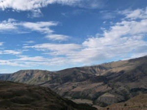
New Zealand … the North Island …
Mon, 14th – Wed, 16th Jan: Quest on Eden, Auckland, New Zealand
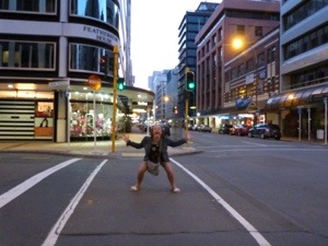
Kia Ora ‘Welcome’
Well, we are on our own now – the first 4 months of our trip is over and the itinerary exhausted! We head to New Zealand aware that we need to take some time out to prepare our own itinerary and it is in Auckland where we spend time preparing our trip around the islands.
Our flight out of Australia is a learning curve!!!!! We are not allowed to enter New Zealand until we have a return flight booked. The Travel Agent sold us our flight to New Zealand without saying a word about this and it is very frustrating indeed. Mindful of our impending flight we have no alternative but to head over to Flight Direct to book a return ticket – not the most cost effective way of doing things. After venting our frustration and with our return ticket in our hands, we finally get to check in!
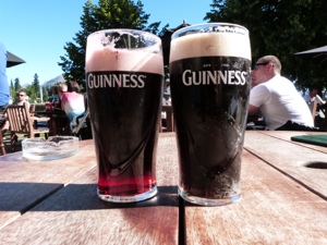
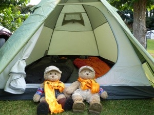
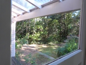
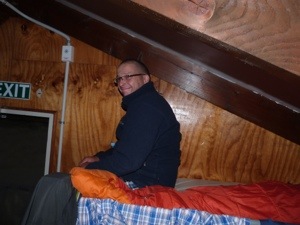
Once in Auckland, we are pleased with our self contained unit at Quest on Eden – our 3 days here will be enough to regroup and plan. Superbly located in the City, we also find a great location in which to make our plans – Britomart Country Club. An open air pub/restaurant with a great atmosphere and lovely staff many of whom show an interest in our trip. We are able to pick their brains about where to and where not to go in the time available to us. Free wifi is also an attraction and on more than one occasion we spread our maps and booklets all over the table here to make our plans. By the end of Tuesday evening we have an itinerary forming and some reservations made, YAY! Oh yeh, we’ve purchased a small tent as well and looking forward to a no frills camping trip.
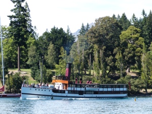
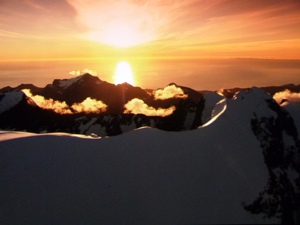
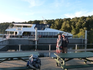
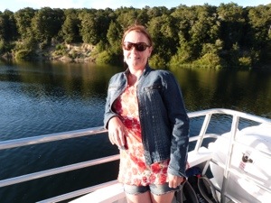
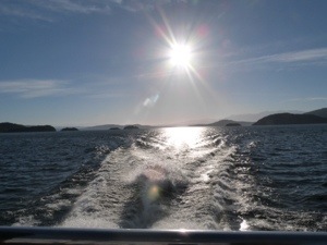
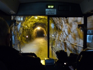
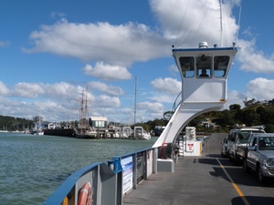
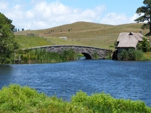
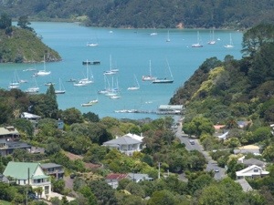
On Wednesday afternoon, we join the Harbour Cruise to cruise around Auckland’s beautiful Waitemata Harbour. This experience also gives us a free return ticket to Devonport. A fascinating commentary from the crew takes us past Bean Rock Lighthouse at the entrance to Waitemata Harbour. This historic lighthouse was built in 1871 and its small hexagonal cottage provided accommodation for one lightkeeper. The light became automatic in 1912 and the iconic design now appears on a New Zealand beer brand. The next stop is Rangitoto Island; an island which erupted from the sea in a series of dramatic explosion about 600 years ago and is now dormant. The summit offers spectacular 360 degree views of Auckland and the islands of the Hauraki Gulf. The next point of interest is North Head, Devonport. North Head guards the entrance to the harbour and for this reason was made into an artillery battery in 1885 to defend Auckland from invasion. It has many interesting gun emplacements and tunnels to explore, not to mention great walks and views of the harbour. We then cruise past Devonport Naval Base which dates back to 1840 when William Hobson, then Governor of New Zealand, arrived on the HMS Herald and established Auckland as New Zealand’s short lived capital. Today it is an important administrative centre for the Royal New Zealand Navy.
The cruise then does a loop under Auckland Harbour Bridge which opened in 1959 after taking over 200 workers nearly 4 years to build. It originally had only 4 traffic lanes and traffic increased so much that a further 2 lanes were added later on each side. It is here we stop for a few minutes to watch somebody bungy jumping off the underside of the bridge.
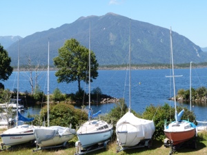
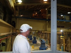
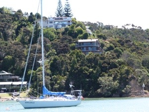
Chelsea Sugar Refinery is the next point of interest on the cruise. Chelsea Sugar, one of New Zealand’s iconic food brands, has been producing sugar at this refinery in Birkenhead since 1884. Today the company produces 2000,00 tonnes of raw sugar each year. The factory is situated in a beautiful privately owned park which is open to the public. The last port of call is Westhaven Marina and the Viaduct. The largest marina in the Southern Hemisphere, Westhaven can accommodate up to 1800 boats ranging in sizes up to 28m. Nearby, the Viaduct Marina is home to many bars and restaurants as well as the Voyager New Zealand Maritime Museum and many superyachts. It is in the Marina that we stop for a couple of drinks looking over our maps and doing some further research for our travels around these islands. Before we know it, time has got the better of us and we decide to use our free return ticket to Devonport and have our dinner over there. Devonport, one of Auckland’s most historic suburbs is just 12 minutes across the harbour. The marine village of Devonport boasts pretty Victorian villas, sandy beaches, stylish shops and charming cafes and it is at one of these cafes that we settle for our dinner.
We have a lovely evening but, unfortunately, on our way back to the ferry I end up ‘on the floor’. I just walk off the end of some steps and stumble head first into the pavement in front of me and it hurts!!!!!!!!!!!! My shins take the immediate brunt of the fall and bruise and swell immediately bringing tears to my eyes. Once back in Auckland they are so painful and Neil ‘my Samaritan’ spends the next hour or so alternating ice compresses on them. Not the ideal way to spend our last night in Auckland 😦
Thu, 17th Jan: Orengo Holiday Park, Russell, Bay of Islands
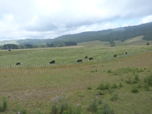
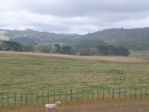
We are picked up today at 8.30am pick by the rental car company. I am a ‘bit worse for wear’ this morning – my body is aching and in pain following last night’s fall. My back and neck are stiffening and my right hand, arm and shoulder are complaining. After completing the paperwork at the car hire company, I feel very concerned and we make the decision to call into Auckland Hospital to ‘get checked out’. After a very thorough investigation and feeling confident that I haven’t done any major damage, we head off to join the Twin Discovery Road, a tourist road along the North Island which today will take us to the Bay of Islands in the ‘Northland’ region. The scenery is just splendid, so vast and never ending.

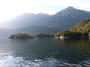
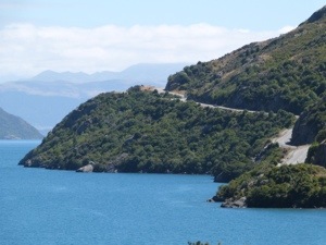
We finally arrive in Paihia, a bustling seaside town right in the heart of the Bay of Islands. Recognised as ‘the Jewel of the Bay of Islands’ it is a place where the local people enjoy a great lifestyle. There are superb golden sand beaches, scenic walks to explore, and a wide range of recreational activities which allow you to explore the 144 islands that make up the Bay of Islands. The town is rich in its history and culture which we later explore in nearby Waitangi – a place where Maori and European residents mix with visitors from all around the world.
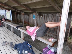
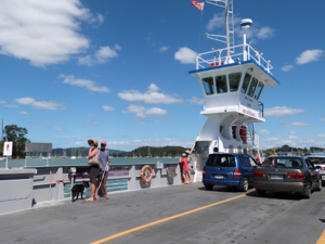
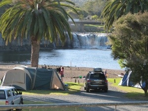
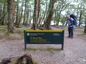
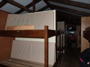
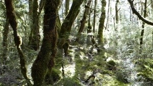
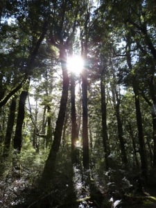
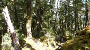
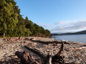
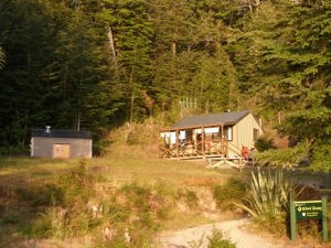
We call into Tourist Information and decide to base ourselves in ‘Romantic’ Russell. We head off to Opua to get the ferry to Russell and seek out Orongo Bay Holiday Park. As my back and neck are so uncomfortable, we decide to put off using the tent for a couple of days and book into a basic no frills hut. Set in 14 acres of park like grounds and native bush, this park offers the quintessential ‘Kiwi’ camping experience. The Russell peninsula is a kiwi and weka protection zone and native bird life abounds within the park.


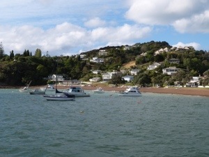
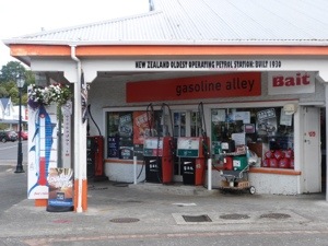
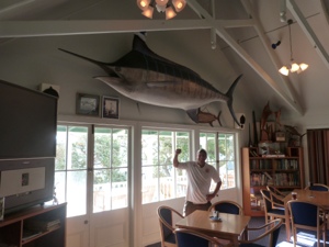
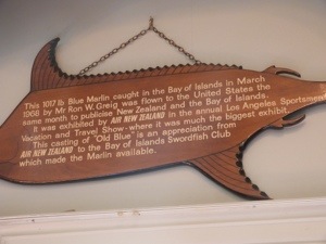
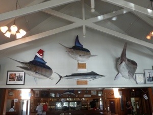
Once settled in we drive into Russell and immediately fall in love with the place. We come across the oldest garage in use in New Zealand before taking a drink at the Bay of Islands Swordfish Club where there are amazing castings of ‘trophy’ fish which have been caught over the years; namely a Broadbill @ 700lbs and a 1017lbs Blue Marlin. Newspaper clippings and trophies adorn the walls for huge records achieved when fishing in the area.


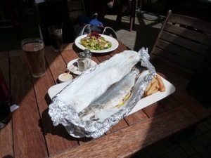
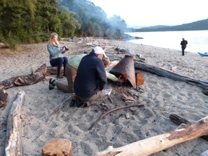
It’s late when we decide to head back so we opt for a curry at the local Thai Restaurant before heading ‘home’ to our basic kiwi camp experience!


Fri, 18th Jan: Orongo Bay Holiday Park, Russell, Bay of Islands
We head back into the quaint village of Russell today to explore some more. Only 1.5km from the park sparkling waters, pohutukawa-fringed bays and a colourful history epitomise this romantic Bay of Islands township. Russell was a focal point for both Maori and European settlement and went through some notorious times in its early days. During the 1800s it was know as the Hell Hole of the Pacific with a population of ship deserters, ex-convicts, whalers, sealers and ship girls, an image totally at odds with its current peaceful charm.
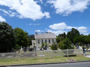
Its background is reflected in historic buildings such as Pompallier House, New Zealand’s oldest surviving catholic building, and Christ Church, the country’s oldest working surviving church. The church facade still has bullet holes dating from conflicts between local Maori and European settlers and Russell Museum tells you more.
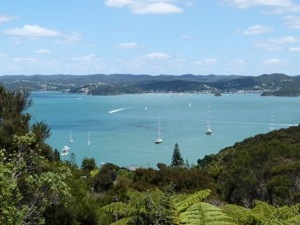

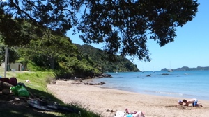
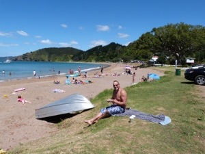
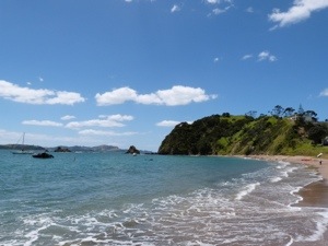
Today, Russell is renowned as a base for big game fishing excursions and cruises around the Bay of Islands. Behind the town, we visit Flagstaff (Maiki) Hill which offers stunning views of the area. We then make a stop at nearby Long Beach which caters for those seeking sand and surf. It is here that we fall madly in love with the Bay of Islands … it is ‘that place’ … and we spend a lovely couple of hours here totally engaged in our surroundings.

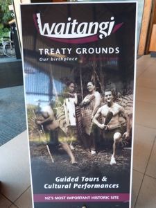
Our final stop of the day is Waitangi Treaty Grounds on the Waitangi National Trust Estate
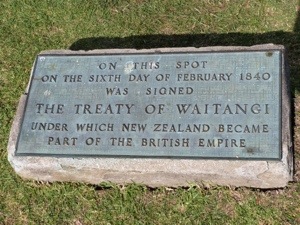
The Waitangi Treaty Grounds, overlooking the Bay of Islands, is New Zealand’s pre-eminent historic site. It was here on February 6th, 1840, that the Treaty of Waitangi was first signed between Maori and the British Crown. The Treaty Grounds are part of the 506 hectare Waitangi National Trust estate, which was gifted to the nation by Lord and Lady Bledisloe in 1932. In the Deed of Gift, Lord Bledisloe stipulated that the estate was never to be a burden on the tax payer, and as such it is not government funded. The estate is administered by the Waitangi National Trust Board, whose members represent various sections of New Zealand people.

It was a very interesting ‘history’ lesson and, following a film introducing the events that took place before, during and after the signing of the Treaty of Waitangi in 1840, we explore the features of the Treaty Grounds including:-
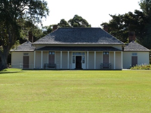
The Treaty House – built for the first British Resident, James Busby and his family. It is one of New Zealand’s oldest and most visited historic homes.
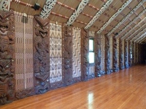
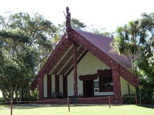
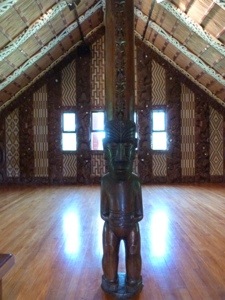
Te Whare Runanga – fully carved Maori Meeting House, which is representative of all Iwi (regional tribes) in New Zealand.
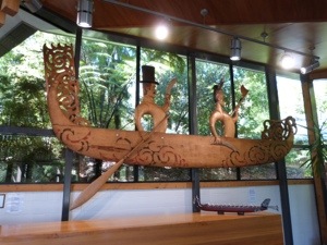
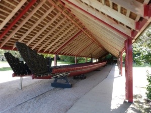
Ngatokimatawhaorua – one of the world’s largest Maori ceremonial war canoes.
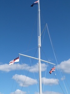
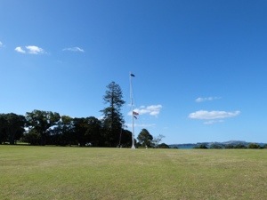
The imposing Naval flagstaff – which marks the place where the Treaty of Waitangi was first signed.


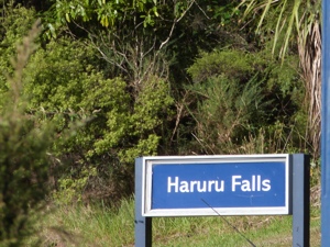
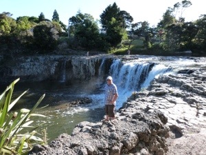
The extensive park-like grounds with stunning sea views of the Bay of Islands, have an abundant native bird life, heritage gardens, trees, and a mangrove boardwalk which make for a beautiful walk. We head off for a highly recommended peek of Haruru Falls before making our way back to the holiday park.
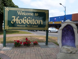
Sat, 19th Jan: Opal Hot Springs Holiday Park, Matamata (Hobbit Country)
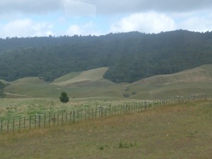
We have a long long journey ahead of us today. We get on the road early for the 6 hour drive back through Auckland for our night in Matamata (the maori word for ‘Headland’) – Hobbit Country! Hobbiton might have put it on the world map, but this bustling rural town nestled at the bottom of the dramatic Kaimai Range has an outstanding reputation in its own right. The wide streets of this pretty town are lined with trees, restaurants, bars and boutique style shopping and surrounded by lush green pastures.


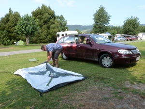
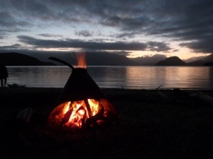
We do a bit of shopping in the town before heading to the park where, for the very first time, we set up our tent, lol, and it goes amazingly well!


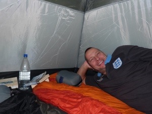

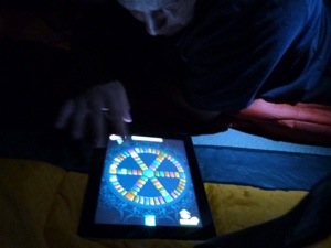
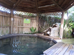
We have a great tea cooked in the camp kitchen before relaxing in the natural hot mineral (37 degrees) pool. After chilling out for the remainder of the evening we hit the tent for a game of Trivial Pursuit and some much needed Zzzzzz’s.
Sun, 20th Jan: Cosy Cottage Thermal Holiday Park, Rotorua, Central North Island
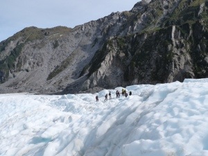
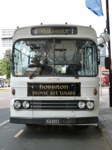
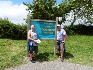
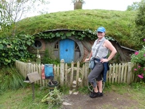
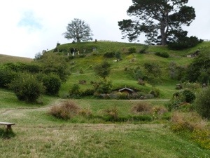
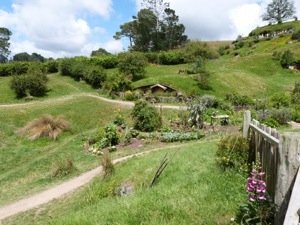
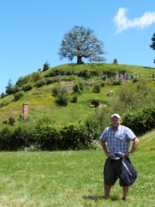
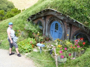
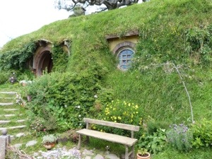
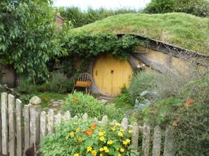
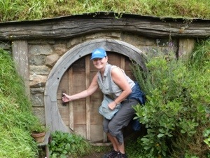
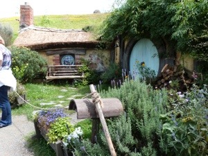
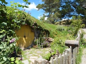
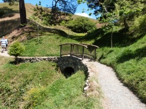
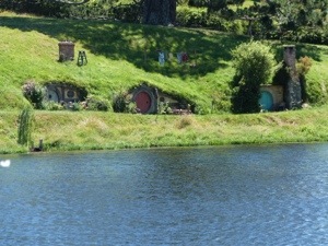
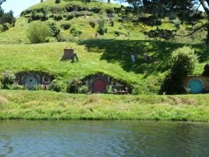
Today, en route to Rotorua, we discover the real Middle-earth on the most picturesque private farmland near Matamata in the North Island of New Zealand, where we visit the Hobbiton Movie Set from The Lord of the Rings and The Hobbit film trilogy in a fascinating two-hour guided tour.
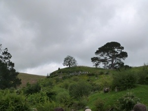
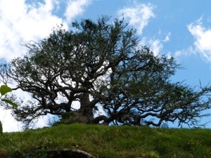
There are also spectacular views across to the Kaimai Ranges from the rolling green hills of the movie set, which is still the working sheep and beef farm of the Alexander family. In September 1998 Peter Jackson and New Line Cinema discovered the farm during an aerial search for suitable film sites. This farm closely resembled that of Middle-earth as described by Tolkien. The large established pine tree, later to become known as the ‘party tree’ was already perfectly placed in front of the lake. The surrounding rolling farmland was untouched by 20th Century clutter such as roads, buildings or power lines.


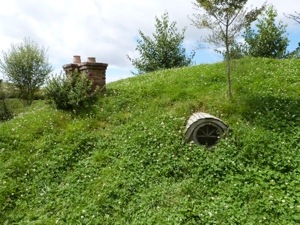
Assisted by the New Zealand Army, the total site construction took 9 months, including building 1.5km of road to the site. At its filming peak, 400 people were on site including Peter Jackson, Gandalf (Sir Ian McKellen), Frodo (Elijah Wood), Bilbo Baggins (Ian Holm) and Sam (Sean Astin).
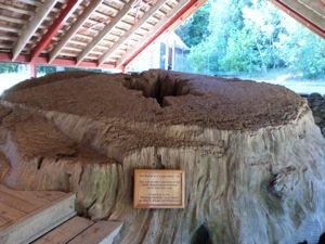
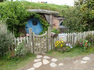
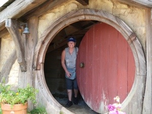
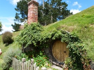
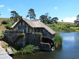
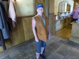
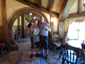
The set has now been completely rebuilt and can be seen as it appeared in the films and it is soooo cute. We learn the tricks of the trade in setting up this filmset of 37 hobbit holes – including the cutting down of the Oak Tree overlooking Bag End which was cut down and brought in from near Matamata. Each branch was numbered and chopped, then transported and bolted together on top of Bag End – all 26 tonne of it. I, for one, am quite excited as we venture around The Shire and see the lane where Gandalf arrives, Bag End, Sam’s house, the Party Tree and Field, the Mill and Arch Bridge.


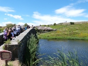

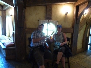
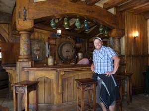
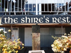
The final stop in The Shires is, of course, the pub! The Green Dragon Inn is now open and is a special feature of the tour – although the actual filming for the scenes in the movies took place at a set in Wellington. We visit the inn as part of the tour and enjoy a complimentary beer before heading off for Rotorua.


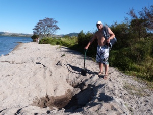
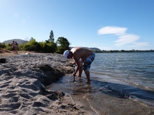
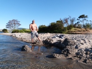
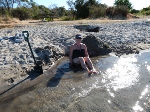
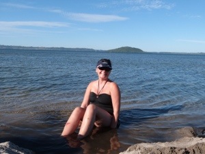
In Rotorua we take an explority drive of the area before deciding on staying at Cosy Cottage Holiday Park on the banks of the Utuhina trout stream with lakeshore access to Lake Rotorua. Located at the edge of the beautiful Lake Rotorua, the distinctive smell of sulphur in NZ’s thermal capital soon lets you know you’ve arrived. We spend a very chilled out evening indeed and once we have set up our ‘camp’ we walk the short distance to Lake Rotorua Hot Water Beach armed with a shovel – this was amazing, we dug a hole in the hot sand at the lake’s edge where the thermals heat the water and we had our very own natural spa bath – loved it!


Afterwards we relaxed in one of the three therapeutic geothermal hot mineral pools before eating and drinking the night away. Bliss!
Mon, 21st Jan: Cosy Cottage Thermal Holiday Park, Rotorua,Central North Island
A late morning breakfast on this sunny day was welcome before heading off to the Duck Tour in Rotorua. However, this tour was not to be as the 11.00am tour was full and the 1.00pm tour – which we ended up booking instead – had a mechanical fault and was cancelled.
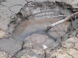
Initially ‘filling in time’ til the 1.00pm tour, we went for a walk around the local Kuirau Park at the northern end of Rotorua; a public park that is definitely alive!!!!!! with walking tracks which lead to numerous areas of vigorous geothermal activity.
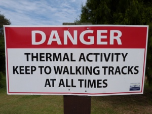
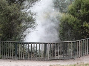

New eruptions do occur from time to time, and only in 2001 did mud and rocks the size of footballs suddenly hurl 10 metres into the air as a new steam vent spontaneously announced its arrival. Two years later, similar eruptions provided a real bonus for delighted visitors. In early Maori times the small lake in the park was much cooler and was known as Taokahu.
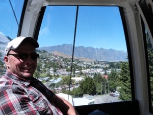
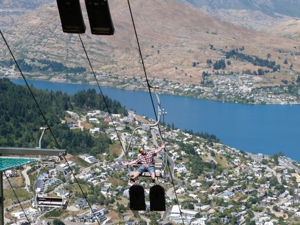
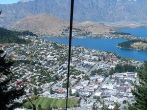
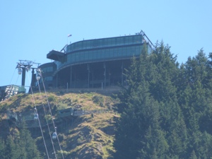
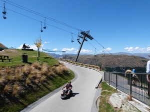
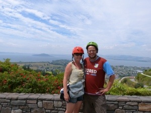
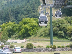
On returning to the town and learning that the 1.00pm Duck Tour was cancelled, we took ourselves off for some fun at the Skyline Luge and what fun we had, lol. Found in the heart of New Zealand’s scenic volcanic wonderland just minutes from Rotorua’s City centre, this is where the Luging adventure all began in 1985. Conveniently located high on the side of Mount Ngongotaha, is Skyline Rotorua. A Gondola carries you to 487 metres above sea level to a stunning environment providing panoramic views of Rotorua City, Lake Rotorua and the surrounding area. A 900 metre long Doppelmayr cableway system with a vertical rise of 178.5 metres, carries us to the Skyline Rotorua complex.

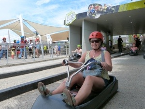

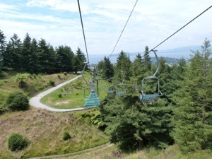

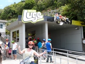
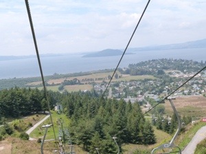

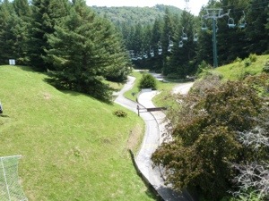
The Luge has three tracks of differing skill levels winding through beautiful forest – whether taking the gentle paced Scenic track, stepping up to the Intermediate or taking on the challenge of the Advanced, the tracks were a truly unique outdoor experience – all 4km of them! Once at the bottom, we took the scenic chairlift back to the top of the track before finally leaving the mountain on the Gondola to return to our camp in readiness for our Maori Cultural Experience in the evening – Mitai Maori Village.
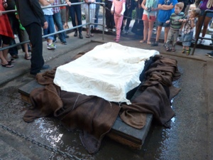
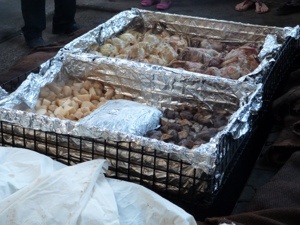
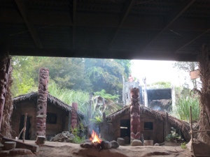
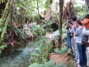
Rotorua’s long Maori history makes it an ideal place to experience the rich Maori heritage and an evening at Mitai gives us an authentic introduction to Maori culture leaving us amazed and in awe. The Mitai family ‘is proud to have created a sacred and spiritual place that offers you an indigenous cultural experience like no other’. After the welcome, ‘Kia Ora’, we are taken over to see our traditionally cooked hangi meal being lifted from the ground – lamb, chicken, vegetables all being ‘steam cooked’ by the thermals in the ground.


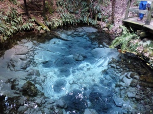
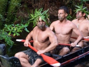
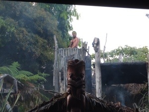
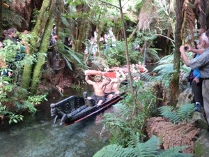
On entering the world of Mitai we are enthralled by the natural bush setting and the crystal clear water full of eels and trout, flowing directly from the earth at the sacred Fairy Spring. Following the arrival of the warriors in traditional dress who paddled an ancient warrior canoe (waka) down the Wai-o-whiro stream, we watched the cultural performance and learned about their past, their carvings and ta moko (tattoo art).

<a href="https://pitkinsaroundtheworld.com/wp-content/uploads/2013/02/20130223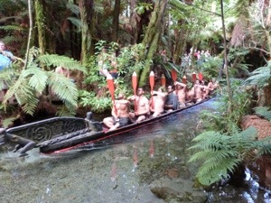

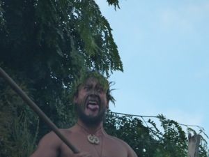
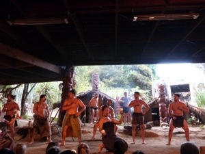
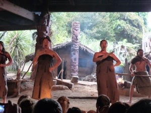
We are captivated by the displays of weaponry and combat, coupled with the grace and beauty of the ladies’ poi dance. The finale of the spine tingling haka was amazing 🙂 and so intimidating lol – you couldn’t look any one of the tribe in the eye!


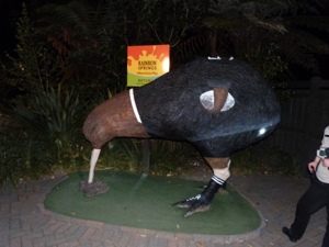
After a succulent Hangi meal, and once it was dark, we were guided back into the bush to see the glow worms (larvae of swamp flies) in their natural habitat which were beautiful to look at. We did the Rainbow Springs Night Tour ‘add-on’ – this took us on a walk with a local guide through Rainbow Springs, a National Kiwi Trust Conservation Centre set in 22 acres of spectacular flora and fauna. It is here we can see huge trout up close gliding through the cold clear water, hear the striking calls of the nocturnal birds and see nocturnal creatures that are normally hidden during the day. The main purpose of this ‘add-on’ was to get to see the ‘elusive’ kiwi and we are not disappointed – we went right inside a kiwi enclosure and got to see them up close and hear them on the forest floor foraging for bugs. A very strange creature indeed – a bird the size of a chicken but with no wings, a huge long beak and very thick set legs. Not in a rush to welcome us obviously but it was an experience having actually seen one.

Tue, 22nd Jan: All Seasons Kiwi Holiday Park, Lake Taupo, Central North Island
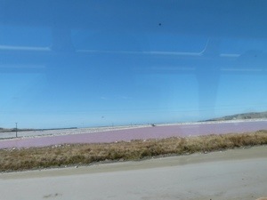
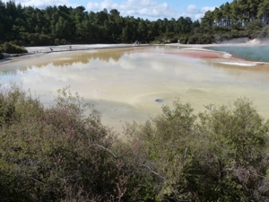
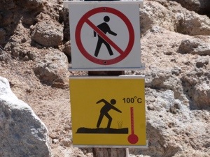
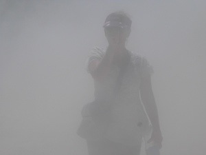
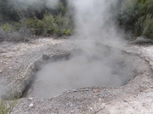
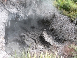
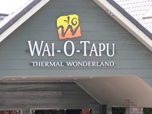
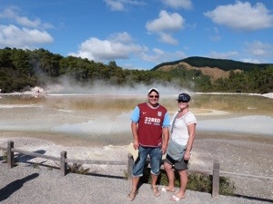
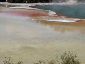
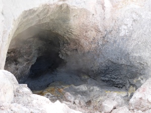
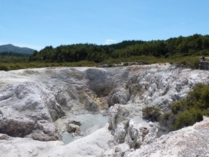
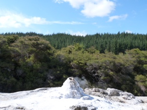
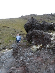
En route to Lake Taupo today we visit Wai-O-Tapu (Sacred Waters) Geothermal Wonderland. Set in the natural bush setting, this adds another dimension to the experience. Sculptured out of volcanic activity and thousands of years in the making, Wai-O-Tapu is considered to be New Zealand’s most colourful and diverse geothermal sightseeing attraction. Here we are introduced to a uniquely different natural landscape – the key to what you see lies below the surface – one of the most extensive geothermal systems in New Zealand.
The Wai-O-Tapu thermal area is part of a Scenic Reserve administered by the Department of Conservation and has the largest area of surface thermal activity of any hydrothermal system in the Taupo Volcanic Zone. Covering some 18sq.km with the volcanic dome of Maungakakaramea (Rainbow Mountain) at its northern boundary, the area is covered with collapsed craters, cold and boiling pools of mud, water and steaming fumaroles and we only get see a very small portion. The area is associated with volcanic activity dating back about 160,000 years and is located right of the edge of the largest volcanic caldera (depression) with the active Taupo Volcanic Zone.
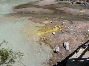
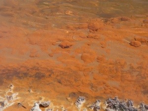
The Wai-O-Tau stream forms and integral part of the drainage system which ultimately flows into the Waikato River and out into the Tasman Sea. Boiling springs and volcanic gases introduce numerous minerals into the water. Beneath the ground there is a system of streams which are heated by magma left over from earlier eruptions. The water is so hot (temperatures of up to 300 degrees centigrade have been recorded) that it absorbs minerals out of the rocks through which it passes and transports them to the surface as steam where they are ultimately absorbed into the ground. This so called ‘rotten egg smell’ (and it doesn’t half honk!) of geothermal areas is associated with hydrogen sulphide. The wide range of colours in the area are all natural and are due to different mineral elements, the predominant colours being:-
Green – colloidal sulphur / ferrous salts
Orange – Antimony
Purple – Manganese oxide
White – Silica
Yellow-Primrose – Sulphur
Red-Brown – Iron Oxide
Black – Sulphur and Carbon
Clearly defined tracks provided us with the opportunity to enjoy the diversity of this area through a series of different walks taking from 30 to 75 minutes or more, each with their own unique volcanic vistas to fascinate. Walking at our own pace we find innumerable colours of every tint and hue displayed in pools, lakes, craters, steam vents, mineral terraces and even in the tracks we walk on. We view a wide range of features (25 in all) which include:
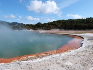
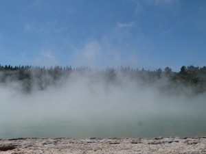
The World Famous Champagne Pool – a unique fifth of a hectare bubbling, hissing water, with a beautiful ochre-coloured petrified edge. This spring is the largest in the district being 65m in diameter and 62m deep. Its surface temperature is 74 degrees c and bubbles are due to carbon dioxide. The pool was formed 700 years ago by a hydrothermal eruption. Minerals contained in the water are gold, silver, mercury, sulphur, arsenic, thallium, antimony and are presently depositing in the surrounding sinter ledge. The various sinter ledges have been associated with tilting of the pool as a consequence of earthquake activity.


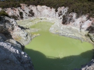
Devil’s Ink Pots – a series of mud pools whose water levels fluctuate with the amount of rainfall. The colour is due to small amounts of graphite and crude oil brought to the surface by the water forcing its way up.
The Artist’s Palette – a panorama of hot and cold pools and steaming hissing fumeroles producing an amazing variety of ever-changing colours. Overflowing water from the Champagne Pool draws with it minerals that have originated from below the surface. To the left of the Palette is a geyser from which steam rises and water can erupt to a height of one metre.
Huge Volcanic Craters – well over a dozen craters, some formed by eruptions, some by internal chasms, all displaying a variety of geothermal features. Formed over the last few hundred years these are up to 50 metres in diameter and up to 20 metres deep. Several contain hot water springs and most have extensive sulphur deposits. In Bird’s Nest Crater, starlings, swallows and mynahs nest in the holes on the walls of this collapsed crater. The heat from below rises up the crater walls to incubate the eggs.


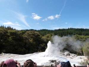
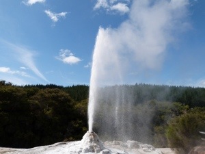
and last but not least, The Lady Knox Geyser – erupting daily reaching heights of up to 20mtrs, we experience the raw beauty and sheer power that Mother Nature offers when this ‘performs’.
We loved it here !
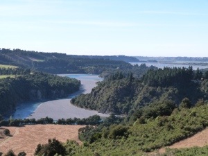
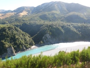
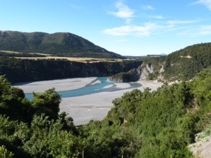
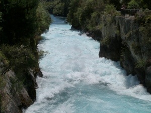
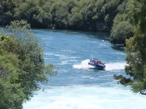
Further on our scenic drive to Taupo, we have an ice cream stop at Huka Falls and we are so glad we did. On our travels so far we have seen so many stunning and amazing places that we feel we are saying these words all the time!!! But, it IS stunning and amazing and Huka Falls is no exception – WOW! Taking hundreds of years to create, Huka Falls is one of the most visited natural attractions in New Zealand. An ancient lake once covered most of the upper Waikato River Valley. Before the Taupo Oruanui eruption 26,500 years ago thick deposits of sediments accumulated on the lake floor eventually becoming hard mineral layers, today known as Huka Formation. Over time the lake drained to become Upper Waikato River cutting a deep narrow channel through these hard layers and reaching a softer layer underneath. Eventually sections of the softer layer eroded and collapsed away leaving the water to plummet over remaining hard layers and creating the spectacular sight we see today. The colour of the water is amazing – a striking blue against the bright white of the air bubbles in the rushing water.

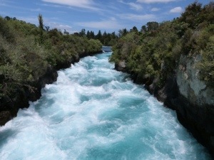


The incredible volume of water is due to the Waikato River, 100m wide and 4m deep upstream, being forced through the carved channel of the hard rock, which is only 15m wide and 10m deep. About 220,000 litres of water plunges over the rock face of Huka Falls every second, and could fill an Olympic swimming pool in 12 seconds!!!! The Waikato River is New Zealand’s longest river, its 425km journey starting at Lake Taupo and ending at the sea south of Auckland.
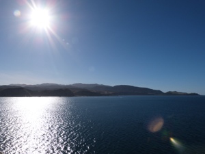
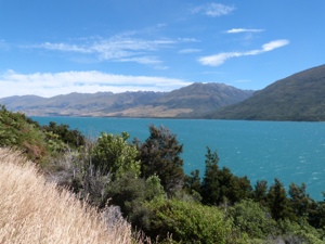
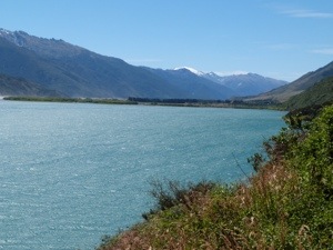
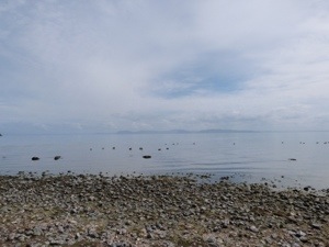
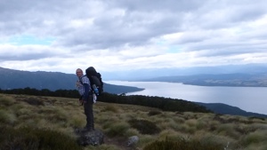
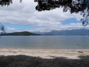
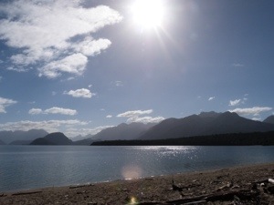
We arrive at Taupo late in the afternoon and are all travelled out! The beautiful Lake Taupo is stunning as it appears over the horizon and we learn that it is about the size of Singapore – more of an inland sea really. The home of much geo thermal activity it is the country’s largest lake as well as the stunningly clear, turquoise waterfall (Huka) and river (Waikato). Lake Taupo was created nearly two thousand years ago by a volcanic eruption so big it darkened the skies in Europe and China.
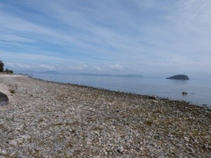
At some of Lake Taupo’s beaches, you can enjoy warm, geothermal water currents. However, we enjoy relaxing at the site for the evening, catching up with home, laundry and generally tidying up before a lovely dinner and a nice cuppa before bed 🙂
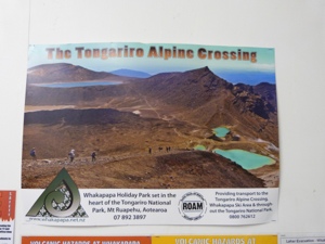
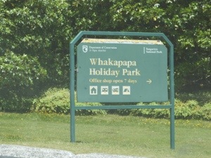
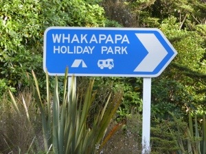
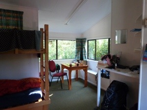
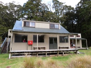
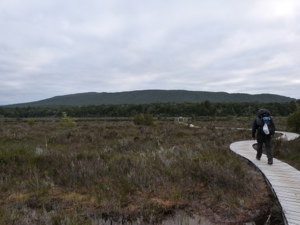
Wed, 23rd Jan: Whakapapa Holiday Park, Mt Ruapehu, Tongariro National Park, CNI
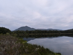
We head off today to Tongariro National Park to prepare for our walk tomorrow. Before leaving Taupo we spend some time at a scenic lookout on the Great Lake Taupo and take in this serene beauty one last time.
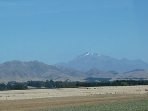
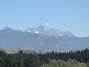
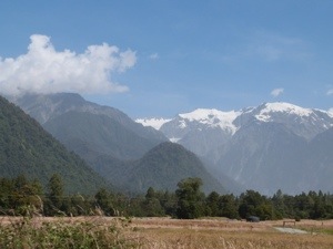
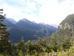
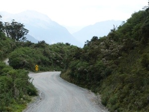
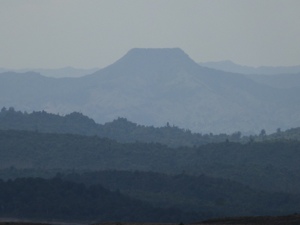
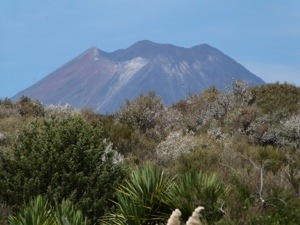
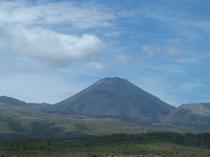
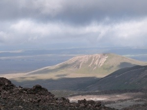
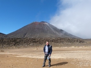
Stocking up with groceries for the next few days (including our ‘picnic’ for the great walk tomorrow!) at Turangi, we make good progress towards Whakapapa Holiday Park, where we will base ourselves for the next two days. Our journey into this volcanic area is truly spectacular and the sights are breathtaking. We see the volcanoes we will be exploring all the way into Whakapapa getting larger and larger. Mt Nguaruhoe (Mt Doom in the Lord of the Rings Trilogy) appears and it is so prominent and dominant in the skyline.

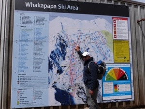
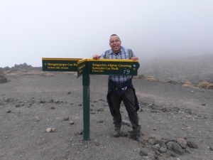
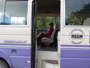
On checking in, we book our tickets with Roam who will pick us up at 7.00am in the morning to take us to Mangatepopo Car Park (1100m), the start of our walk of the Tongariro Alpine Crossing.
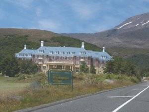
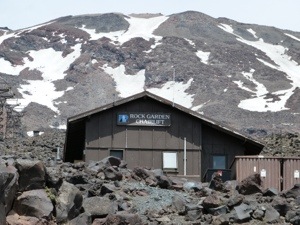
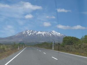
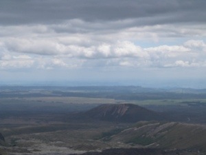
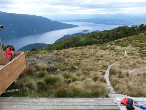
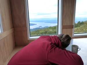
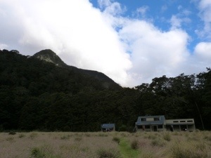
After settling in, we explore the tiny Whakapapa Village and take off up to the upper slopes, and also home of Whakapapa Ski Area, of Mt Ruapehui – New Zealand’s largest volcano. A 20min journey on 2 chair lifts takes us up across the volcanic landscape to Knoll Ridge Cafe, New Zealand’s highest cafe at 2020m where we walk some of the Skyline Walk and play in the snow! We have arrived too late to do the full walk and be back in time for the last chair lift 😦 The full 2hr round trip takes you to Skyline Ridge (2,300m) where the views across Tongariro National Park and beyond are said to be breathtaking. However, it has to be said that the views we had anyway were also stunning.


The Lord of the Rings, Mordor the strong hold of the dark lord Sauron was filmed on and around this Volcanic Plateau. Much of Frodo and Sam’s journey into the land of Sauron was filmed here and our views across to Mt Doom (real name Mt Ngauruhoe) are spectacular!
We have loved our first few hours in this area so much and both agree that we would have loved a good 5 days walking holiday here. Oh well, can’t have it all!!!!
Thu, 24th Jan: Whakapapa Holiday Park, Mt Ruapehu, Tongariro National Park, CNI
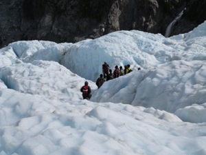
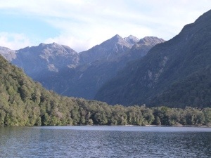
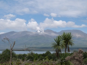
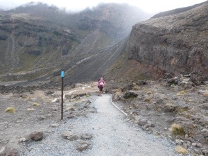
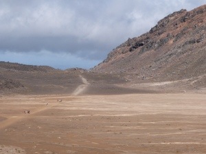
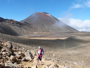
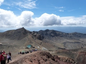
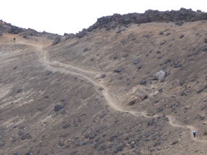
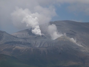
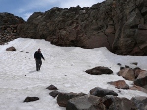
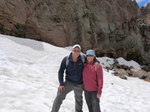
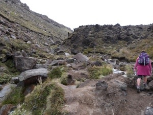
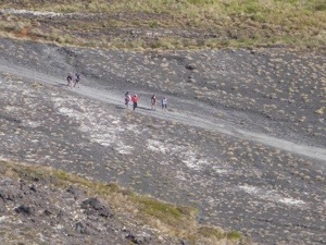
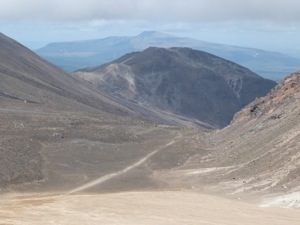
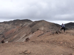
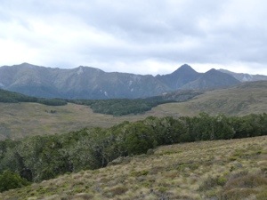
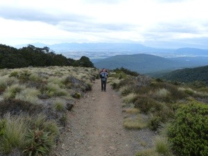
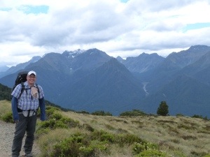
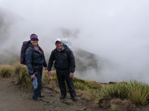
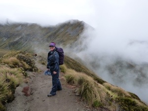
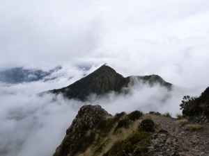
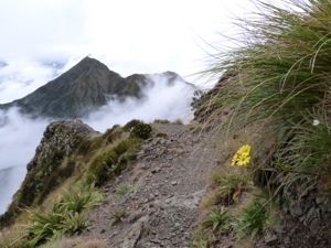
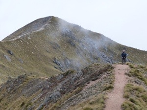
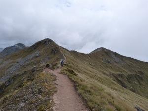
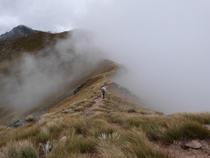
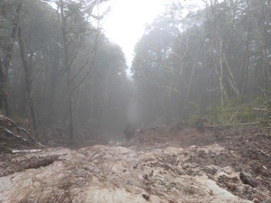
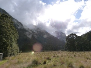
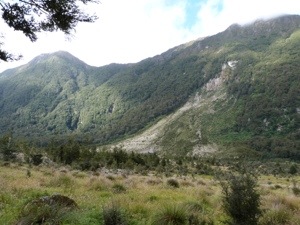
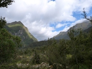
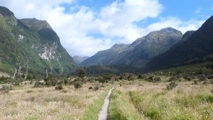
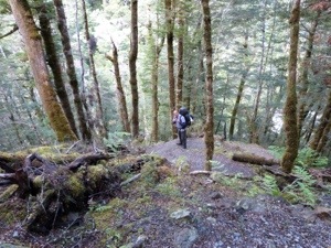
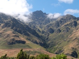
Up extremely early today (6.00am) to do the Tongariro Alpine Crossing heralded as the best one-day trek available in New Zealand (from alpine meadow to mountain summit with stunning volcanic features along the way), while others say it ranks among the top ten single-day treks in the world. Set in New Zealand’s oldest national park and a dual World Heritage Site, The Tongariro National Park is rich in both cultural identity and dramatic, awe-inspiring natural scenery. Unique landforms, including the volcanic peaks of Ngauruhoe (2287m) Tongariro (1967m) and Ruapehu (2797m) ensure the Tongariro Alpine Crossing is considered a world-renowned trek.

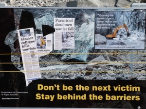
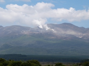
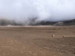
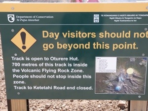
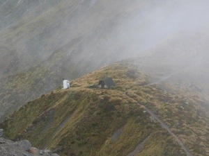
Unfortunately, at the moment the public are only allowed to walk half of the crossing (to the Red Crater @ 1900m) at which point we have to return to base (8-9 hrs allowing time for photos, any sidetracks, lunch and breaks). The paths from the Red Crater are closed as last August and November there were eruptions from the vents on a mountain in the range and we can see that they are still smoking today!

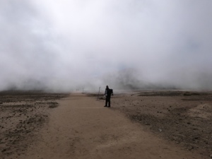
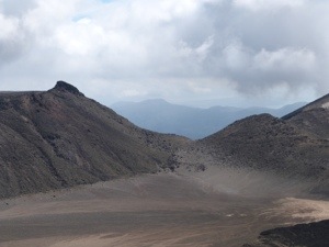
What an amazing experience this walk was – the whole place is alive, imposing, violent and fragile. Words are just not enough to describe it!
The traverse of the stark and spectacular volcanic terrain of Mt Tongariro is one of the most fascinating treks in NZ. Among its highlights are steaming vents and hot springs, old lava flows, beautiful water filled explosion craters and stunning views. The mountains of Tongariro National Park are sacred to Maori. Mounts Ngauruhoe and Tongariro are active volcanoes and trampers are told to be prepared to move off the mountains quickly if there any signs of volcanic activity – lol.
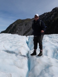
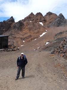
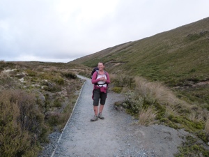
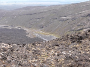
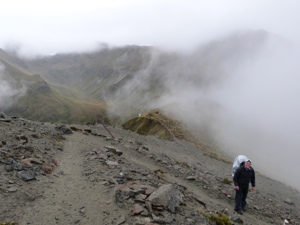
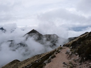
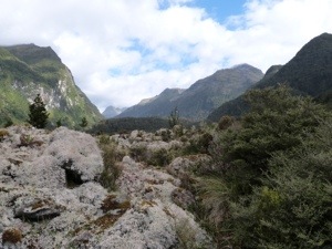
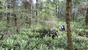
From the Mangatepopo Road Car Park @1100m we walk to the main track and continue at a gentle gradient alongside a stream and around the edges of old lava flows. The track climbs steadily to the South Crater @ 1700m and we are ‘in the clouds’ as we cross over two lava flows from eruptions in 1870 and on this now clear day there are magnificent views from this section of the track. It is here where, for those who want to, you can clim Mt Ngauguhoe (Mt Doom). We continue across the South Crater to a ridge leading up to Red Crater @1886m, a still active crater.


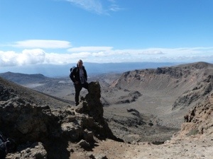
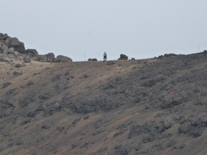
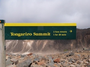
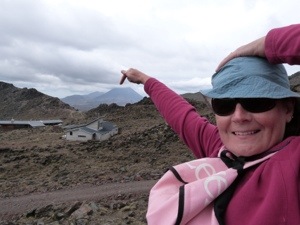
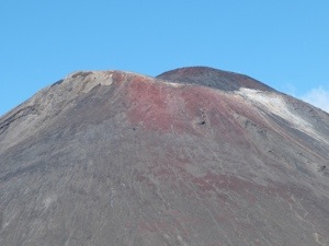
Once at the Red Crater there are spectacular views to the east over the Kaimanawa Forest Park and Desert Road. Looking into the crater, there is an unusual formation within known as a ‘dike’. This feature was formed as molten magma moved to the surface through a vertical channel in the crater wall. The red colour is from the high temperature oxidation of iron in the rock. It is from here that a side trip can be taken to the summit of Mt Tongariro, which Neil completes later in the day.


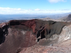
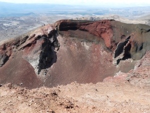
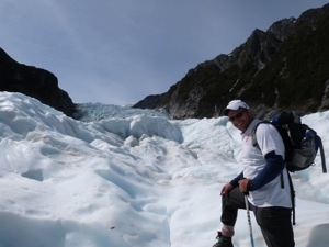
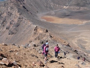
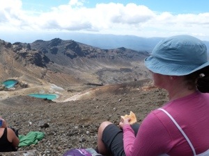
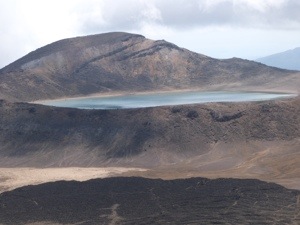
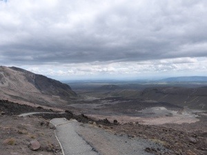
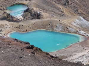
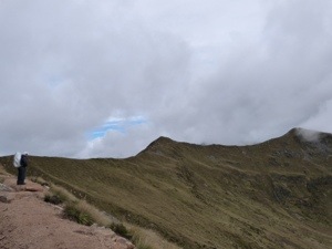
The summit of Red Crater is the highest point on the Tongariro Alpine Crossing. It is here that we sit on the loose scree of the steep incline and eat our lunch overlooking Emerald Lakes. Minerals leaching from the adjoining thermal area cause their brilliant colour. The Maori name is Ngarotopounamu meaning greenstone-hued lakes The lakes freeze in winter. Due to the recent volcanic activity, it is here that our crossing ends and return the way we came. If we were allowed to carry on, our walk would have skirted the Blue Lake – a cooled lava lake – but we do not miss out on this as we get a good view from where we are.
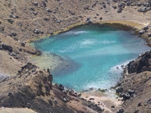


Once we got as far as we could go, we sat and ate our lunch – the best location ever for dining! On top of the world overlooking the trio of Emerald Lakes, Blue Lake and the Red Crater. From here and in front of us, we could also see way into the distance to where the rest of the walk would have taken us. Behind us on one side is the top of Mt Ngauruhoe in all its ‘oh so close’ glory, and on the other is the summit of Mt Tongariro which Neil completes on our way back.


Not having walked for a while, our efforts today push us to our limits – 19k over this terrain took its toll and, whilst being very apologetic to our feet and legs, our minds and eyes really appreciated the experience, lol.


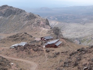
9hrs and thousands of footsteps later, we arrive at the car park for our bus back to the village. Well, to the bar in the village which overlooks Mt Ngauruhoe, for a much deserved celebratory drink.


Then it’s back to camp for a freshen up and a ‘Neil Pitkin Gourmet Burger’ then it’s all we can do to manage to drop ourselves into bed – 9pm 😀 – it’s been a most spectacular day!
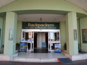
Fri, 25th Jan: Downtown Backpackers, Wellington (drop off car)
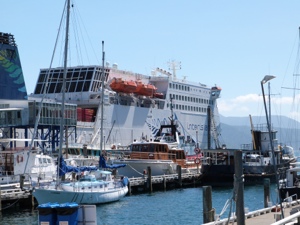
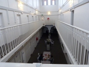
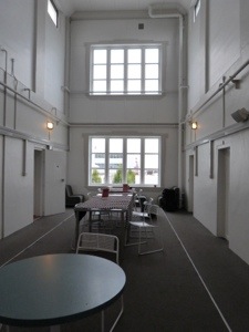
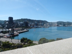
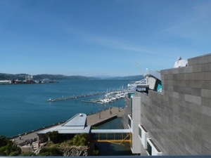
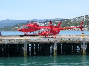
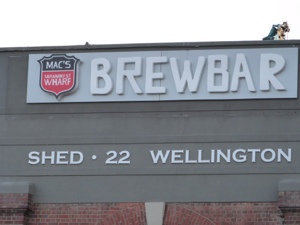
Very surprisingly not too stiff this morning, we are up, packed and away by 9.30am starting the long drive to Wellington. We make good progress and it is another beautiful journey. Arriving in the City at 2.00pm, we are chuffed to find our accommodation right smack bang in the middle of everything – a truly wonderful spot with all the amenities you would ever need. Right in the heart of the Capital City, Downtown Backpackers is the closest accommodation to the Inter-Island Ferry Terminals, the Stadium and is directly opposite the Wellington Railway Station.


The Historic Hotel Waterloo that is now Downtown Backpackers was chosen to host the Queen’s entourage on her 1953 Coronation Tour of New Zealand. Therefore when the hotel was converted for budget accommodation, the luxuries remained. Downtown Backpackers has a different feel to that of other budget accommodation properties featuring elegant staircases and high ceilings. The on-site cafe is actually located in the old hotel’s ballroom. The whole atmosphere in the place is great and the really friendly staff interact with you so well.
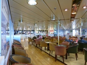
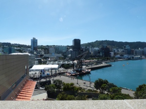
Once settled, we chill out in the In-House Bar and shoot a few games of pool; didn’t we Neil??? lol. Afterwards, as we walk around the City of Wellington we see a vibrant, compact cluster of heritage buildings and sleek modern high-rises with tree-lined streets. The City has the normal shopping outlets, enticing restaurants, theatres and galleries. Its compact nature and excellent public transport make it easy to get around – which we are grateful for when we leave for the South Island.


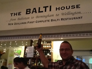
It’s not long before the rumbling in our bellies leads us to The Balti House ………

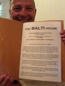
As we tuck in, we realise that it’s been too long x pmsl. Bellies full, we head off downtown to ‘home’ and fall happily into bed – a perfect Brummie Evening ❤
Sat, 26th Jan: Downtown Backpackers, Wellington
Wow, an extremely lazy morning was had – well, it is Saturday! We lazed in bed watching tv – just like the good old days before travelling, lol – before hitting the cafe for our brunch (a fry up! and it was great) and exploring this gorgeous City.
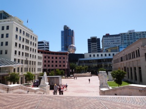
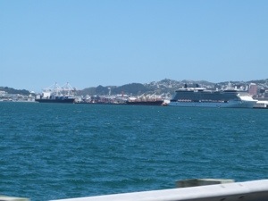
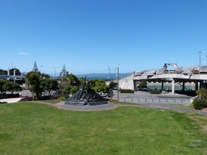

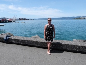
On this most beautiful sunny Saturday we take the short walk to Te Papa (The Museum of New Zealand), via the Harbour which is an integral part of the city's lifestyle. It is a very lively and scenic waterfront as we make our way down the Harbour's Quays – Waterloo, Customhouse and Jervois. A key attraction, Te Papa, the Museum of New Zealand has prime waterfront location along with numerous bars, cafes and restaurants.
It is the museum which we are heading to and stop for an hour at the Taranaki Wharf Jump Platform, a series of platforms from which the public are jumping into the Wharf!
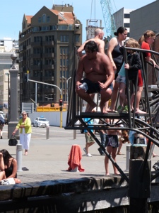

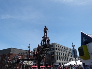
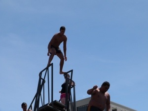
Amazingly, there is a huge crowd around this area just watching the antics that are going on and it's very enjoyable to witness. One huge guy just bombs from the platform and, much to the delight of the crowd, creates a great splash of water wetting everybody near the edge. Very funny!
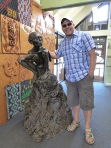
We continue on to Te Papa an extraordinary interactive national museum to 'experience the treasures of Aotearoa New Zealand'. Te Papa Tongarewa literally means 'container of treasures' and, once inside the museum, we discover the treasures and stories of New Zealand's land and people, told with authority and passion. The museum is built on a unique bicultural partnership, which recognises and celebrates Maori as tangata whenua – the original people of this land. The collections are spread over six floors of engaging, interactive displays and we encounter Maoria and Pacific cultural treasures, NZ's extraordinary natural life and its unique history.
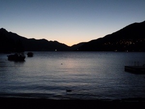
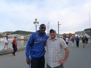
We finish the evening at a bar in the harbour watching the sunset ……….


… oh yeh, and ‘bump’ into Emile Heskey !!!!!!
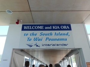
I am a little worse for wear by the time we get back to Downtown Backpackers and poor Neil is left to sort all our luggage out for our epic travelling day to the South Island tomorrow. Bless x

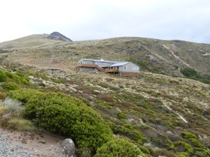


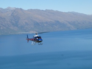
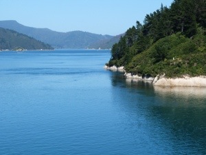
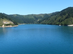
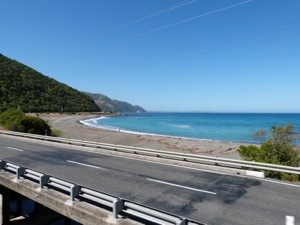
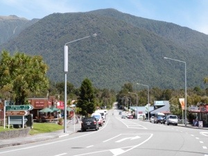
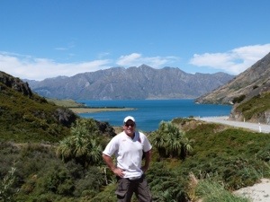
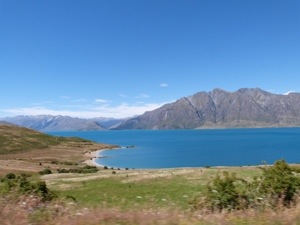
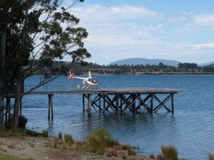
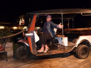
 – this is what we did!
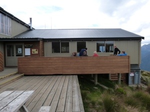
 – good or what!
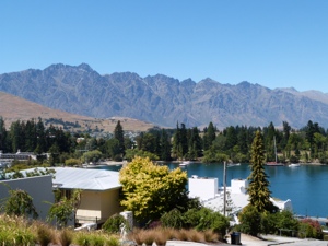
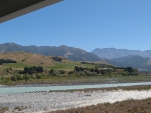
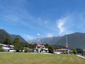
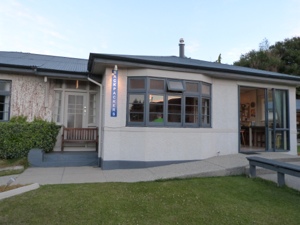
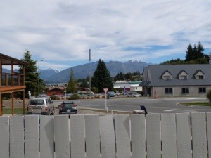
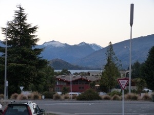
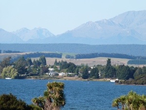
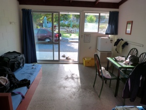
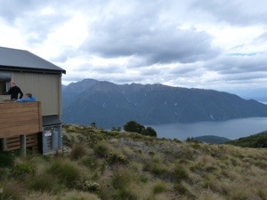
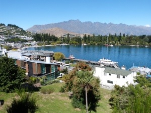
 – view from our accommodation!
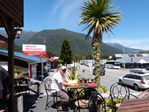
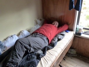
 – our room
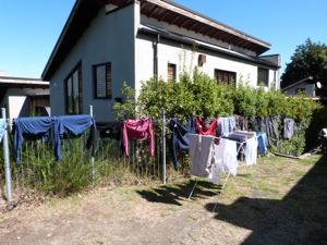
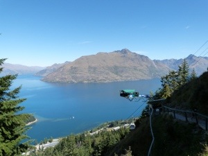
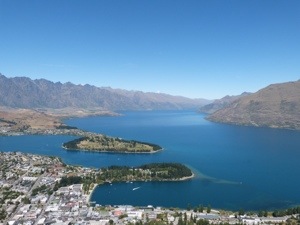
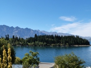
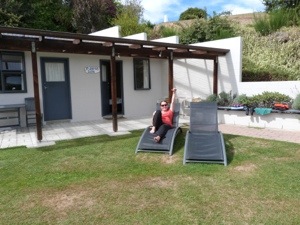
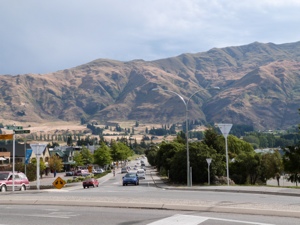
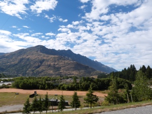
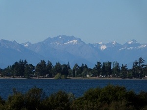
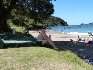
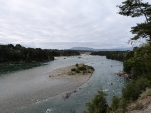
 – remarkable Remarkables!