Sun, 27th Jan: Backpackers: Jailhouse, Addington, Christchurch, South Island
An epic day of travel today to the South Island but, oh, what a journey it is – by ferry to Picton in the South Island and TranzAlpine Coastal Pacific Train to Christchurch. We are blessed with a beautiful clear sunny day on which to travel and this rewards us with stunning views all along.
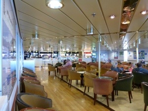
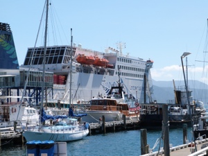
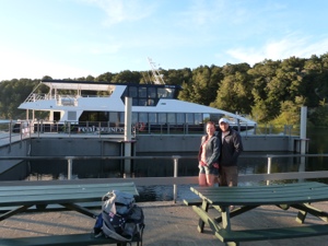
The first leg of our journey is the 3hr ferry crossing from North Island to South. Connecting Wellington and Picton by sea, the Interislander ‘Kaitaki’ has been described as one of the most beautiful cruises in the world.


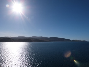
We sail out of the picturesque harbour of Wellington across the Cook Strait through to the stunning Marlborough Sounds of the South Island – a journey totalling 92km. The Cook Strait, known to Maori as Raukawa, was named by Captain Cook but visited earlier by Abel Tasman (who mistook it for an inlet) in 1642 – it’s narrowest part is 22km wide.

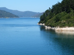
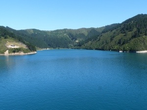
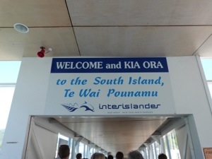
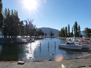
We arrive in Picton, a maze of forest fringed waterways and idyllic seaside town which is our gateway to the South Island.


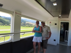
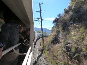
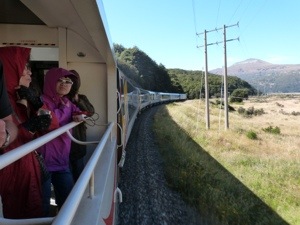
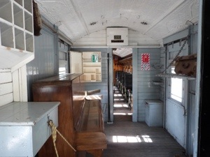
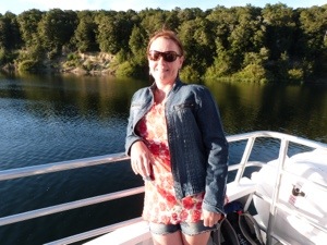
We walk through the quaint little town to the platform that is the railway station, lol, to meet our train. It’s an absolutely first class, beautiful train with huge windows and an open air viewing carriage at the front. We find our seats and are delighted with the standard, the leg room and the overall service. This is definitely the way to travel :D.


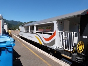

Our journey along the edge of the world, allows us to sit comfortably and explore one of the most rugged yet accessible corners of New Zealand’s scenic South Island. Settled in our seats we arm ourselves with headphones for the commentary at particular points of interest on the way.
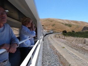
High up on the track as we leave Picton we are at eye level with a bird of prey soaring in the sky – out of these huge clear windows you feel as though you are soaring with it ! Amazing.
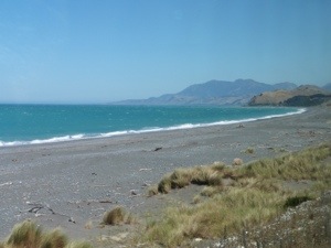
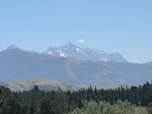
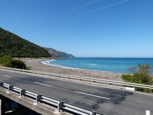
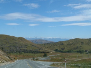
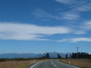
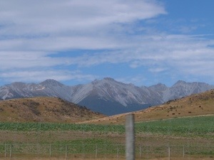
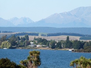
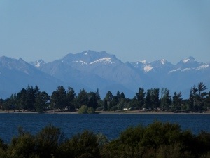
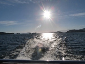
Our train journey today travels alongside the lonely Pacific Ocean coastline, where a roaring, windblown sea meets enormous bush-clad hills and the steeply rising Kaikoura Ranges. It is here that we are immersed in the sheer drama of the special landscape and where the majestic alps meet the rugged coastal scenery.
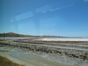
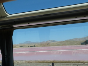
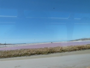
Near Blenheim, the train rolls through sundrenched vineyards and wineries and we pass the salt fields of Lake Grassmere. Passing at exactly the right time the ponds have turned a beautiful pink due to the temperature and the naturally occurring algae.
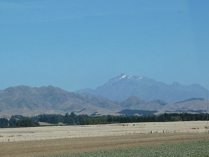
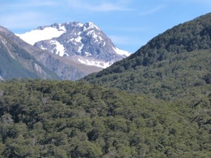
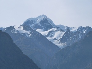
Travelling over Clarence River, the 9th longest in NZ, to the right of us on this clear day is a great view of the 2880-metre peak of Tapuae-o-Uenuku, the highest peak in the Kaikoura Ranges and we learn that Sir Edmund Hillary climbed this peak in his training for the climb of Everest.


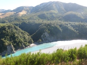
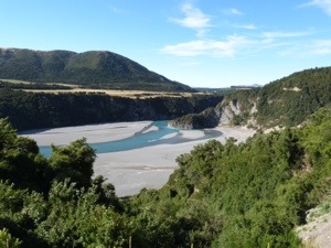
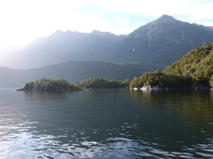
As we travel astonishingly close to the surging Pacific we see surfers braving the surf and, looking carefully, we see the colony of NZ Fur Seals frolicking and basking on the rocks. Crossing beautiful rivers, we see more spectacular scenery where they have carved out gorges through the hills.


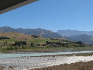
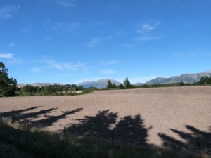
At Claverley we leave the Pacific behind and, in Canterbury, sweep inland over broad braided rivers – having crossed 175 bridges in just one journey. The rich patchwork farms of the Canterbury Plains, the largest flat expanse of land in NZ, make for a vastly different landscape to the rest of the journey. There was lots to take in so all we had to do was relax and take a load off as we ventured through NZ’s coastal scenery arriving in Christchurch just over 5 hours later.
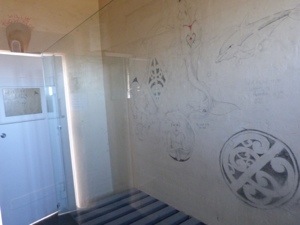
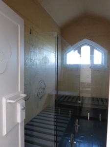
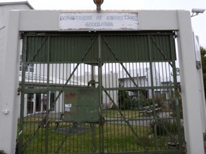
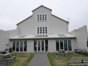
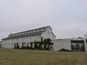
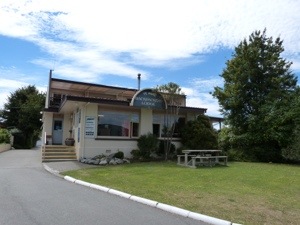
Once at the station, we make our way directly to Annandale to check in to the Jailhouse at Christchurch. This truly unique backpackers accommodation is ace – we literally are staying in a jail!! – a top pick accommodation in Christchurch.


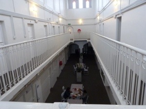
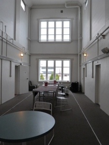
The renovated heritage accommodation has had a colourful history as the Addington Prison. Built in 1874 it is an important example of Gothic Revival architecture. Constructed out of 60cm thick concrete, a relatively new material at the time, the building has survived and is in pristine condition. When opened, the building catered for the needs of both sentenced and remand prisoners. Over the years it has been used as a jail, women’s prison and military camp. The Mountfort cell block and remaining perimeter walls are scheduled as a protected item for historical and architectural reasons. Room 20 has also been left untouched since the last prisoner was held here.

Christchurch is NZ’s second largest city and gateway to the South Island, bordered by hills and the Pacific Ocean, it is situated on the edge of the Canterbury Plains that stretch to the Southern Alps. Renowned as the Garden City, it boasts a number of beautiful parks and gardens, tree-lined boulevards, the meandering Avon River and the delightful Botanic Gardens and Hagley Park. The City is still flourishing despite being damaged by a major earthquake in 2011. After travelling all day, we didn’t actually explore Christchurch itself but stayed in Addington, freshened up and had a chinky take out with a dvd – The Fellowship of the Ring !!!!!!!


Mon, 28th Jan: Backpackers: Ivory Towers, Fox Glacier
25 years ago, the historic passenger train between Christchurch and Greymouth was given a new name and a new purpose – to bring some of the world’s most breath-taking scenery to visitors and it does not fail us! A quarter of a century later, the TranzAlpine is still going strong and we look forward to stepping aboard for what is rated as one of the world’s great train journeys.
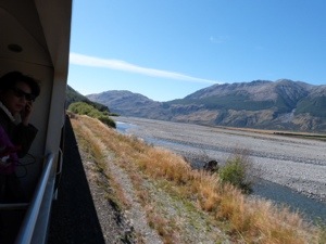
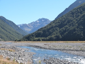
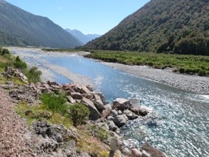
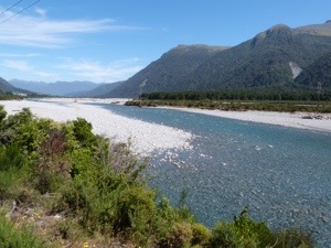
Out past the suburban bungalows of Christchurch, the TranzAlpine travels through patchwork farms of the Canterbury Plains. With the Southern Alps on one side of us, we cross the broad braids of the ice-fed Waimakariri River, which means ‘cold water’ in Maori.

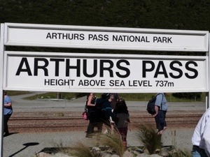
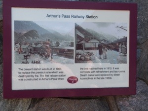
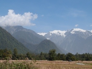
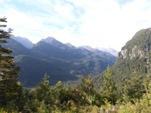
Traversing the mighty Southern Alps with spectacular views of the chiselled alpine landscape we venture to Arthur’s Pass – the South Island’s highest settlement where the National Park is a mecca for nature lovers. It’s not long before we are rolling through the striking landscapes used as locations in The Lord of the Rings and The Lion, the Witch, and the Wardrobe. Between the Alps and the West Coast we are shrouded in sub-tropical rainforest. Out in the viewing carriage Neil is in his element taking photographs of the magnificence that surrounds us. Quite literally, it takes our breath away.


After an amazing 4 hours, we descend through thick stands of native beech to the West Coast and our destination, Greymouth – proud and quaint riverside town which was the epicentre of NZ’s gold rush back in the 1860’s, pick up our rental car and take off to explore this unspoiled region with its mighty glaciers and wild rivers.

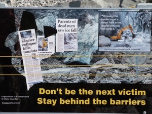
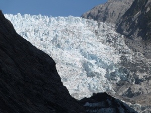
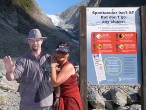
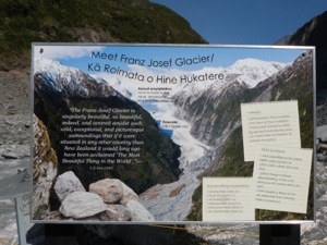
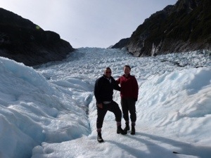
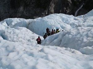
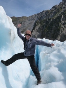
En route to Fox we stop off at the Franz Josef Glacier and even though this glacier is closed to hiking due to its instability, we managed to find a walk across the river bed to its base. Taking just over and hour we were, once again, rewarded with stunning views and photographic opportunities.


Once at Fox, we checked in to Ivory Towers in the heart of Glacier country and close to beautiful Lake Matheson. Fox Glacier is nestled under the mighty Southern Alps and Ivory Towers is the closest hostel to the Copland Pass and Welcome Flat Hot Pools. We are very pleased with the location and go off to explore.
We immediately fall in love with the township which is small, charming and retains a peaceful country town feel. In fact, when you arrive at Fox Glacier you immediately feel relaxed in its intimate, village atmosphere.
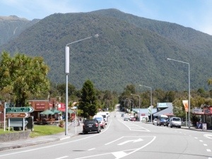
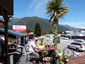
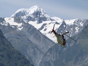
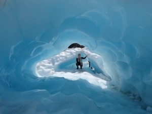
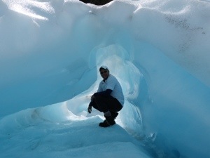
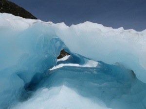
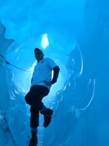
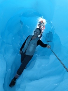
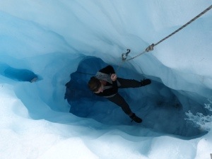
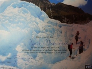
It has a stunning outlook across surrounding farms and offers breathtaking views of New Zealand’s highest peaks Aoraki (Mt Cook) and Mt Tasman. Tucked discreetly into the rainforest-clad foothills of the Southern Alps, the town was founded when gold was discovered. Complimenting the charm of this delightful country village are nine licensed restaurants and cafes. The Fox Glacier General Store and Fox Glacier Motors also offer passing travellers a good variety of food and other conveniences. Once in the high street, we seek out the base for our Heli-Hike which combines the thrill of two helicopter flights, with the opportunity to explore a remote and pristine part of the glacier on foot with our knowledgeable guide. Glacial forces are greatest in this area and often create spectacular ice caves, arches and tunnels, brilliantly blue in colour.
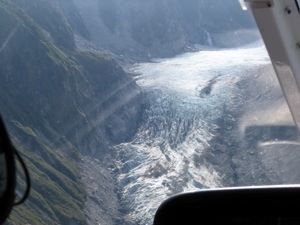
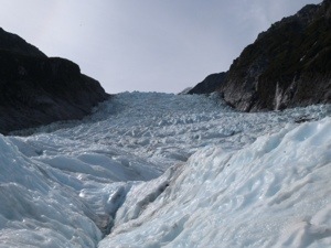
The unique combination of climate and shape means that Fox (and Franz Josef) Glaciers move at approximately 10 times the speed of other valley glaciers around the world. At Fox Glacier this is due to the funnel-like shape of the glacial valley and the huge neve, the snow accumulation area, at the top of the glacier. Fox Glacier’s neve is 30 sqkm, bigger than the whole of Christchurch City!
It is difficult to appreciate how truly massive Fox Glacier is. At 13kms (reaching a height of 2,800m) Fox Glacier is the longest of the awe-inspiring New Zealand West Coast glaciers. At its head, soaring peaks of over 3,000m dominate the vista. These include Aoraki (Mt Cook) and Mt Tasman. This mighty moving river of ice falls 2,600m on its journey from the base of the Southern Alps to the West Coast.
New Zealand’s West Coast glaciers are unique and probably the most accessible glaciers in the world, as they terminate amongst temperate rainforest just 2250m above sea level. So special is this mountain environment, that it forms part of the South Westland World Heritage Area.
Before heading back to Ivory Towers, we treat ourselves to a gorgeous meal at one of the four restaurants in the town, The Last Kitchen. Then it’s one more drink at the Backpackers next door and we head off ‘home’ for our early start tomorrow.
Tue, 29th Jan: Backpackers: Ivory Towers, Fox Glacier, South Island & the Heli-Hike!
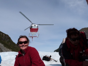
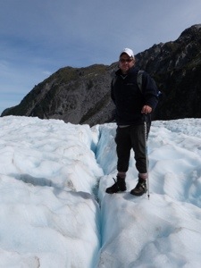
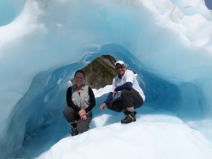
We awake this morning very excited for our visit to the glacier today. The fly-in, fly-out Heli-hike combines the excitement of walking on the Fox Glacier with the thrill of helicopter flights. By flying in we are able to access and explore a part of the glacier where its forces work hardest and often create spectacular ice caves and arches.
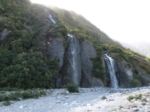
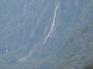
Equipped with sturdy leather boots and other equipment, we board the helicopter for our first flight over the pinnacles of the lower icefall where the ice is in constant motion. We then circle the upper icefall and Victoria Falls before landing.

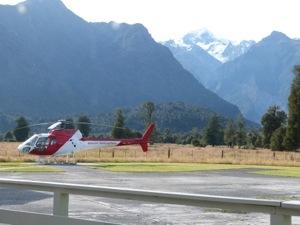
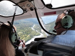

The landing site on the ice is a remote and exceptionally beautiful part of the glacier. At this stage, our guide (Zara) issues us with our crampons, specially designed for these ice conditions and we follow the ice steps she cuts out with her axe and explore the amazing formations and ice caves which are only seen here.
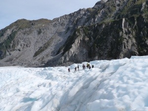
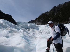

It really is a true voyage of exploration and, as there are so many changing features, the guides always find something new.

Overwhelmed by our experience this morning we decide to reflect on it by taking some time out at Cook Saddle Cafe and Saloon. On the Main Street in the sunshine, the atmosphere is so relaxing. Feeling quite high on emotion, we decide to stay in this beautiful part of the world and book another nights stay at Ivory Towers.

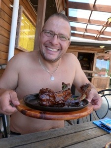

Taking our time now, we tuck into a huge spareribs and chicken wrap at the Saloon before relaxing in the hot tub, freshening up, having a beans on toast supper and slipping contentedly into bed. 😀 happy, happy, happy days.
Wed, 30th Jan: Backpackers: Mountain View, Wanaka
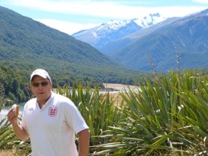
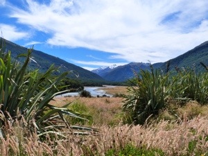
Having been entranced by the dramatic scenery of the North which we absolutely loved, we are becoming overwhelmed by the sheer beauty of the South and our 3hr drive to Wanaka far exceeds our expectations. En route we stop for lunch at a Department of Conservation Camp at Cameron Flat – WOW! Overlooking the Makarora River ….. you’d be hard pushed to lunch anywhere better!
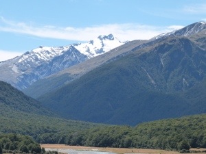
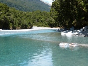
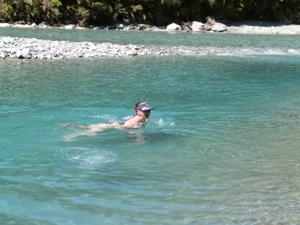
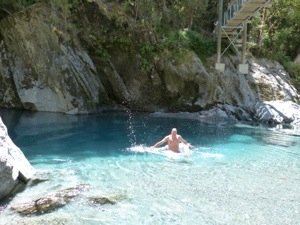
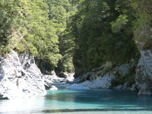
The beauty of driving around by yourselves is that you can just park up literally anywhere that takes your fancy! This was exactly the scenario as we pulled out of Cameron Flat. After this beautiful stopover we pull into a car park 330m further up the road to walk to the Blue Pools. The pools are the result of the Blue River and Makarora River meeting and derive their name from their distinct blue colour. This is due to light refraction on the clear, snow fed, icy cold water running from the mountain. The 30 minute walk to the pools was via a gravelled path giving easy walking through a silver beech forest to a viewing platform. From here we are on top of the crystal-clear pools and it’s not long before we join the other people in dipping into the icy cold water. Neil more than me!!! It’s soooooo freezing but invigorating at the same time and the heat of the day is welcome as you step out of the water – amazing.

It’s not long before our journey takes us to the head of the remarkable overwhelmingly stunning Wanaka Lake OMG! and the road from Haast to Wanaka via the Haast Pass is marvellous as we head into a wonderful scenic area travelling through the Haast Pass to the West Coast.
Driving through the Haast Pass is stunning and the road follows an ancient trail used by Maori travelling to the West Coast in search of pounamu/greenstone/jade/nephrite. The name for the trail is Tiora-patea, meaning “The way is clear”. The Haast Pass is the lowest across the Main Divide (563 metres above sea level).
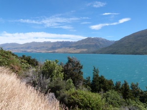
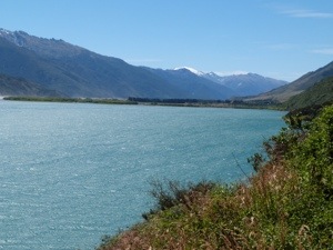
After crossing the Clutha River and driving along flat to undulating country we meet with Lake Hawea – OMG! Different to Lake Wanaka, the beaches and the gently sloping shoreline were drowned by the raising of the lake, so it has a different appearance. The colour of the water in the lake is an instant attraction for photographers. The vivid blue results from the depth of the water – 410 metres (1,345 feet).
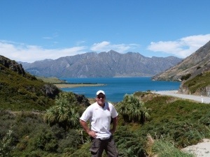
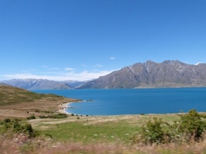
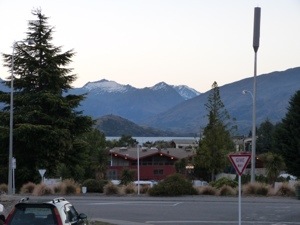
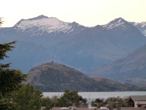
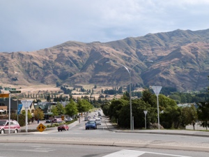
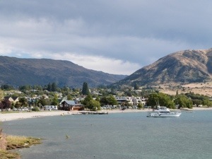
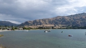
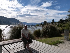
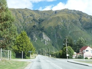
The road then follows the shore of Lake Hawea to the Neck, a narrow strip of land separating Lakes Wanaka and Hawea. The road drops to lake level before rising over the Neck, and then follows the shores of Lake Wanaka. Wanaka itself breathtaking … it is a town in the Otago region of the South Island and is situated at the southern end of Lake Wanaka, adjacent to the outflow of the lake to the Clutha River. It is also the gateway to Mount Aspiring National Park which, in December 1990, was given World Heritage status. Primarily a resort town Wanaka has both summer and winter seasons is based around the many outdoor opportunities which are very evident as we drive around.
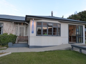
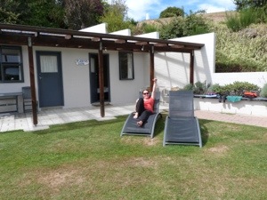


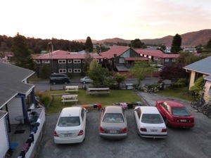
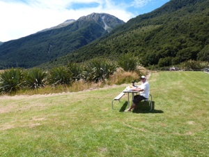
We stay at Mountain View Backpackers, centrally located with a large sunny garden for relaxation and we decide to stay another day so we can chill out here as it is so beautiful
Thu, 31st Jan: Backpackers: Mountain View, Wanaka
We choose an extremely lazy day today – we breakfast whilst watching the rest of The Fellowship of the Ring before whiling away the day.
After ringing around for our accommodation over the next few days, Neil heads off down the road (literally) to sort out some bits and pieces – a visit to vodafone, a haircut, a visit to the travel agents and some small purchases. I stay at Mountainview to use the internet to catch up on blogging amongst other things. The glorious afternoon pulls us out for another walk around the town and, whilst doing so, we bump into Mike and Michelle. We shared a table with them on our TranzAlpine journey a couple of days ago, with Mike and Neil out in the viewing carriage most of the time! We shared a beverage or two with them – well it would be rude not to – before heading back to the backpackers for the evening.
Fri, 1st Feb: Backpackers: Te Anau Lakefront Hostel, Fiordlands
Awake bright and early we commence our journey to Te Anau via the Tourist Drive and it blows us away. We really are struggling to find the words to convey just how gorgeous it is.

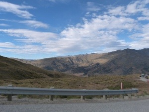
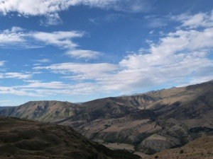
It’s not long before we are driving through the ski fields of Cardrona where the Harrier Hawks (or Kahu – NZ’s most common bird of prey) are somersaulting through the air – whether they are fighting or mating we do not know, but they are stunning. It is a common sight in the sky all over NZ. Its most common food these days seems to be roadkill so many die in collisions with traffic. Although they are wonderful fliers they are very slow in taking off and often cannot avoid oncoming traffic. The drive today is totally different to yesterday; part of an ever-changing scenery, we head through the hills and it’s almost claustrophobic as they get closer and closer to the sides of the road.
Changing again, the road soon opens up with the mountainous Crown Range prominent in the distance. We have a MUST STOP at the breathtaking scenic lookout here overlooking the valley before dropping down steeply on a multi hairpin road to the bottom in the Lake Hayes Region.
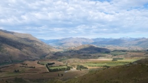
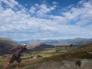
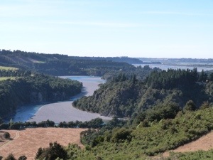
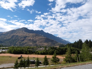
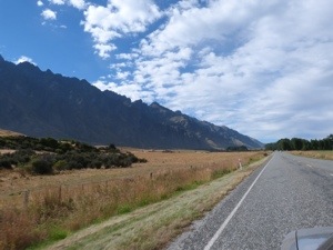
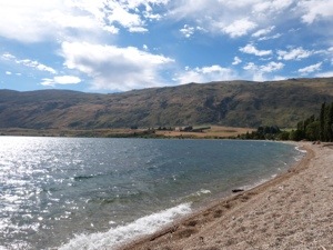
Once through Frankton we journey alongside the dramatic Remarkables Range to the left of us – all around us now are mountains and hills all patch-worked in a multiple of colours. If this isn’t enough, we then have the gorgeous Lake Wakatipu to the right of us.


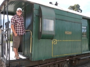
At Kingston we have a coffee and scone break at the cafe of the Kingston Flyer; NZ’s famous vintage steam train, on the southern shores of Lake Wakatipu and 40mins south of Queenstown.
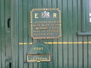
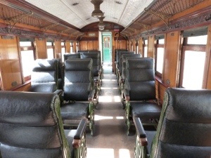
As the weather is so hot and dry at the moment this old steam train timetable has been temporarily suspended due to the risk of fire. A bonus for us as we were able to climb onto the carriages and have a relaxed walk around the beautiful carriages. The Train is made up of two steam locomotives and seven wooden carriages, seating 226 passengers. It features a turn of the century buffet carriage and an authentically restored 1898 ‘birdcage’ compartment carriage, with luxurious leather upholstered seats.
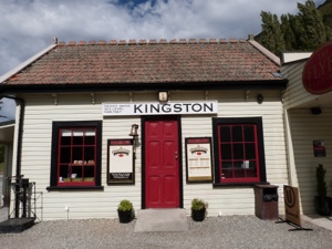


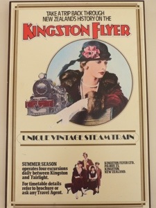
The original Kingston Flyer was a passenger service that operated between Kingston and the Main South Line at Gore from 1878 through to the mid 1950s. It provided a passageway to Queenstown and the surrounding stations, by meeting up with the lake paddle steamers at Kingston Wharf. Today The Kingston Flyer operates on a 14km stretch of track and consists of:
Two AB Pacific Class steam locomotives (NZ built)
AB 795 dating 1927 was a former Royal Train Locomotive
AB 778 dating 1925 and seven steam-heated wooden vintage carriages dating back to 1898.
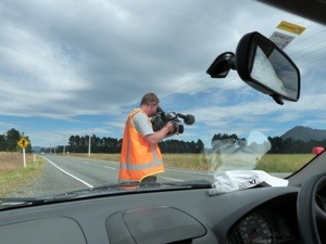
As we journey on leaving Kingston behind, we are surrounded in all directions by hills hills hills. Coming out of Garston we pass Stu’s (apparently) World Famous Fishing Shop. The scenery opens up into flat farmland – where there are deer which is a nice change to all the sheep – with views of marvellous ranges in the distance. Once on the Heritage Trail to Te Anau the road opens up and so does Neil’s speed level 😀 and we get done for speeding!!!!!!! 117k in a 100k zone – Neil is very dismayed but every cloud and all that, we are filmed for NZ Highway Cops, pmsl. Anything to get his face back on the tv, lol.


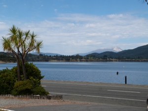
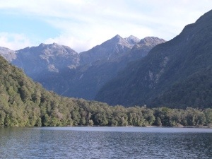
It’s not long before we bypass Mavora Lakes and the Red Tussock Conservation Area which is so in contrast to the magnificent Manapouri Range of mountains in the distance. Fiordland National Park and Te Anau welcome us in glorious sunshine and it is a sight to behold.
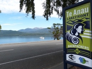
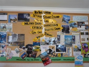
We are delighted to check into Te Anau’s only backpackers located on the lakefront, a stones throw from Lake Te Anau. Te Anau is central to all of NZ’s most famous scenic beauties, and within 2 hours you can be inspired by the sheer forces of nature. We have chosen to do this in Doubtful Sound by means of a cruise (Saturday) and in doing the 4 day tramp on the Kepler Great Walk starting on Sunday!

We take our evening walk around the town and head to the cinema for the 7.00pm showing of Ata Whenua – Shadowland. Fiordland on Film where you literally become ‘part of the scenery’. Filmed by award winning cinematographers, with outstanding musical composition in surround sound. Ata Whenua – Shadowland brings you the Fiordland World Heritage Status Wilderness you would otherwise never see. Mysterious, evocative, exhilerating and utterly spectacular. Filmed across extremes of season, climate and terrain, it takes you on an unforgettable journey through the most awe inspiring landscapes on earth. It really is an outstanding production of 32mins and makes the hairs on your arms stand up!
 – a photo of a photo! Stunning!
Sat, 2nd Feb: Backpackers: Te Anau Lakefront Hostel, Fiordlands
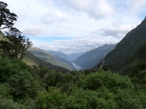
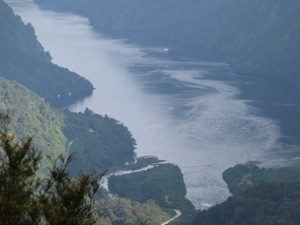
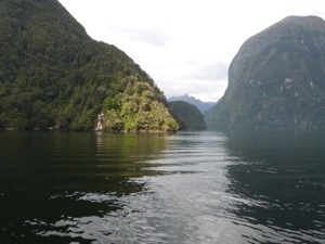
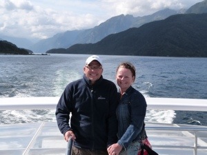
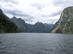
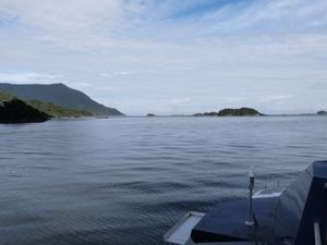
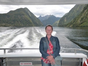
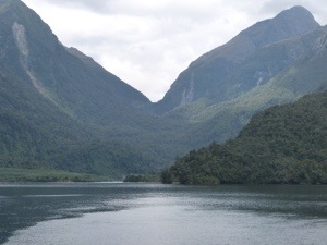
Today, we immerse ourselves in the vast and untouched wilderness of Doubtful Sound, the second largest fiord in Fiordland National Park.
Getting to Doubtful Sound is an adventure in itself. With no direct road access, the only way we can to get there is by a cruise across Lake Manapouri and a coach trip over Wilmot Pass – a 22km road; the most expensive in NZ @ $2 per cm (4.4million total!). This isolation makes the fiord a very special place. On our drive we come to a lookout just before we make the steep descent to the Wharf and it’s stupendous overlooking the start of the Doubtful 😀
We are very fortunate today as our guide tells us that in Doubtful it rains every two out of three days! The vegetation of fern beech trees and moss is very dense all around us. During the drive over Wilmot Pass, NZ wood pigeons (Kereru) are also flitting about and our guide informs us that they can be quite comical as they get drunk on Puriri Berries which are their favourite food. A Weka also crosses our path, a flightless sturdy brown bird, about the size of a chicken.
With its rugged peaks, verdant rainforest and twisting, hidden inlets, Doubtful Sound takes your breath away.


 – the only building in the Doubtful, this fishing hut was built ‘on the water’ highlighting a loophole in the law. As it is not actually on the land, there was nothing that could be done to prevent it being built!

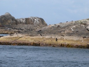
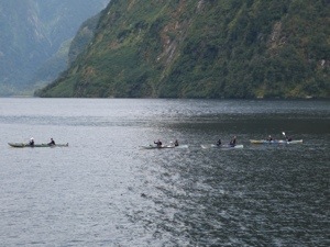
Home to abundant wildlife such as fur seals (we see a colony at the mouth of the Doubtful sunbathing and frolicking in the water), the Little Blue Penguin and the rare Fiordland Crested Penguin – one of NZ rarest mainland penguins. The bottle nose dolphins also found here form a small resident population living at one of the southern most locations in the world for this species. We cruise as far as the Tasman Sea where the fur seal colony is and where we spot an albatross on the horizon.

It is here that the boat turns around to explore some of the hidden inlets on our way back to the underground power station. At one such inlet, the boat’s engine is turned off and we are requested to turn off mobile phones and cameras and to stay silent for a couple of minutes. It is a really surreal experience – one that cannot be explained! It is so still and so remote resulting in a really unique feeling. Will we ever experience such solitude again? I don’t think so, it was a great couple of minutes – just priceless!


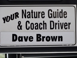
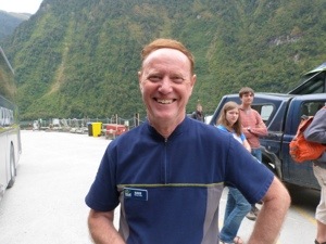
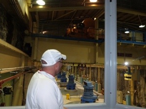
Soon, we are met off our boat by Dave (who reminds us of home 🙂 sorry Dave! lol) who is our guide to NZ’s largest hydroelectric power station, the Manapouri Underground Power Station, located deep beneath the Fiordland. The construction of this power station was one of NZ’s greatest engineering achievements, with the majority of the work completed underground in a remote location. The only external signs are the above-ground control building, a switchyard and two sets of transmission lines that loop across the head of the lake on their way to join the national grid.
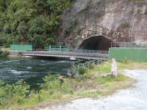
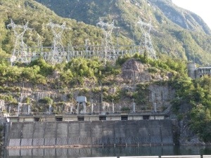
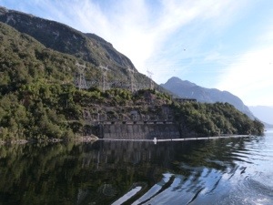
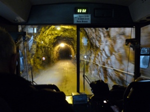
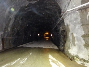
Our guide asks for permission to enter the tunnel after which we travel by coach down a 2km (1.2 miles) spiral tunnel to view the immense underground machine hall and learn the story behind this amazing power station and its construction which, including building the road, took over 8 years!


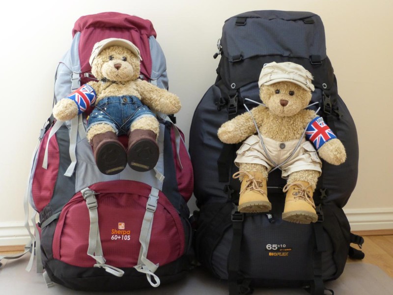
A return cruise over Lake Manapouri and we head back to Te Anau to prepare for our Great Walk which starts tomorrow. We have booked into the huts along the way which are remote and we in the wilderness – no leccy, gas or Internet!!!!! We have to carry with us our own cooking equipment, food for 4 days, sleeping bags, toiletries and clothing, lol. This should be fun!

Hi Theresa and Neil,I am in awe at the amazing time you are both having, the sights and sounds you are experiencing will stay in your memory for ever. I can only imagine what a truly magnificent journey you are experiencing and I am so looking forward to seeing more photos from you. I wish you safe travels and lots of fun for the next leg of your journey. Love Gill xx